This July, I set off to the South of Wales to walk 230 km along the sea in what is Britain’s only coastal national park. Seals, sand and soothing solitude made this the perfect rural summer escape. If you’re wondering whether wandering in Wales might be for you, too, read on!
(If not, just look at the pretty pictures. :-))
DAY 1: THERE… Manchester to Manorbier
I fell in love with Pembrokeshire last summer on a working holiday with the National Trust. After helping to set up a mountain-bike track on the stunning Stackpole Estate, I explored the start of the Coast Path – the section from Amroth to Manorbier. Charmed by immaculate beaches, dramatic cliffs and splendid isolation, I knew I had to come back and do the rest some day!
Planning this trip was unexpectedly straight-forward. I relied heavily on Jim Manthorpe’s guidebook, the surprisingly titled “Pembrokeshire Coast Path”, published by Trailblazer and pretty much the authoritative text on this national trail. Moreover, choosing the accommodation was simplified by the fact that whole stretches of the route don’t offer many options to choose from! So finding the right dates was key. To keep costs down, I opted for youth hostels where possible and B&Bs for the other nights (and a spot of luxury now and then).
Even if you’re not as fond of train journeys as I am, it is the best option to reach the Coast Path and a nice, hassle-free way to start your adventure – if you’re setting off from the North, that is! Flying to Cardiff and then taking the train would be another good option. My trip took me through the charming towns of Shrewsbury, Ludlow, Leominster (pronounced – you’d never guess it – Lemster…!) and Hereford. After a change in the rather sober-looking Carmarthen, the journey got truly scenic, with views of the sea at low tide.


From Manorbier station, I had to walk to actual Manorbier first, with then a further 2,5 mile hike to the youth hostel – I would finally find out whether I’d packed that new backpack too full or not… The weather was gorgeous and I certainly couldn’t wait to dip my feet in the sand. However, I first had to make it down very narrow country lanes! I could see why the YHA didn’t recommend walking from the station…but picturesque it was. Soon, the view was opening up towards mighty Manorbier Castle – a place the eagle-eyed viewer might recognise from I Capture the Castle with Romola Garai. Manorbier also boasts a post office-cum-supermarket, two pubs, a café and a picture-perfect 12th-century church that overlooks beach and castle beneath.


As lovely as the beach was, especially after a 6-hour train journey, hunger was driving me towards my first accommodation – the wonderfully situated YHA Manorbier. After a hearty dinner, I reacquainted myself with the lovely spot it sits in, which borders a military range – one of several along the coast path, looking quite eerie in the light of the setting sun.


DAY 2: The delights of Manorbier!
My first day in Pembrokeshire was – rainy. Still, the forecast for the next days was more than promising, so I couldn’t complain. After a lazy morning I set off back the way I’d come the evening before, and braved the stiff sea breeze. In Manorbier, I headed straight up the hill to the Norman church, which is a typical British country church with swallows nesting in the entrance – and a loo in the corner! So if the Sunday sermon proves too stirring for your bowels, fear not, the Lord provideth…


Then on to Manorbier Castle – a truly splendid and pretty intact model of a Norman fortress, where scholar Gerald of Wales was born in the mid-12th century. He would go on to describe his birthplace as “the most pleasant place” in all of Wales. Looking out on to the sea from one of the castle turrets, you might agree with him!


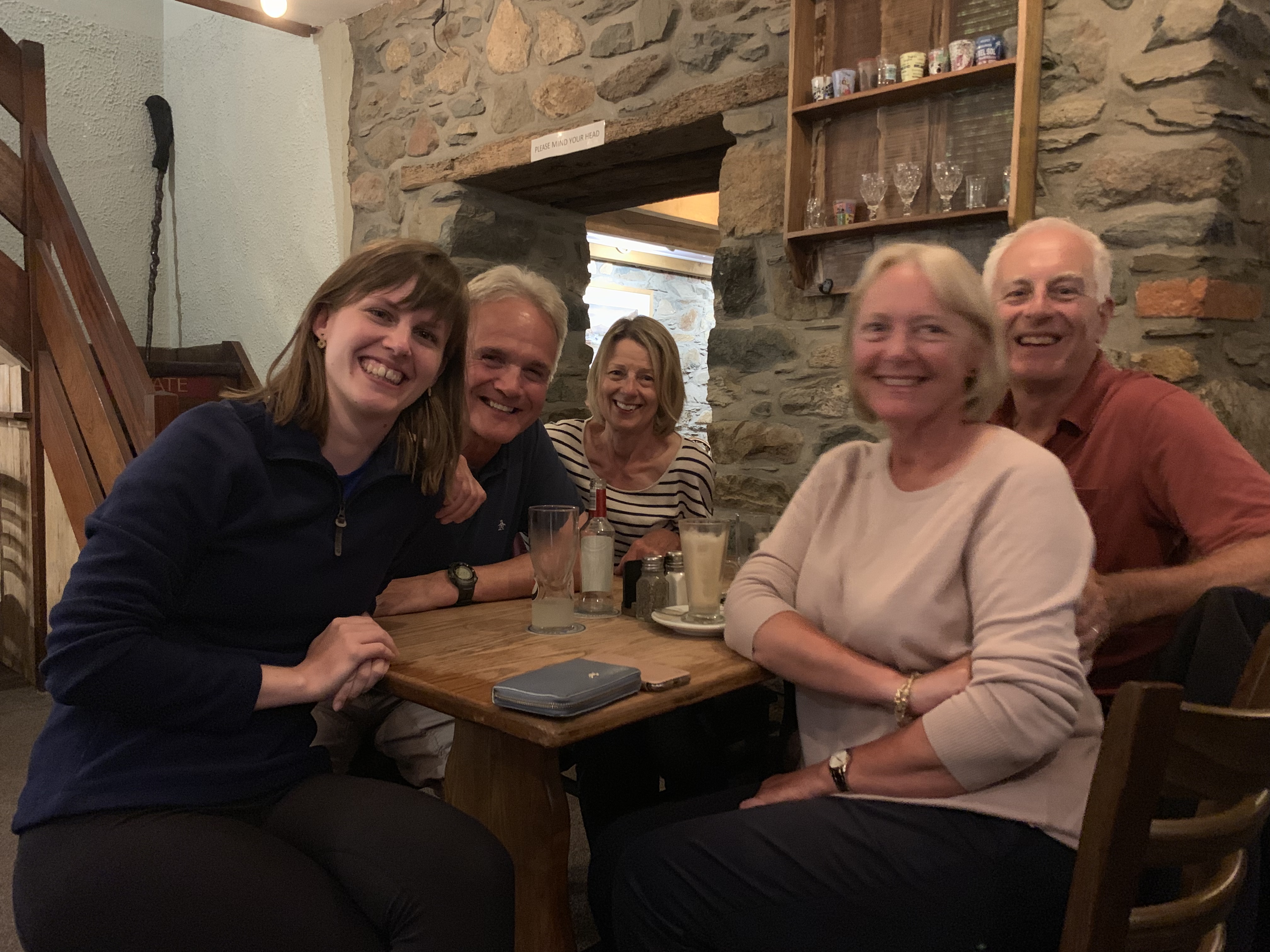
I spent the rest of the day in the cosy village pub, chatting to the locals and reading up on the next day’s walking. Bring it on!


DAY 3: Manorbier to Bosherston, 19km
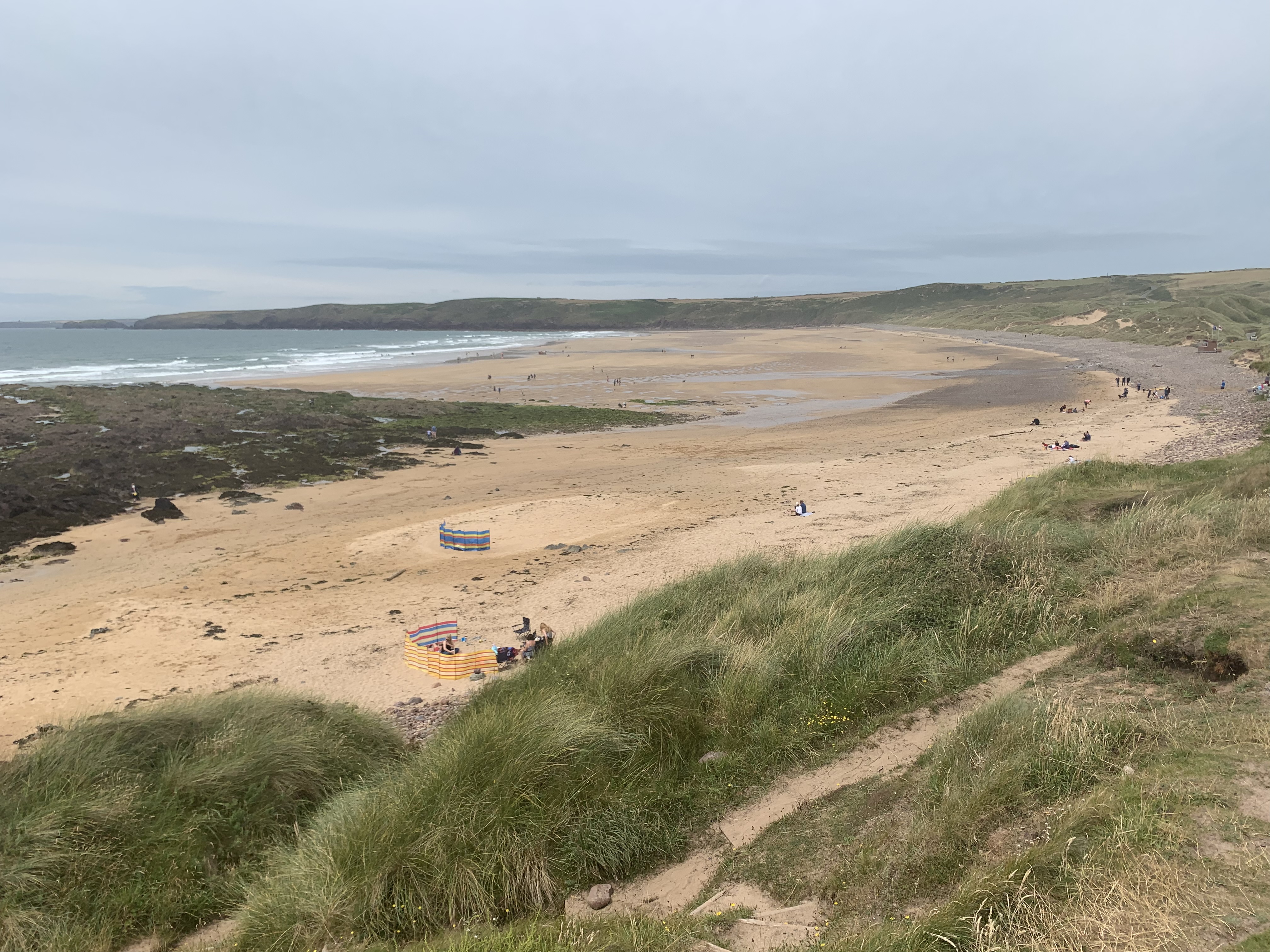
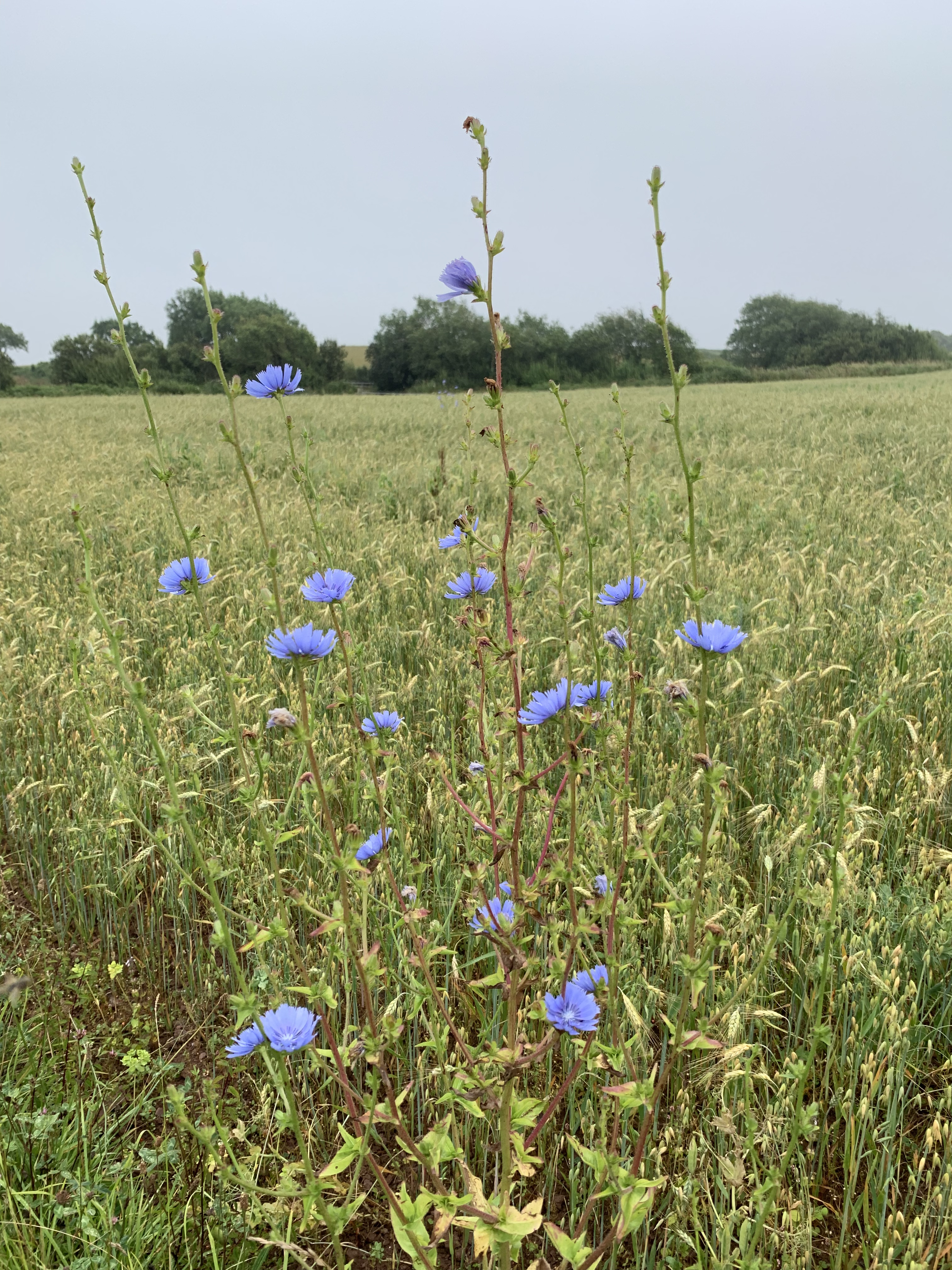
I was immensely looking forward to this stretch, as it was taking me past my beloved Barafundle Bay, Broad Haven Beach and along lovely lily ponds to the charming village of Bosherston, where my first B&B awaited. This was a section I already knew well: the working holiday had been in Stackpole, and we stayed in a bunkhouse a mere 15-minute walk to Barafundle, a beach often voted in the British top 3! No wonder, as it has clear waters, gorgeous sands with no stones or algae in sight, and undulating dunes as well as a fairy-tale forest just behind it. It’s definitely a part of Pembrokeshire everybody exploring this area of Wales has to put on their itinerary. The photos speak for themselves, methinks!


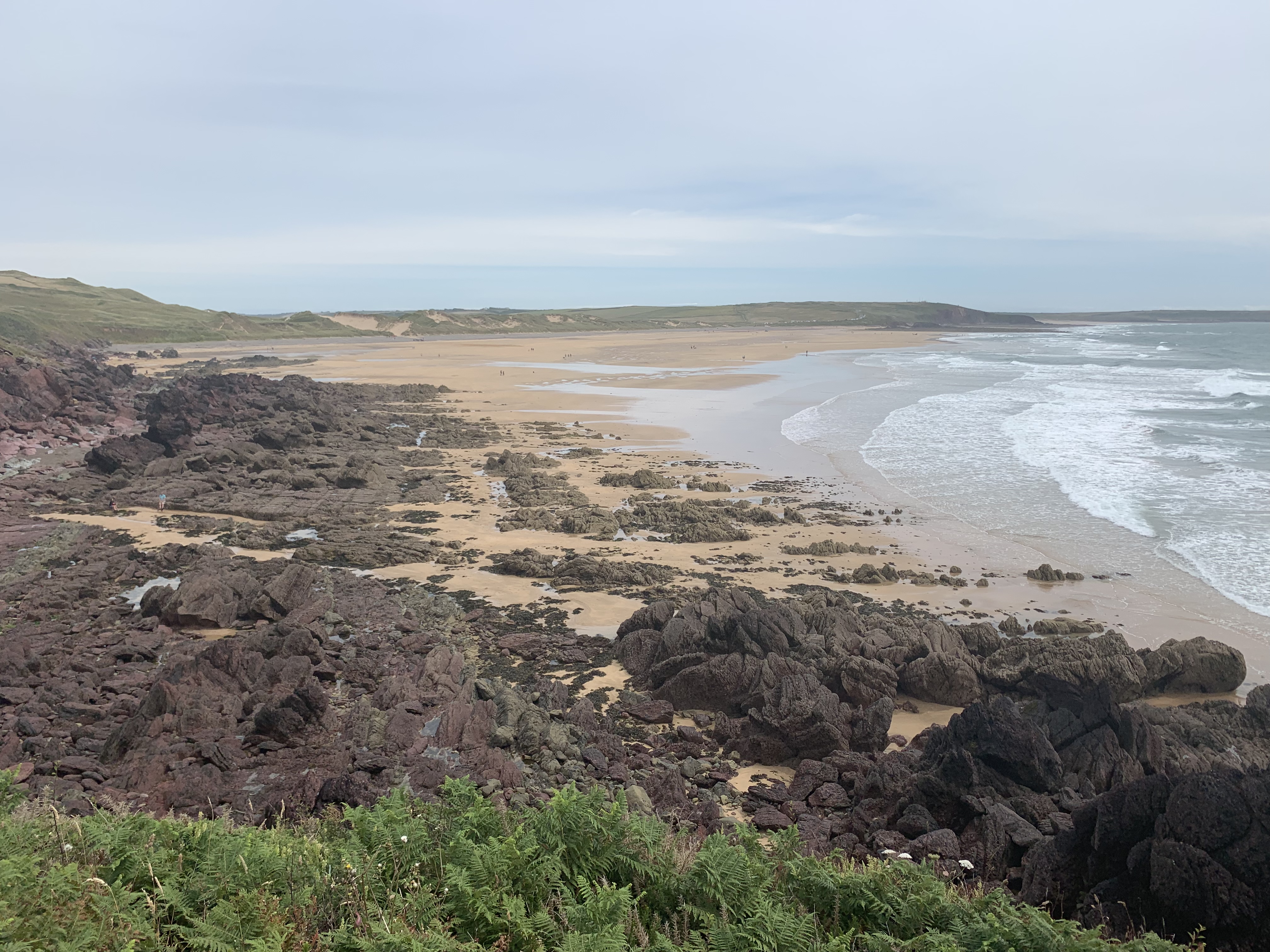
A feast for geologists and amateur rock enthusiasts, the path offers viewpoints along this section that show you sandstone to the left and limestone to the right – in addition, you can see striking rock formations that developed due to Wales travelling nearly 6000km in its lifetime.
After a refreshing swim in Barafundle’s turquoise waters, I bumbled leisurely past the lily ponds of Bosherston and was soon in the village, which offers a lovely church, a café that the owner, and her parents before her, has run for nigh on 100 years (!) and is fittingly called “Ye Olde World Café”, and the pub I was staying in – the St Govan’s Inn.


DAY 4: Bosherston to Angle Bay, 27,7km
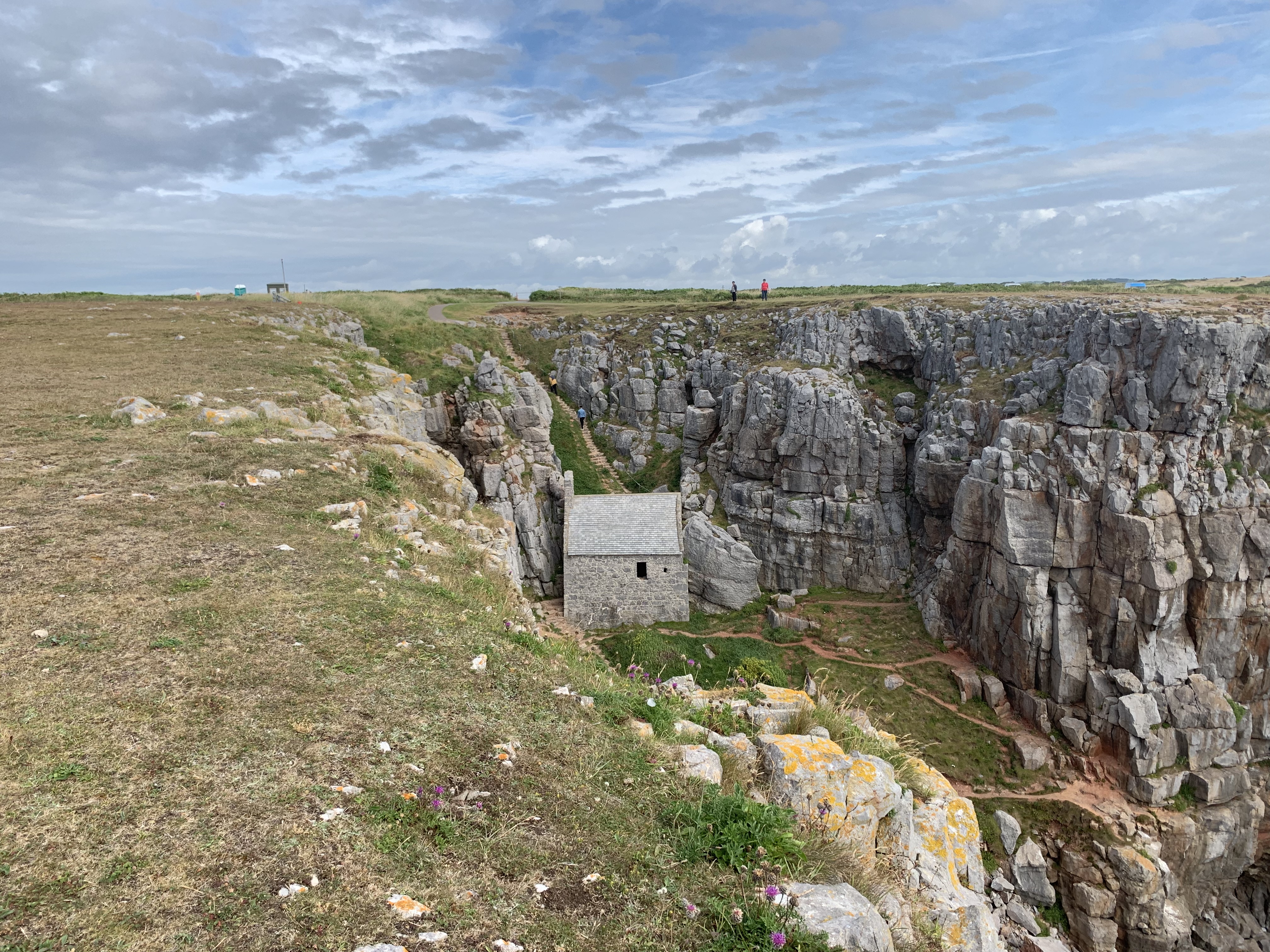
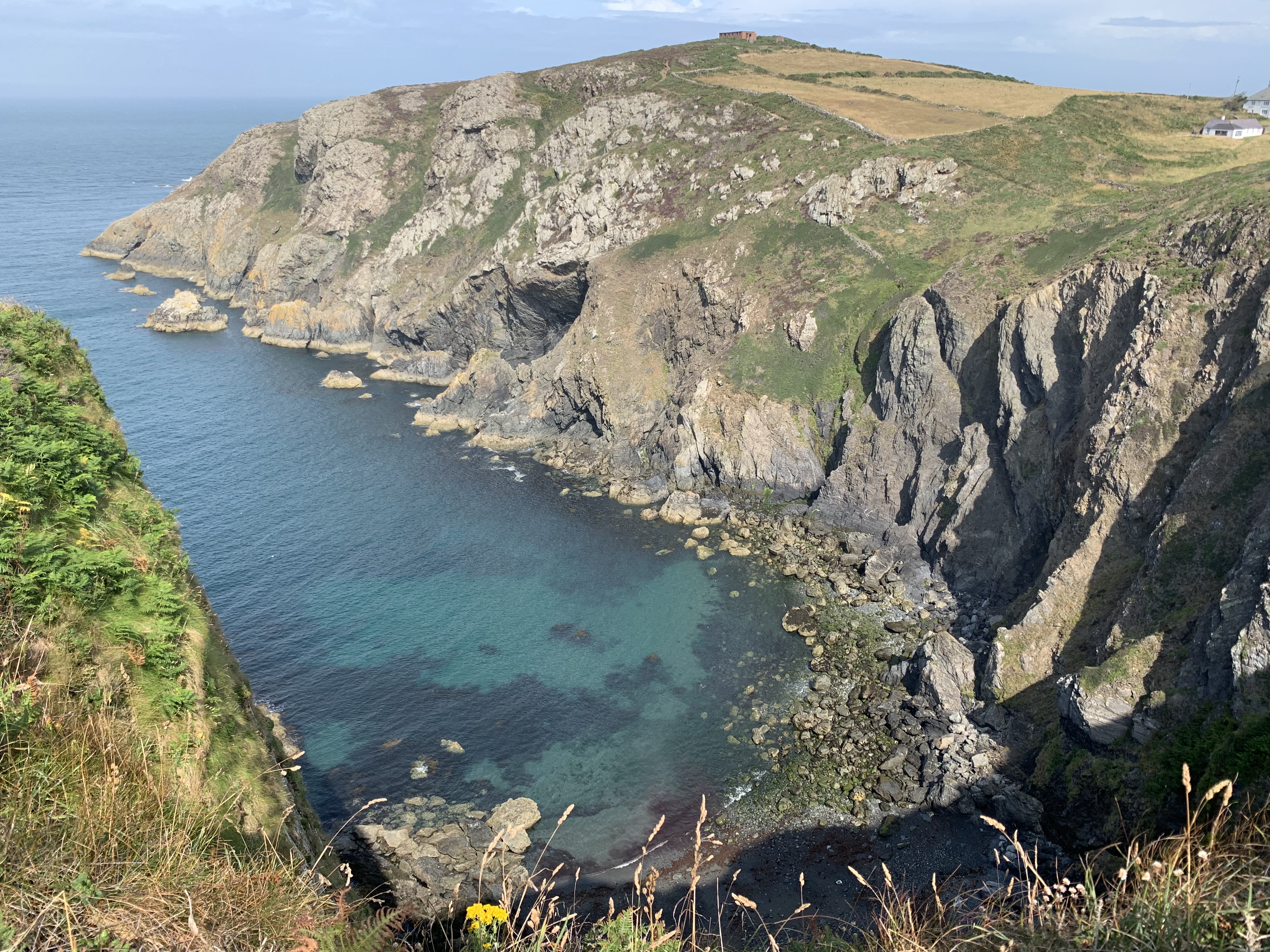
After a hearty breakfast and a nice chat with a fellow walker, who was doing the Path in reverse and was therefore only a couple of days away from the end, I revisited St Govan’s Chapel (pictured above) – a captivating little edifice that was built into the rocks some seven hundred years ago, and was named after the monk who hid in a cave on its site back in the 6th century.
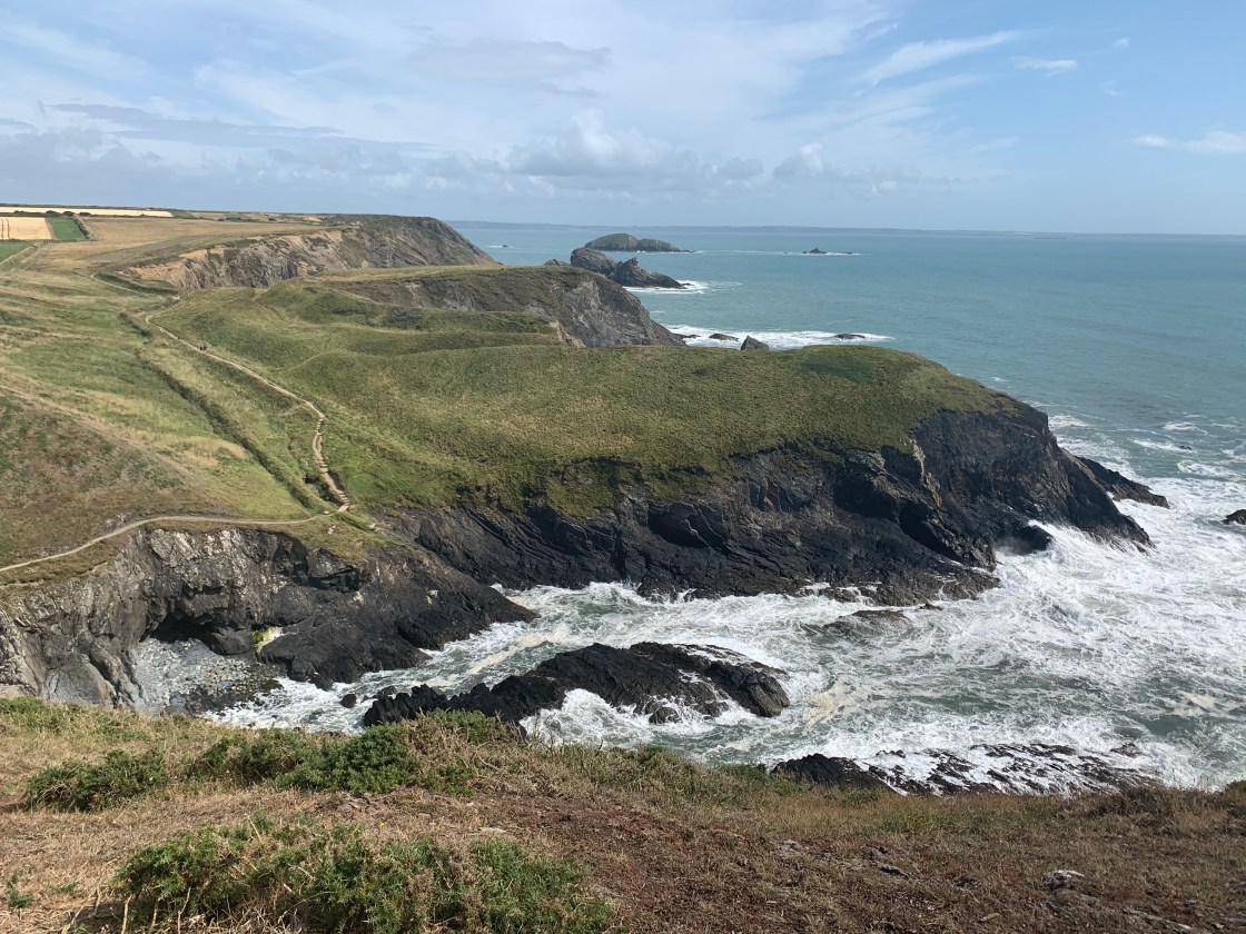
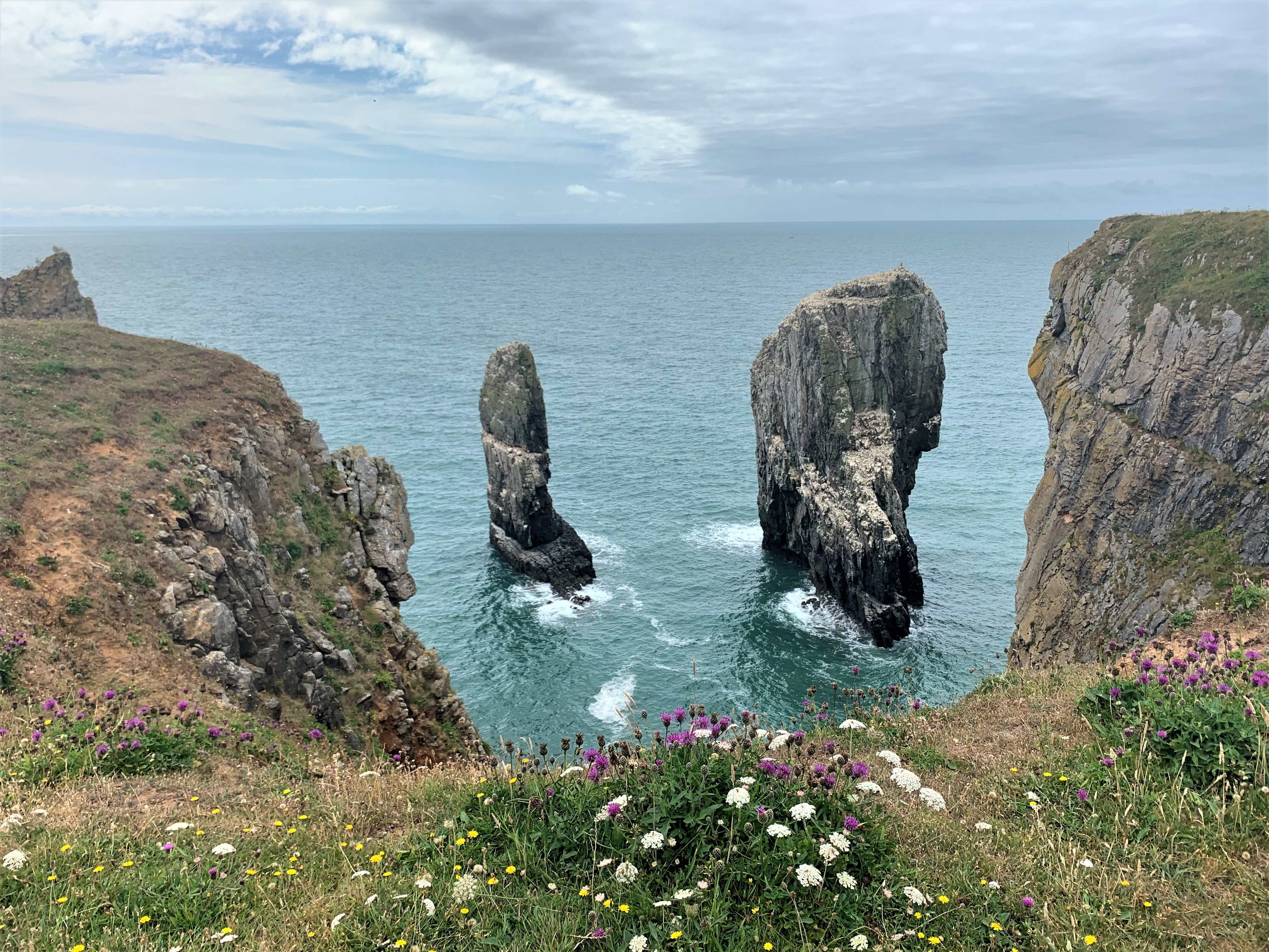
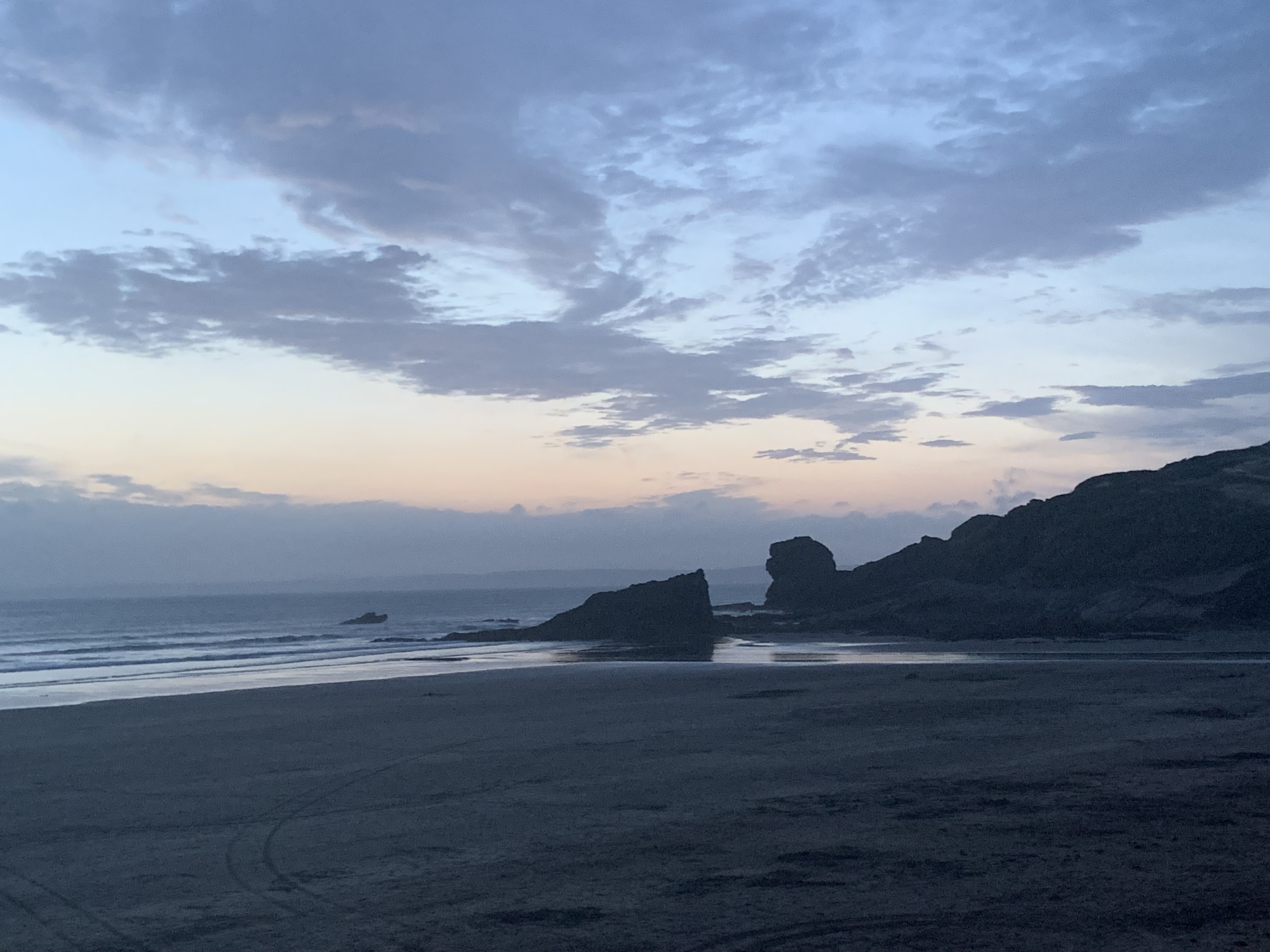
It’s not the only highlight of the first half of this section, so be sure to walk it on a day the Castlemartin Military Training Area is open to walkers. Just before you take the road in land, you will see Stack Rocks, swiftly followed by the Green Bridge of Wales:
The next hour or so was not a trudge, but certainly not a spectacular walk along roads until the village of Castlemartin. My guidebook, updated in 2010, said that there were no cafés or pubs to be expected, so it was a welcome surprise when the cute village hall was open and offering cakes and drinks in its community café! Very happy with my lemon drizzle and a coke (why does it taste so much better from a glass bottle?), I sat on the patio next to a couple of older women, who were discussing a common acquaintance’s capacity to drive: “If it takes him 40 minutes to get from his house to his car, that tells me he shouldn’t get behind the wheel!” You can’t argue with such logic. Then a couple on road bikes arrived. Seeing my big backpack, they asked me where I was headed – they turned out to be the owners of my next B&B!
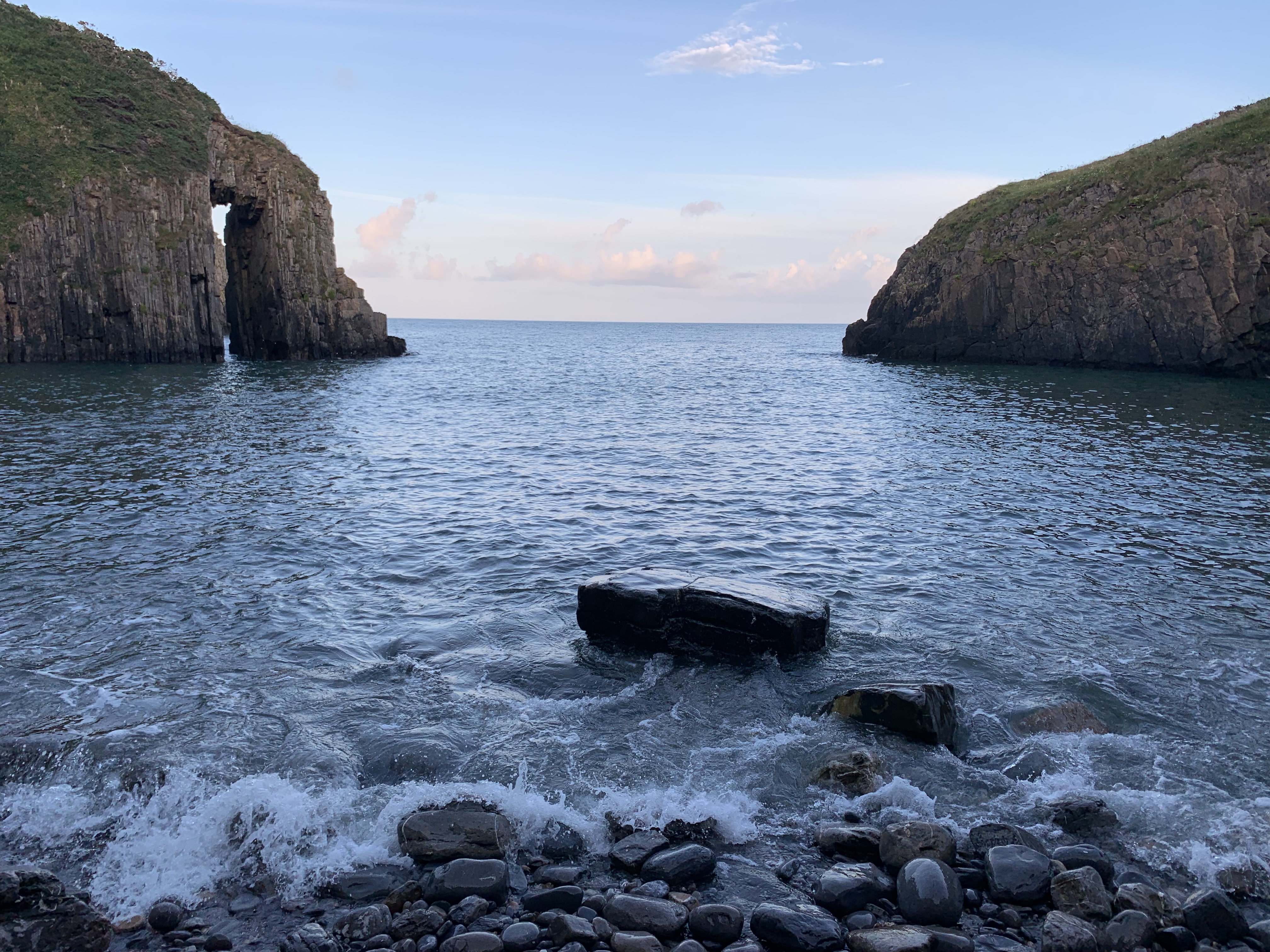
Refreshed, I headed down the road and soon arrived at the magnificent beach of Freshwater West – famous as a surf spot and for featuring in numerous films. Not least, it was the location of Fleur and Bill’s cottage in Harry Potter, the setting of Dobby’s demise and the beach used in Ridley Scott’s Robin Hood. You can easily see why: it does look rather epic.
Leaving Freshwater West behind, the path got more strenuous again – but quite beautiful. The only thing was, my right calf started to hurt quite a lot. I walked past some wild horses and a weird Alcatraz-like island and on to West Angle Beach, by which point I was in quite a bit of agony. My Achilles’ heel turned out to be my Achilles’ heel! Still, I made myself walk the peninsula, which added another hour, and got to the B&B at about 17:30. I was dead glad when the owner of my B&B had a tube of Biofreeze that I could borrow. If you’re not familiar with the stuff yet, I highly recommend it – it has magic powers! I had somewhat hobbled the last half-hour of the way, so I opted for the pub that was close-by, rather than retracing my steps a bit to eat at the atmospheric-looking Old Point House. This is probably my only regret of the whole walk – if you ever had a soggy steak pie, you know what I’m talking about. Mary wept! (Mary Berry, that is.) But a comfy chamber comforted me.


DAY 5: Angle to Pembroke, 21,8km
What a day. It featured angry horse-flies, an unfortunate encounter in a field, and the most complicated shower in the British Isles! But let me begin at the beginning.
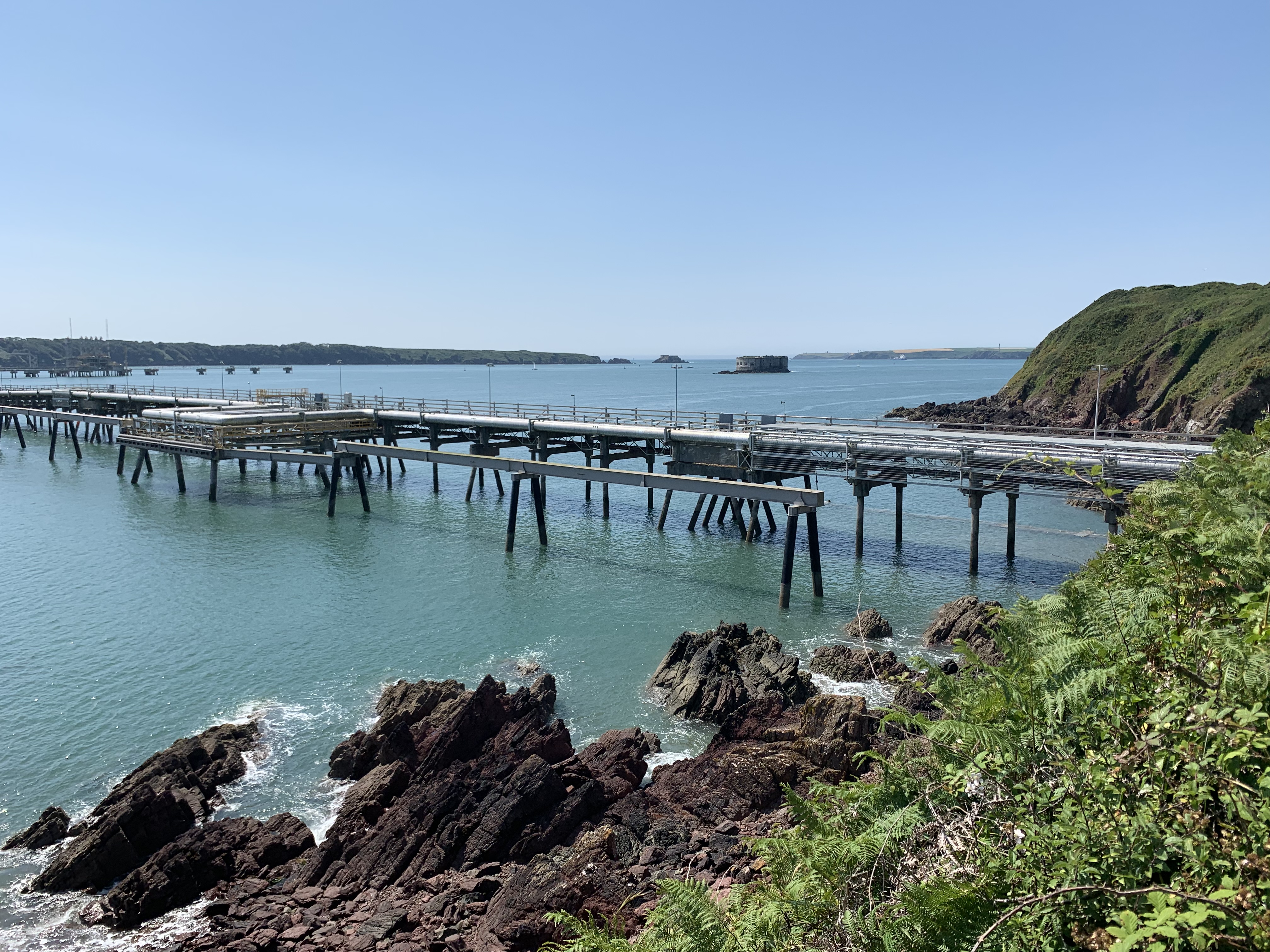
As the picture shows, it started off rather misty, but considering that the background was dominated by electricity works (which did look very pretty at night), it wasn’t a great loss. The only issue was that wading through dewy grass made me wish I had packed gaiters after all. Still, that was soon left behind, and I was now up close and personal with a huge oil refinery. Charming!
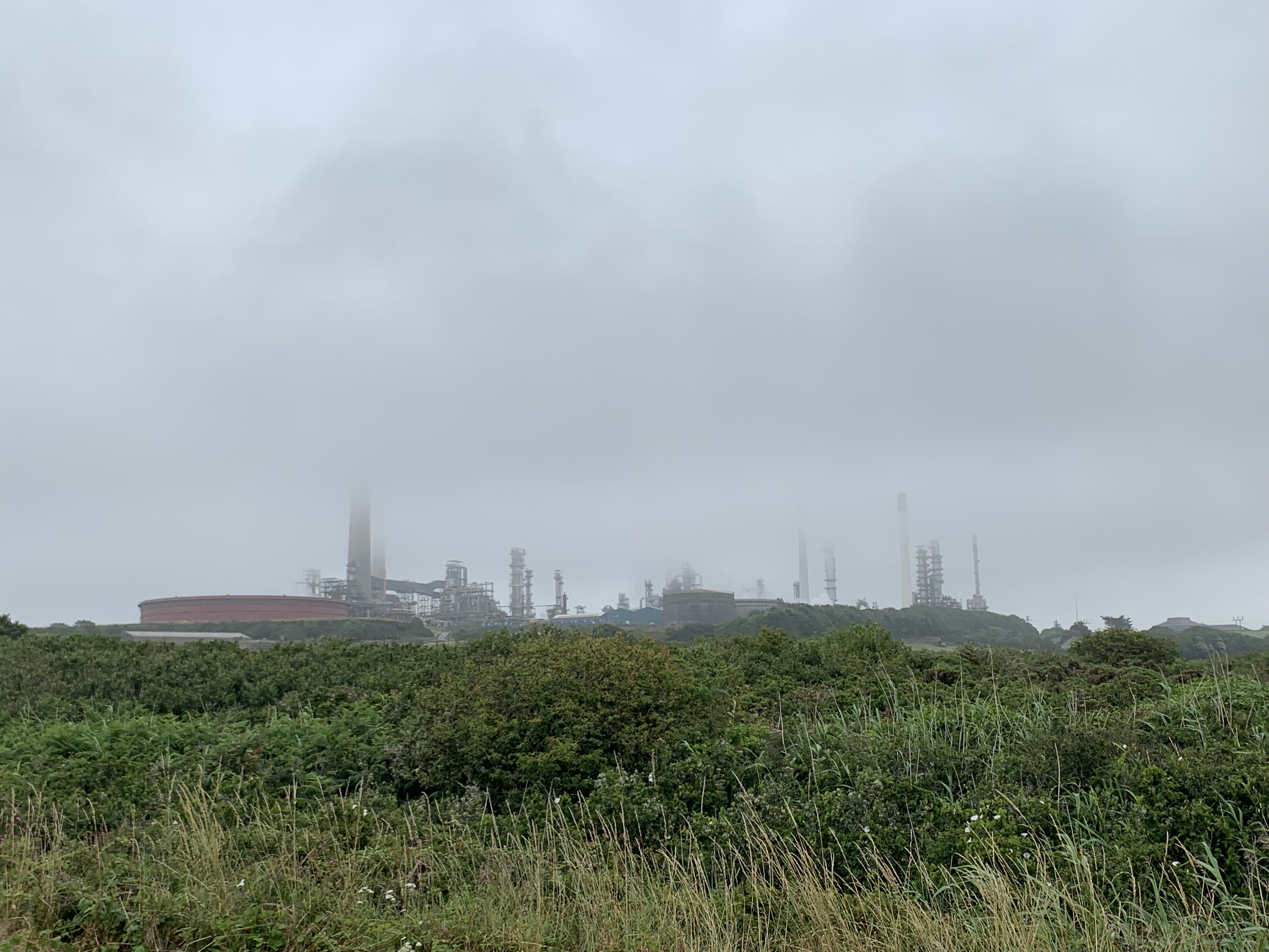
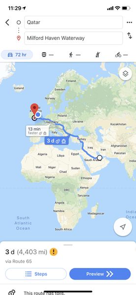
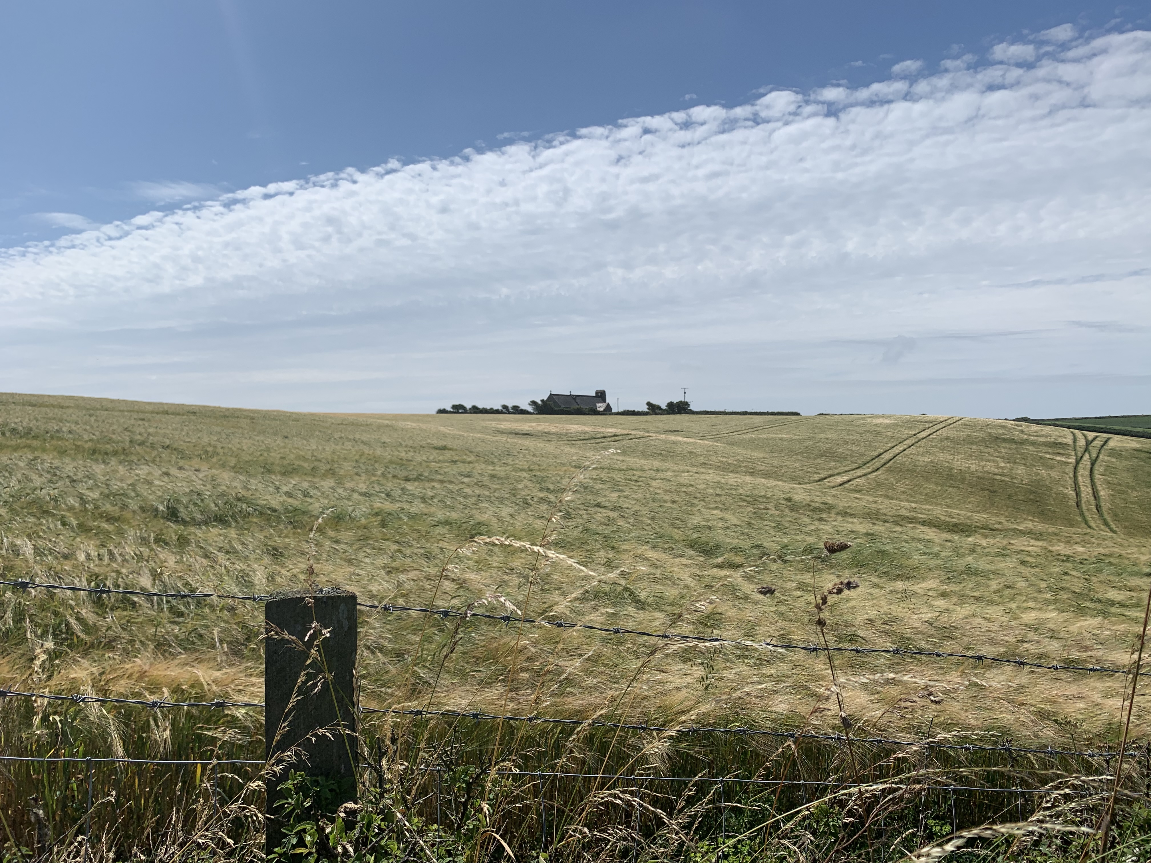
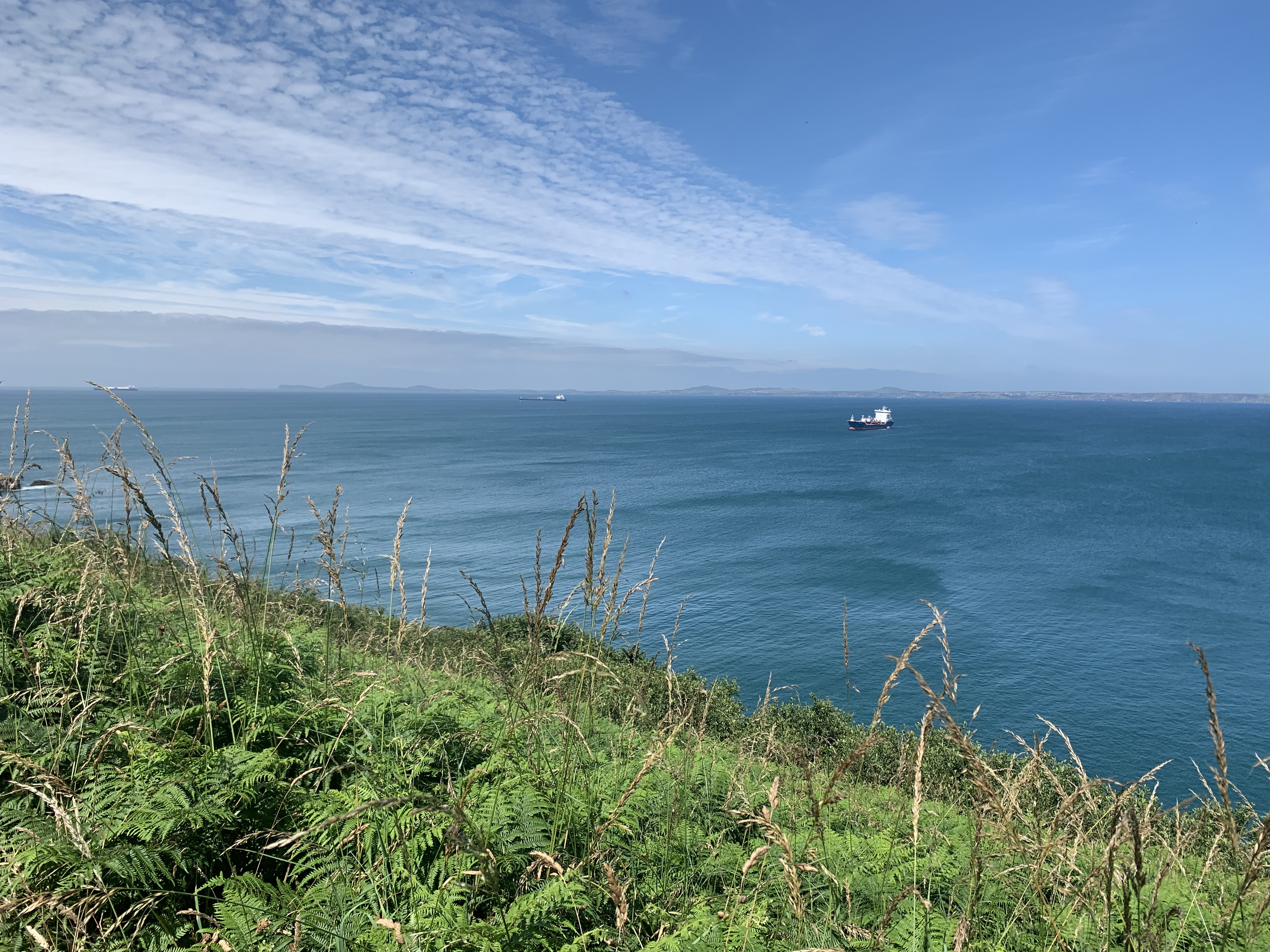
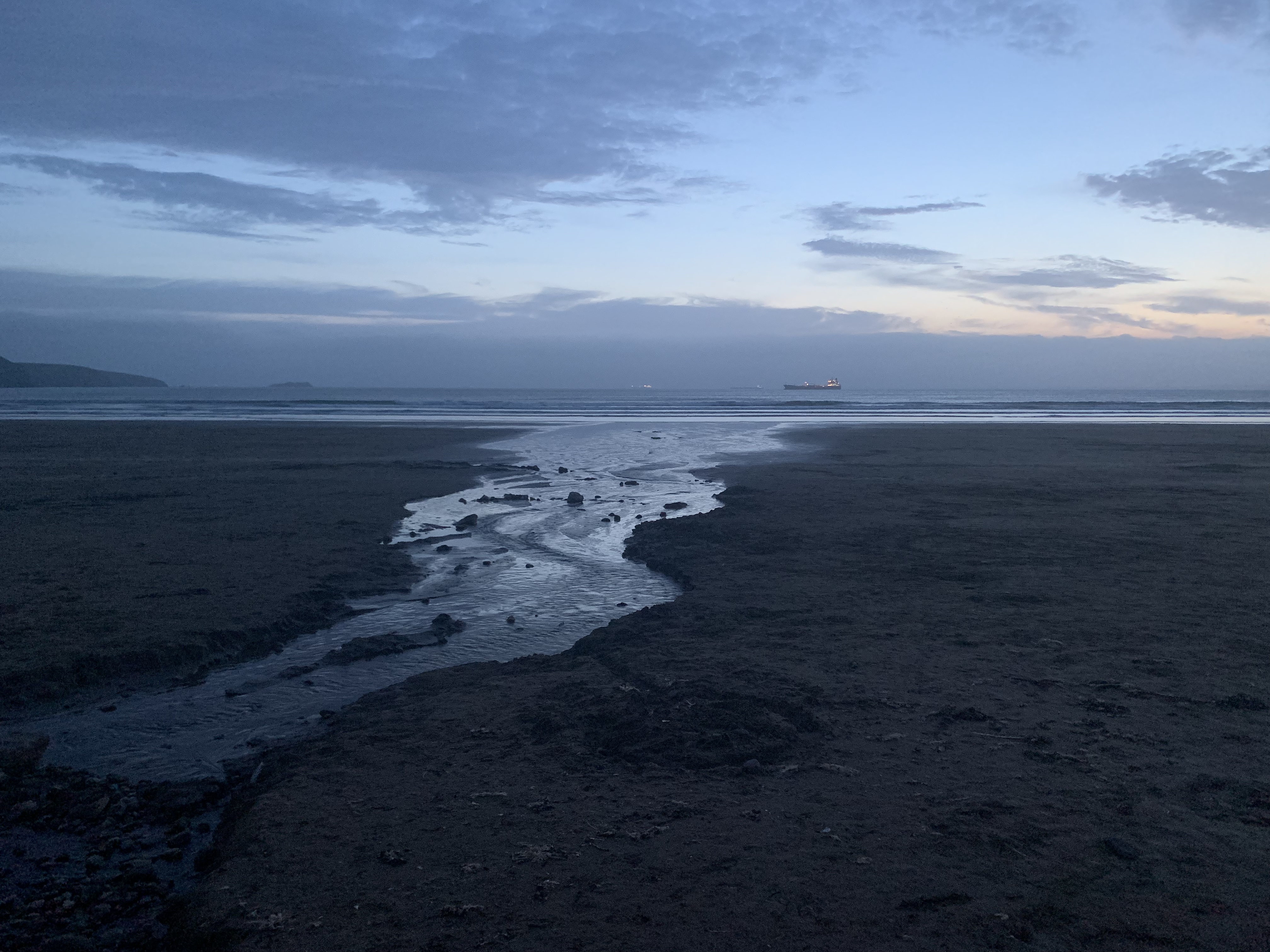
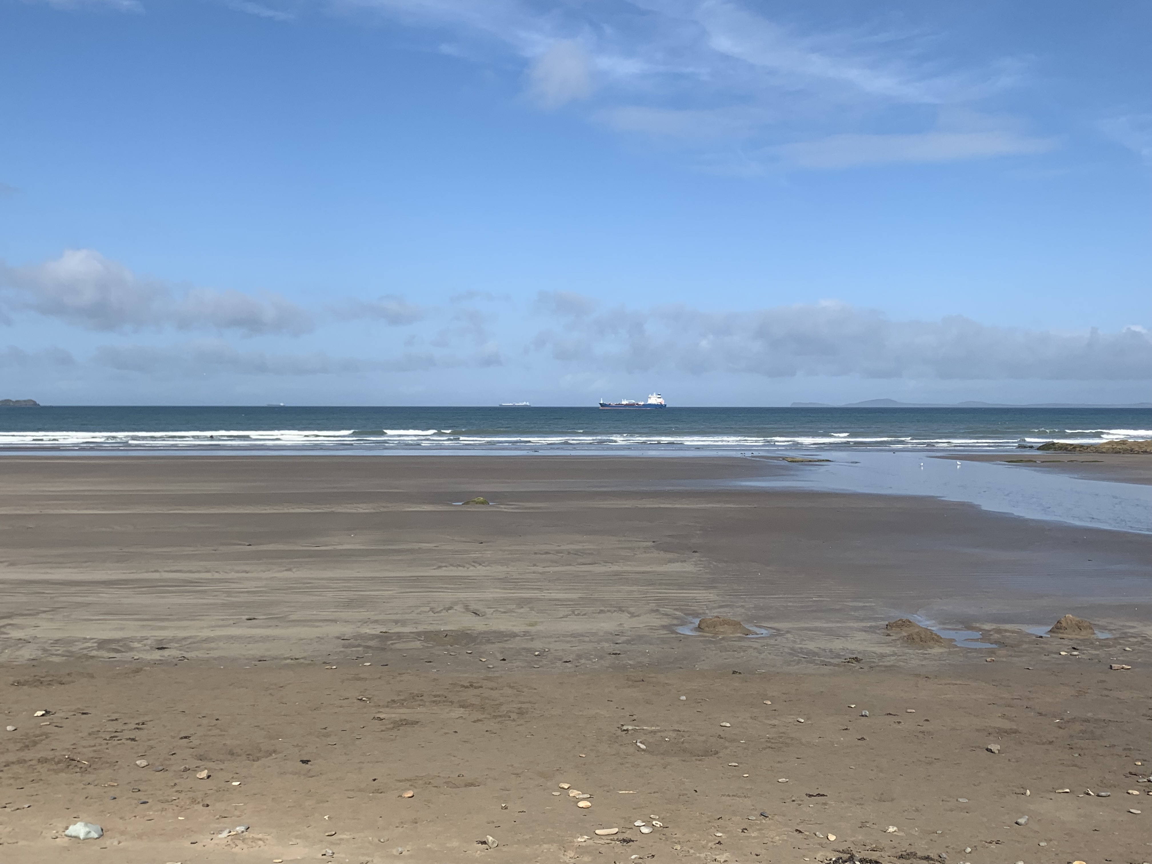
The guidebook had made it clear that this wasn’t going to be exactly the most scenic section of the coast path, however, it was very interesting! I don’t know about you, but when I turn on the gas hob, I don’t think much about where the energy has come from. Well, now I know: if you live in Britain, chances are the gas you use comes exactly from this spot! The Milford Haven estuary, my destination on this day, is Europe’s second-largest oil port, and the huge tankers you see arrive in it have travelled all the way from Qatar – that’s a hell of a journey.
All the way to Pembroke, I passed hundreds of metres of oil pipes and jetties, though sometimes the route took me a little away from the shoreline and through fields, woodland as well as along paths with very high shrubbery on either side. And there was cattle. Lots of it. And streams and ponds. And what does that combination bring? You guessed it – the most treacherous beast in all this green and pleasant Land!!!! THE HORSE-FLY. There I was, walking among these dark Satanic Mills, chased by the devil himself, who had donned this cunning disguise:
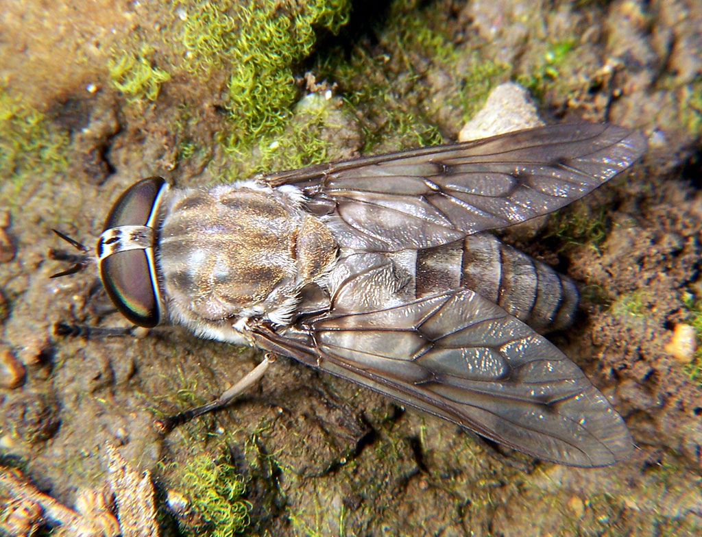
Truly, I cannot stress how evil horse-flies are – they even bite through your jeans! And it hurts! After half an hour of wafting my guidebook through the air like a lunatic, in a vain attempt to discourage the little whatsits, I was so desperate I resorted to running, as it seemed the only way to escape!
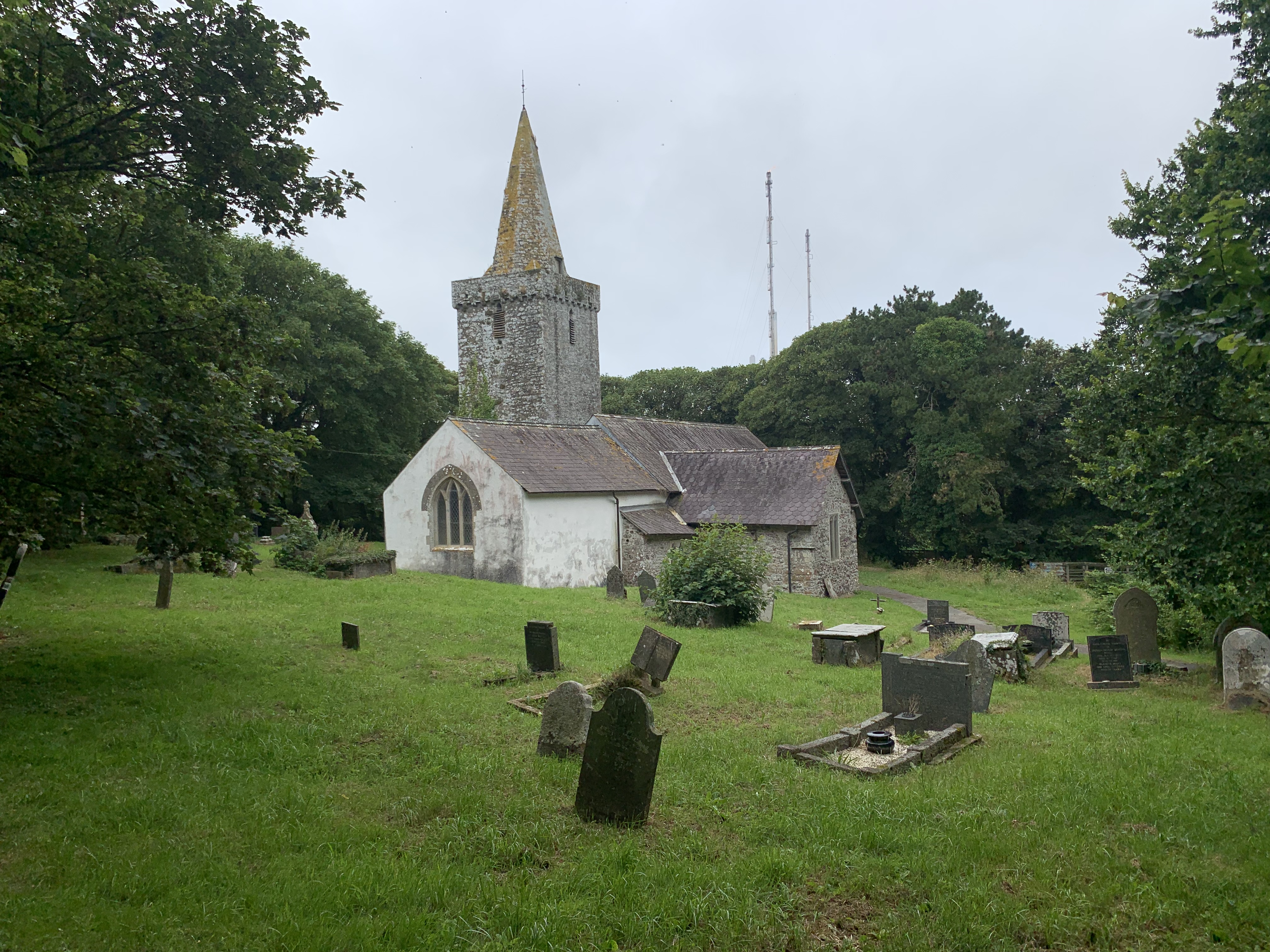
If you flee from the devil, the most natural hideaway would be – a church! I chanced upon one, but alas, ’twas locked – so on I went.
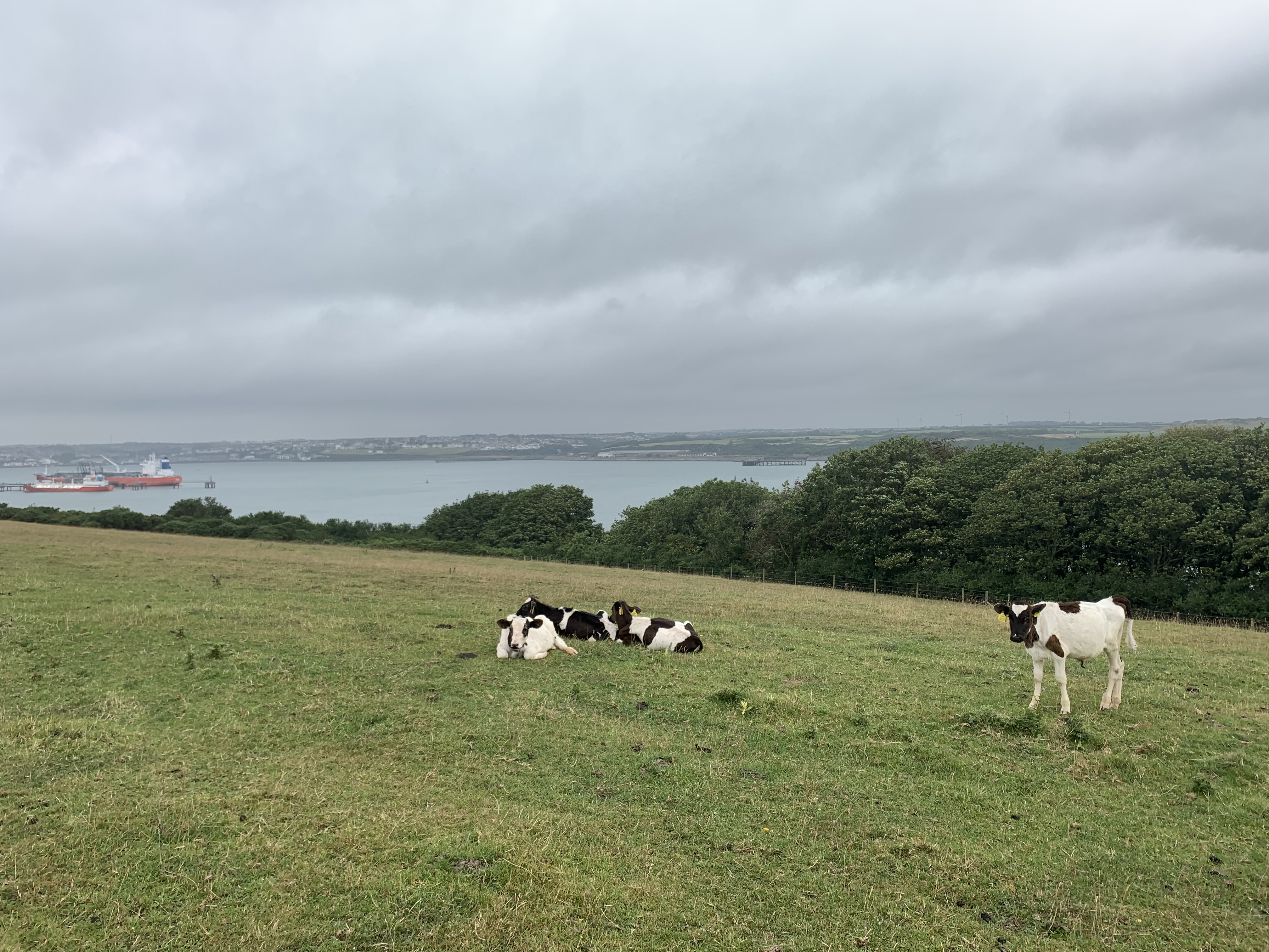
I mentioned the cattle. There was one particular field during the first half of the walk that had loads of cows in it, which, for the most part, were small and cute. Exhibit A:
However, I eventually came to a hedge, with fence in between, with an opening only about four metres wide – and of course all the big cows had gathered there. I could make out the wooden pillar with the Coast Path arrow from afar, but I could also spot a bull amongst his female companions! That I was not so thrilled about. Knowing there was no other option, I cautiously approached – but when I got to about three metres away, the bull looked at me and got on his feet. Without a moment’s hesitation, I turned around and rolled – with backpack still on my back – underneath the fence to safety. Who knows, it might have been fine, but would you have risked it?
With no idea where the arrow had pointed, I followed down the field’s slope and found myself faced by – more hedges. After 20 minutes of misery, in which I tried to find a way out, I eventually found another opening, where, naturally, more cows were waiting for me. Since there was no bull in sight this time, I braved it and squeezed past those peaceful ruminants, but I cannot tell you how relieved I was to spot the longed-for gate on the other side! At that point, I had no idea of the horse-fly ordeal that lay in store for me…
If this paints a somewhat negative picture, I humbly apologise – as I said, it was a fascinating section of the Path. After more animal encounters – with horses and farm dogs – I made it to lovely Pembroke, the county town, by way of the housing estate of Monkton. I hasted into the supermarket there and then enjoyed an icy coke and a bag of crisps while watching joy-riding youths stopping for neon-coloured slushies. Gandalf and I didn’t really fit into the picture somehow (except for the coke and the crisps, I guess).
There is a more picturesque part of Monkton, and soon, the impressive Monkton Priory fell into view. Close by is the stunning Monkton Old Hall, which in part dates back to the 1300s and now sadly houses holiday apartments. I then walked down the Awkward Hill (!) and trundled into Pembroke, where the wonderful castle was waiting to be explored.


Built between 1189-1218, with more buildings added in the mid-13th century, it remained relatively unscathed for the most part, until that old spoil-sport Oliver Cromwell came along. Although the Earldom of Pembroke sided with parliament in both civil wars, it came to a Royalist uprising in the second one that took a seven-week siege led by Cromwell to defeat – who then, after even ordering its destruction, apparently lost interest in the castle’s fate, which subsequently fell into disarray… Only in the 1880s, and then again by the Philipps family in the late 1920s, was it finally restored to its former glory.
You might recognise it as one of the settings of 2016s sop-fest Me Before You!


The guided tour was so lovely that I decided to take a later bus, and an hour-long journey via Pembroke Dock and over the Cleddau Bridge brought me to Milford Haven and my next B&B. A house dating back to 1797, it was built by one of the whaling families that had come all the way from Nantucket, Mass., by way of Newfoundland and had settled in what was then essentially just a hamlet. That’s why the house is Canadian in design and almost identical examples can be found over there .
Well, I fell in love with this B&B straight-away – it oozed old-world charm and seemed to consist entirely of stairs! The owners, who have run the establishment for over 40 years and are now, nearly 80, contemplating retirement, explained to me at breakfast the next day that the house had been divided into two at some point. They bought both halves and joined them up again – hence the abundant amount of staircases, nooks and crannies!


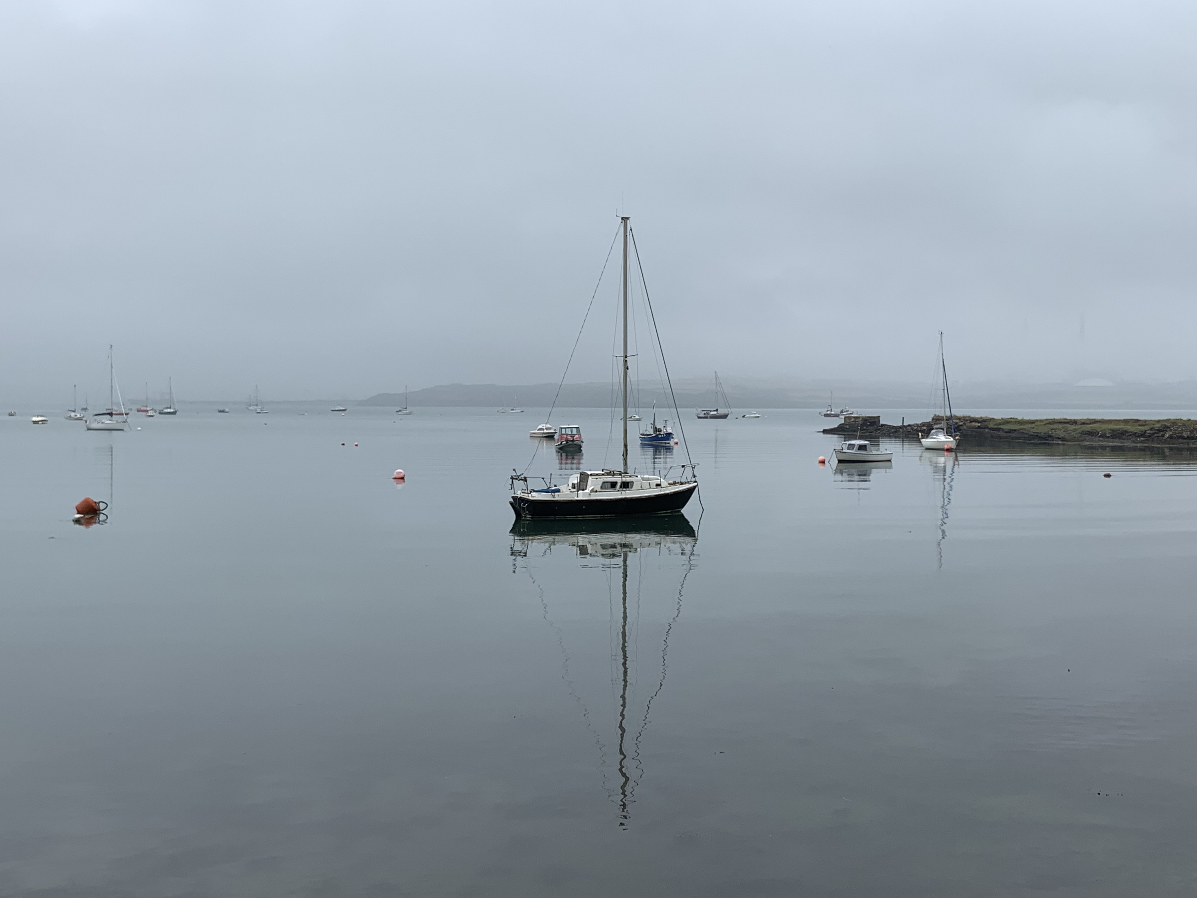
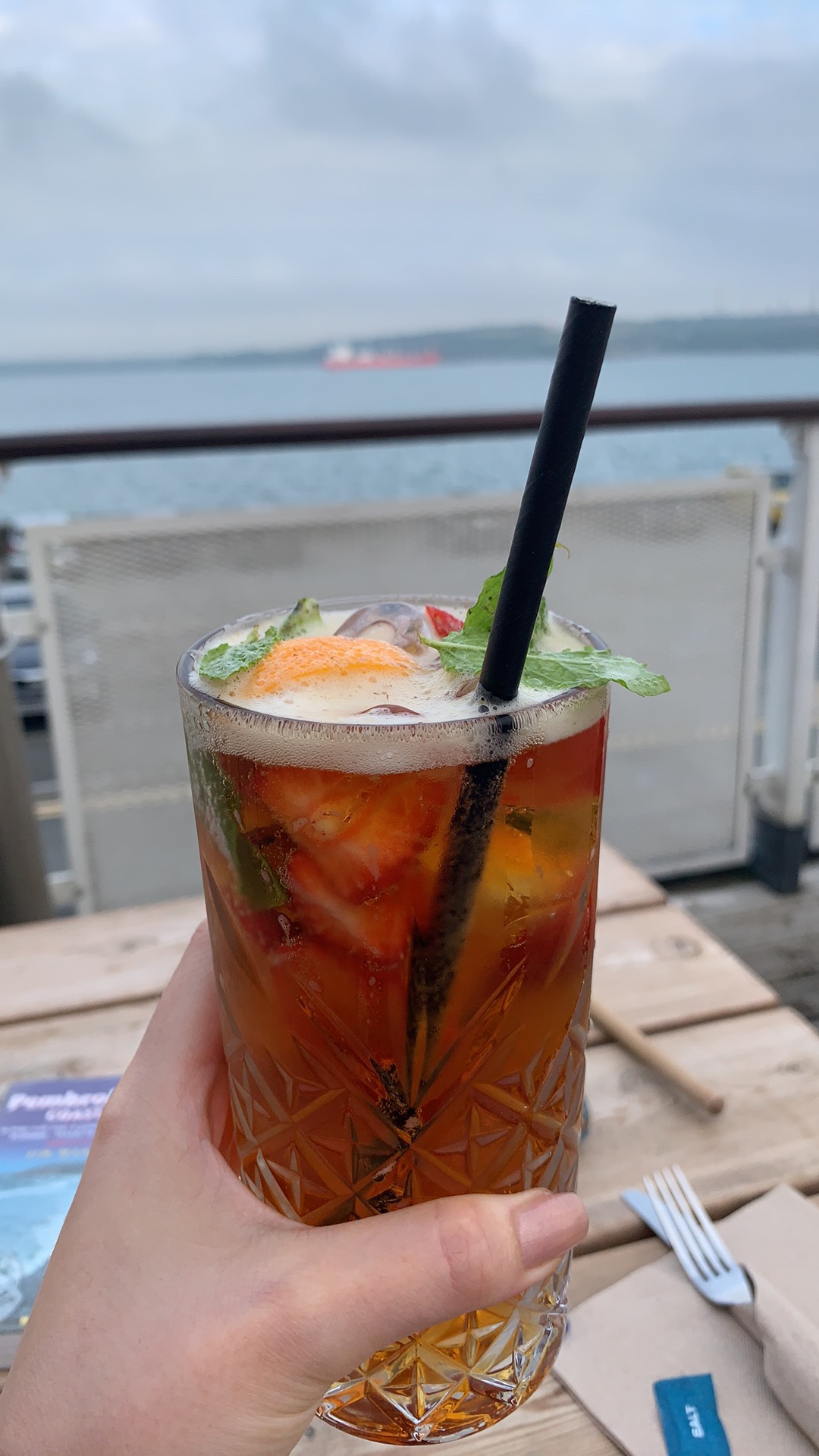
After working out the shower pod, I had a nice dinner at the marina, looking over to the other side of the waterway – wondering whether “the devil” was still plaguing unsuspecting walkers. One thing was for sure: I was in need of a drink.
Cheers!
DAY 6: Milford Haven to Dale, 17,7km
This day was all about leaving the industry behind, but first, I visited the Milford Haven Museum. What a gem it is! I thought I’d spend maybe an hour there at most, but in the end it was at least double that. On two floors you learn all about the three stages of the town’s industrial history – the whaling, the fishing, and the oil…ing.


It truly was fascinating! When in its heyday, 5200 men and women worked in the Milford Haven fishing industry. There were even overhead rails to transport ice blocks (see above) to wherever they were needed in the harbour to keep the incoming masses of fish fresh. H.V. Morton, in his 1932 book In Search of Wales, paints a vivid picture:
“It is a great sight to see the trawlers come in heavy with their catch. There are about 120, some of them the largest and most modern fishing-vessels in Great Britain. They come steaming up the magnificent harbour, sometimes in small companies. They have been out, perhaps a week or a fortnight. Their crews have not had time to shave. They climb about the decks in great sea-boots. They prepare to unload their catches. Hundreds of men on the dockside are waiting for them. Tons of fish lying in crushed ice are dumped on the quayside…. The men work all night sorting and washing the fish…. The buyers come at 8a.m. The sales are over at 10a.m. Shortly afterwards the special trains steam out of Milford Haven, taking fish to the ever-open mouths of London, Manchester and Cardiff.”
Of course, this abundance wasn’t bottomless, and in the 1950s the industry started to decline due to the effects of over-fishing. Still, today’s oil industry, though less to look at, is hardly less interesting – for example, you could fit the Albert Hall into each one of the South Hook LNG (=liquified natural gas) terminal’s five tanks! However, even more impressive is that this terminal is the receiving end of the biggest supply-chain ever forged for the global movement of energy.
Put that in your pipe and regasify it!
But I digress – if you’d like to know more about Milford Haven’s past and present, I highly recommend this well-researched article by WalesOnline: The Welsh waterway which is the industrial backbone of a nation
It was very hot, so I was glad that time was not of the essence today – the route included the Sandy Haven Pill, but I was lucky with the tidal times and could cross from 3pm. Be sure to check them, as otherwise you need to take a lengthy 6km detour inland, with only the otherworldly Taberna Inn en route for refreshment (check out their TripAdvisor reviews, they make for an entertaining read!).
It’s a beautiful section of the path, with Lindsway Bay a good spot for a swim. Just before you reach Dale, you need to cross The Gann, a creek with a wide shingle beach that gets flooded at high tide. Walking over the huge amount of algae was like walking over bubble wrap!


Maybe it was simply because it was my fourth day in a row walking, but my legs were absolutely killing me by the time I got to Dale. It sure was a welcome sight, and a pretty one at that – I even took the long way round to the B&B so I could take in the church and the local castle, or rather grand manor house, that is still in private hands.


I must say, there’s nothing better than a long shower after a long walk and to then wrap oneself in a huge fluffy towel and lie on the bed to rest aching limbs. Heaven! But hunger forbade me to sleep just yet, and I somehow managed to put clothes on and walk – nay, crawl – to one of the local eateries. The heaving Griffin Inn luckily had a free table left, and so I got to enjoy the best fish pie in all of Pembrokeshire, if not all of (South) Wales! It was simply delicious. Finishing off the dinner with a knickerbocker glory that was truly, well, glorious, accompanied by a shimmering sunset, I felt rather pleased with the world. And even more pleased when I finally rested my head on a comfy pillow!
DAY 7: Dale to Marloes, 20,5km
The day started in the most pleasant way: with good conversation over a hearty breakfast! At the table with me were two couples from Lincolnshire who were also doing the Path, and who had roughly the same itinerary as me. They headed out before me and walked the Dale peninsula anti-clockwise, which meant they could go back into Dale for a coffee before continuing the day’s section. A clever idea, as that morning turned out to be the only time during my entire walk (!) with rain! At least it meant I hadn’t packed my waterproofs for nothing…
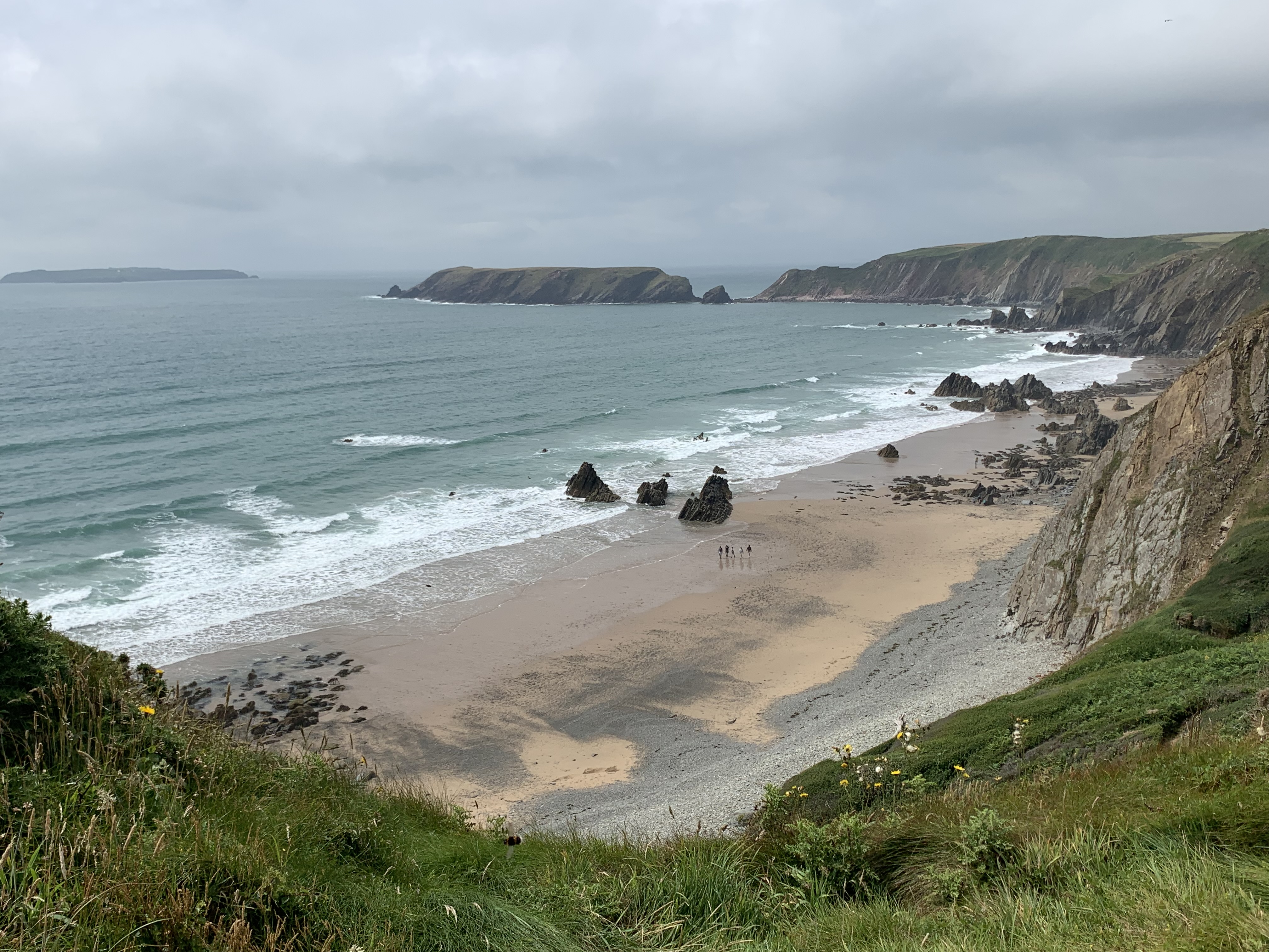
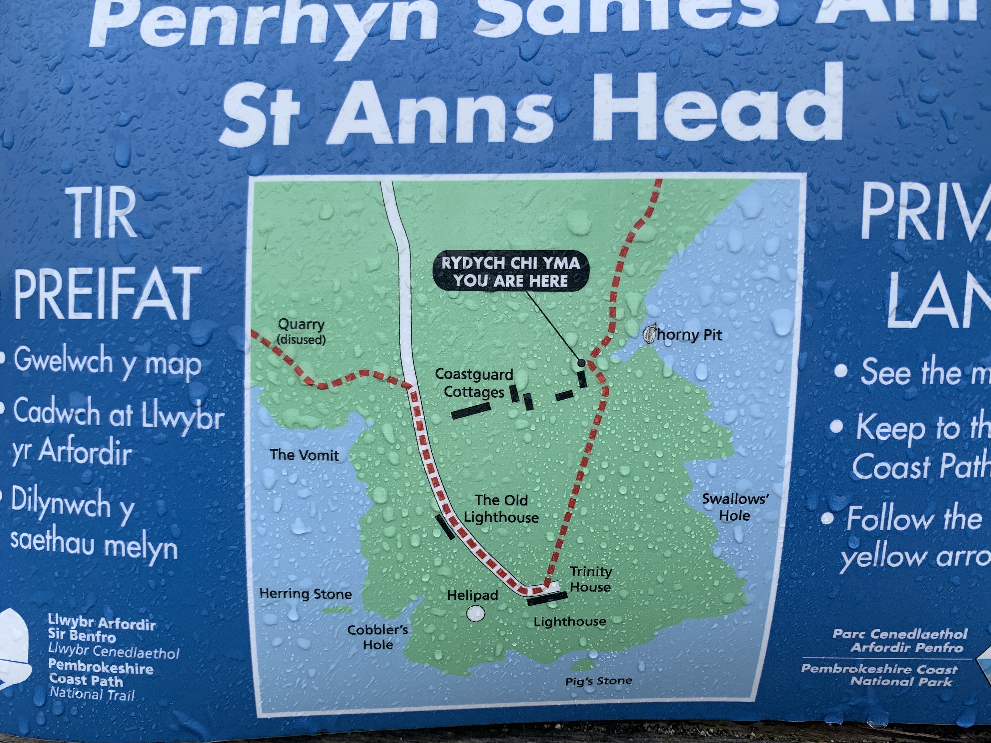
The peninsula is scenic, but surely a strange place to live. The few cottages there looked weather-beaten, and no surprise! There’s also St Ann’s Lighthouse, and a further building with a tower that you can now rent for a holiday. The décor is an acquired taste in places, but if you fancy swimming in an indoor pool overlooking the sea crushing on the rocks, then this certainly unique home might be for you:
Dale Peninsula – The Lighthouse (I’d like to point out that I don’t get any commission…)


Striking were also the names of the various other points of interest… Pure poetry.
After looking down The Vomit without vomiting, I was headed for Marloes Sands – apparently another surfers’ paradise. Since it was early on a Wednesday afternoon, the beach was nearly deserted – but I spotted one surfer who was trying to get into the water, only his tiny dog kept following him! I watched this drama unfold from high above; the little dog eventually gave in, but it was impressive how he was prepared to brave the waves!
The weather gradually brightened and I gradually dried. By the time I reached the coast off Skomer Island, it was another beautiful summer’s day and the views were to die for. And to top it all off, I spotted my first seal!


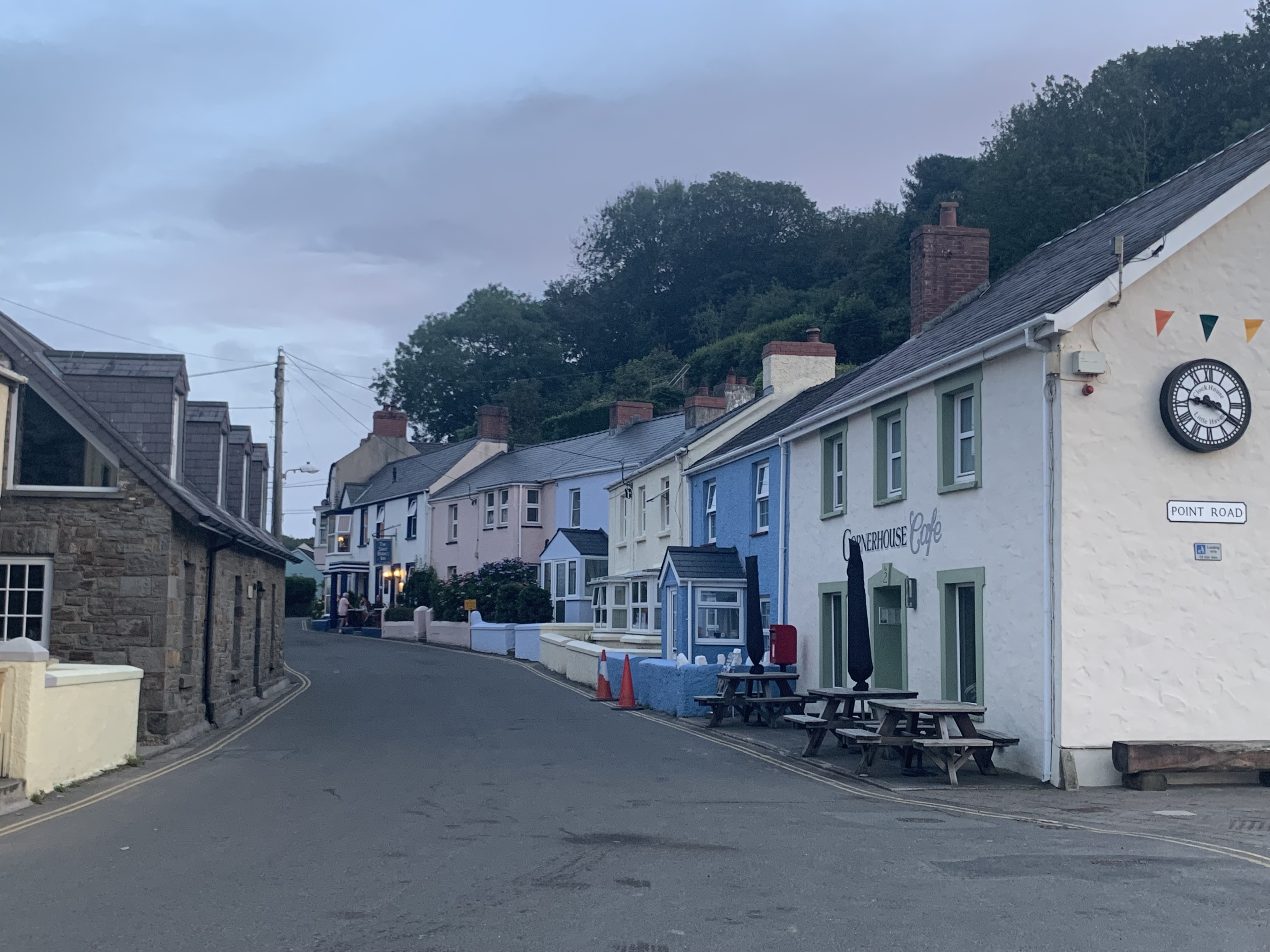
It was only another hour or so to Marloes and the Clock House Café, my next abode, so I took a nice break and enjoyed the panorama. Near the boat station, I bumped into the two couples from breakfast again, who were heading for the same place.
The description of Marloes in my guidebook was rather lacking enthusiasm, so when I finally got there I soon began to wonder if I was in the same village…it was so pretty!
Maybe Manthorpe was having a bad day when he wrote that
“Marloes is not an especially attractive village although the strange clocktower is quite interesting.”
But decide for yourself:


The B&B didn’t disappoint either! It’s linked to a café that closes at 5pm, therefore check-in was via named envelopes. I was thrilled when I learned I had received an upgrade due to somebody’s cancellation. This had already happened in Milford Haven – I was on a lucky streak! I also enjoyed a new variation of my name, one I hadn’t yet come across…
After soaking in the bath, I encountered my new friends downstairs enjoying a delicious pre-ordered supper, whereas I was on my way to the Lobster Pot pub next door, with some apprehension…the reviews online were quite damning. What followed was a dinner I can only describe as…otherworldly! I think the ambiance this picture captured says it all:
Having found an explanation for the ill humour reflected in Manthorpe’s review of Marloes, I fled as soon as possible and re-joined the jolly group in the café, who had been exploring the honesty bar. Later, I snuggled up in my comfy room with a hot chocolate and a new episode of Who Do You Think You Are? Ah, simple pleasures.
DAY 8: Marloes to Broad Haven, 15km
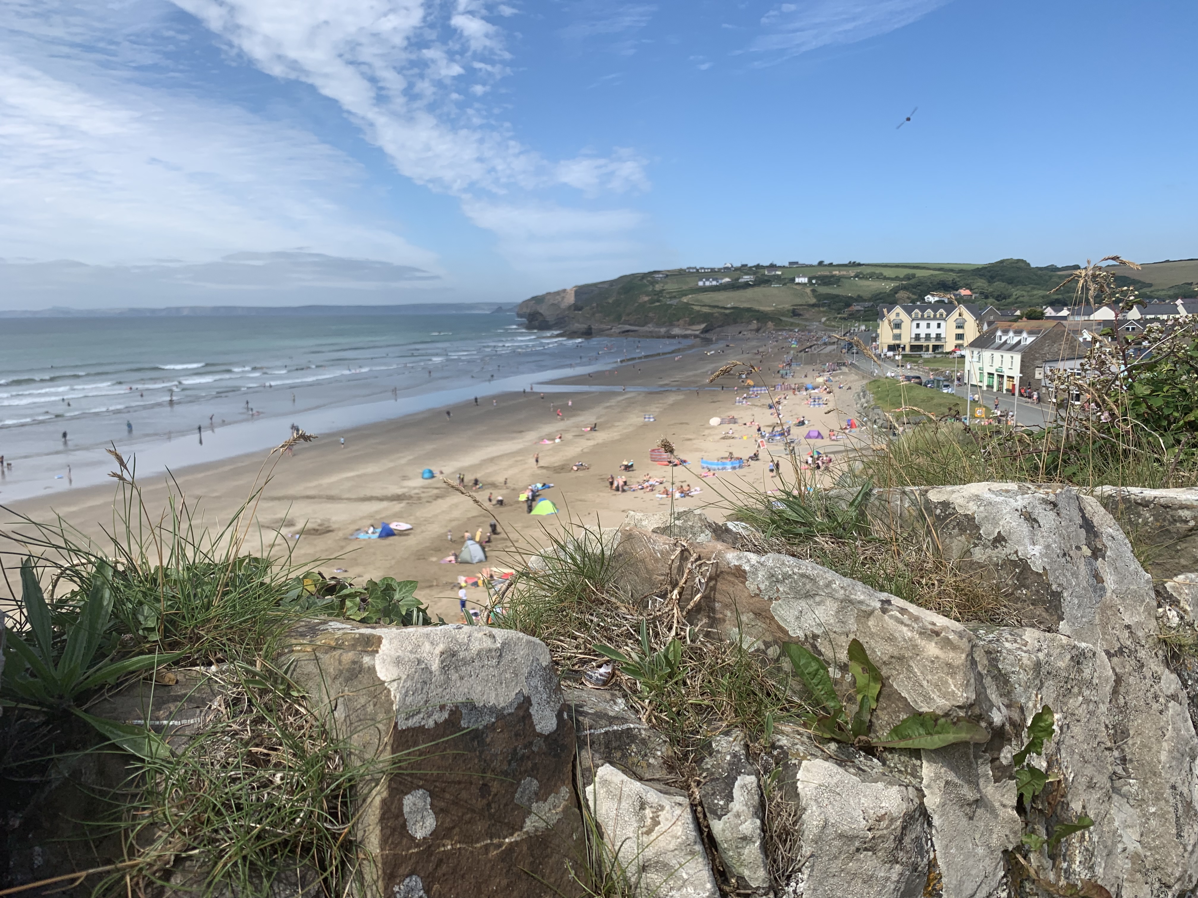
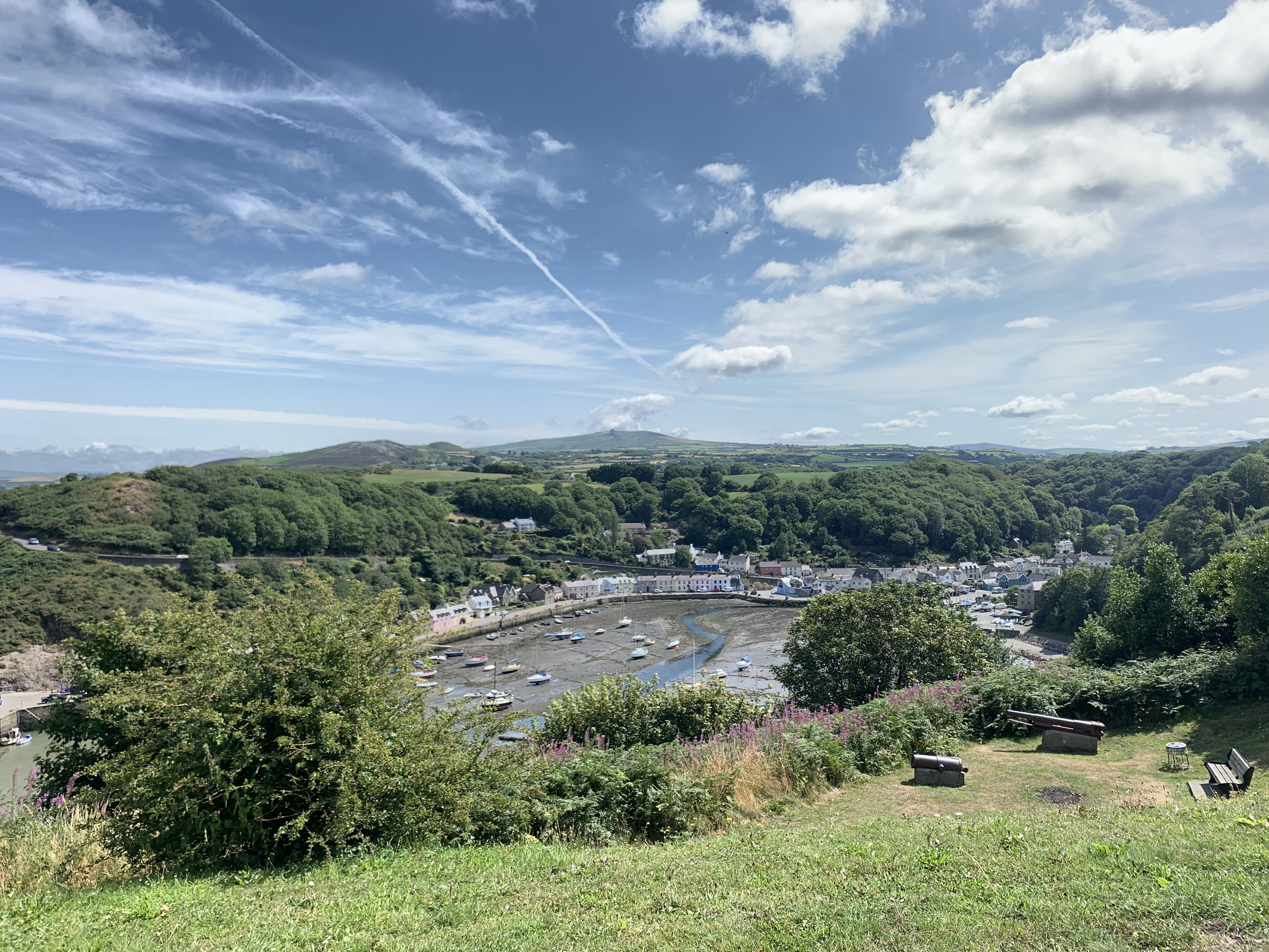
The morning once again began with a lovely breakfast and good company. The route for this day was not very long or overly strenuous, and with pancakes in my tummy and a blue sky above my head, I was ready for the day’s walking! I soon found that I was quite eager to finish it, though – not because it wasn’t enjoyable, but because it was quite a straight-forward stretch of the Path and I had heard good things about Broad Haven, so was eager to see it. Before you get to Broad Haven, you go through Little Haven, an enchanting and, indeed, little haven. It is only separated from its bigger brother by a hill, albeit a substantial one. Yet both villages have their own character: Little Haven has a lot more old world seaside charm, whereas Broad Haven has the huge beach and is rather cheap and cheerful. But see for yourself:


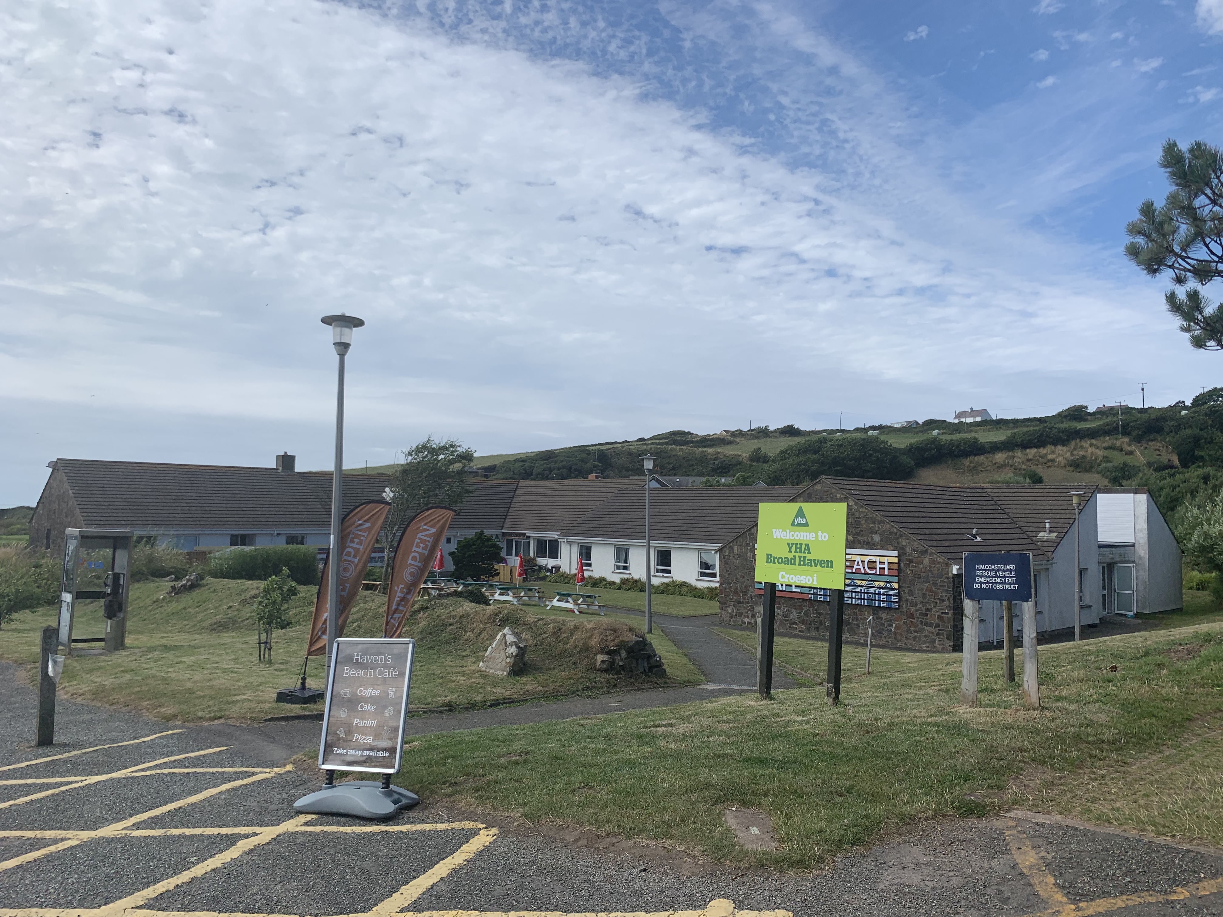
I headed straight to the Youth Hostel at the far end of Broad Haven, eager for a shower. I was early for check-in, but luckily, the room was ready and I had the 7-bed dorm all to myself for a while. Soon I was joined by two other residents, a girl from France and one from the US. Lindsey, from LA, and I ended up heading out to dinner together – we left busy Broad Haven behind and had some delicious seafood in a quaint but bustling pub over the hill.


Afterwards, the real extent of the location’s beauty became obvious in the sinking sun. Simply stunning! Gone were the families and merry crowds, only a few surfers were still out. The light made for some extraordinary pictures – I was so glad we caught it!
Back in the YH, we discovered to our joy that we had only been joined in the dorm by one more guest. Alas, we had been jubilant prematurely – guess who turned out to be the one snorer in our midst…
DAY 9: Broad Haven to St Davids, 28km
After a disturbed, but altogether still decent night’s sleep (it’s the sea air that does it), I got up at 7:20am, as I was rather nervous about this day. I had combined two walks in order to be able to get to St Davids without another over-night stop, so was keen to get the first stage “over with” early, since the terrain further up was supposed to be a lot more strenuous. In pursuit of sustenance, I was surprised to find that the YH breakfasts differ quite a bit from place to place in terms of what’s on offer (although they have the same price). The one in Manorbier had been fantastic – this one was pretty stingy, with not even tea other than black available. However, the waitress took pity on me and let me have a “speciality tea” from the bar… After saying goodbye to Lindsey, who was off to Stackpole and Barafundle Bay as recommended by yours truly, I started with a brisk pace, only stopping for a quick look back on Broad Haven.


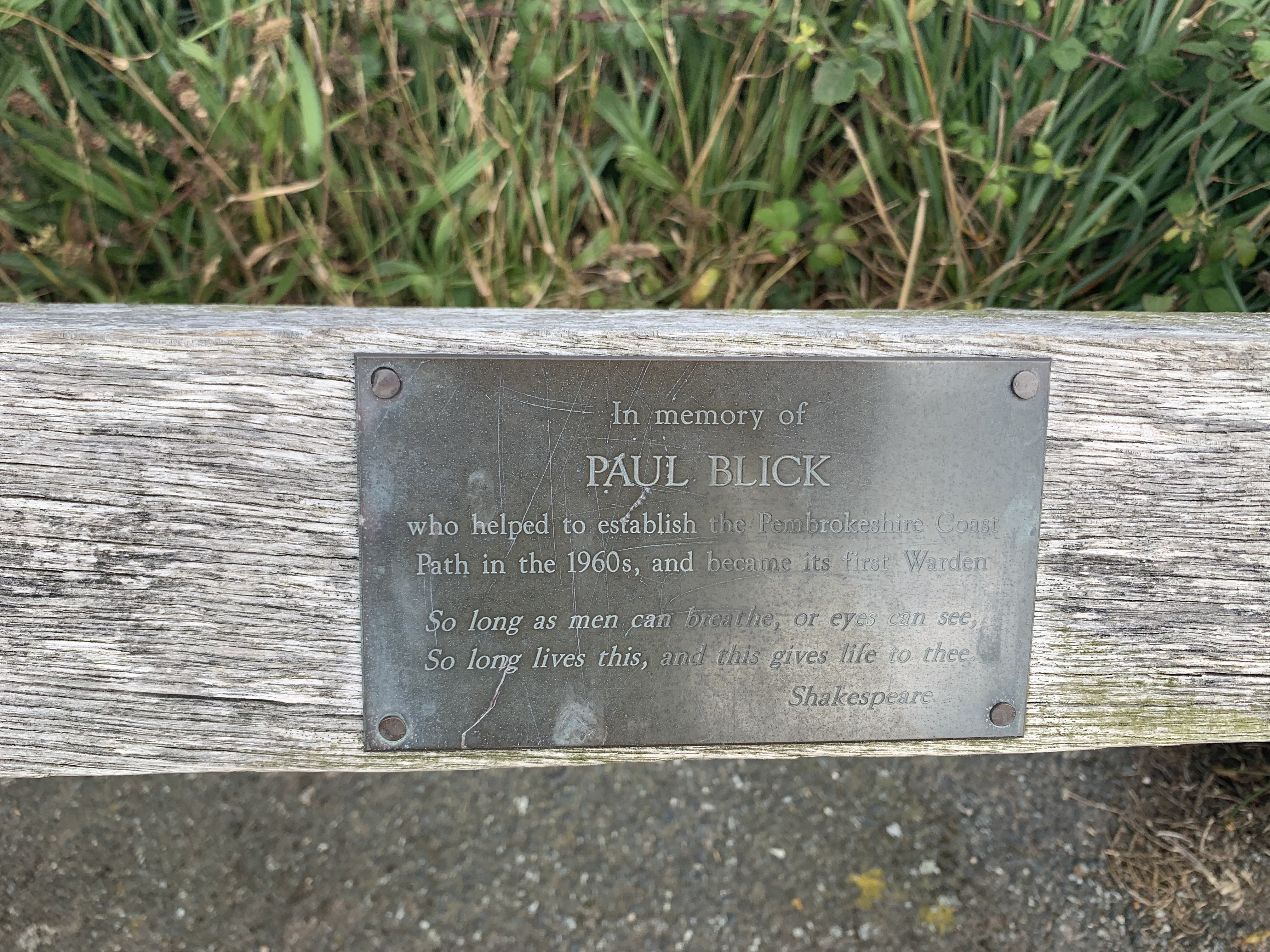
I came across several moving memorial plaques along the way, but this one stood out. Incidentally, “Blick” means “view” in German – nomen est omen, as one of my teachers used to say!
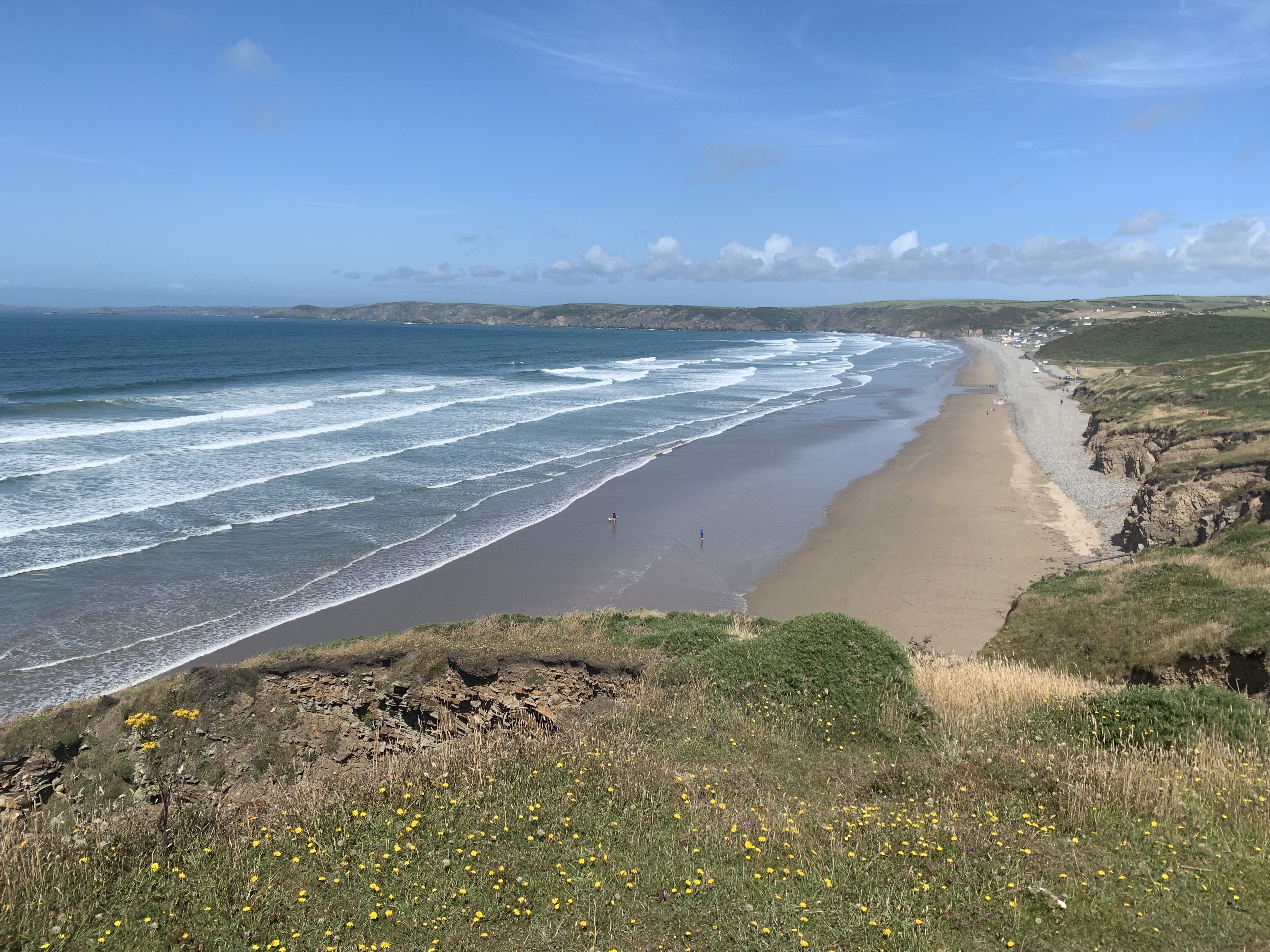
The route on this day was supposed to be 11+14km, not including the walk from the Path to St Davids, and again from St Davids to the Youth Hostel. All in all, quite a few variables! However, I needn’t have worried: this turned out to be one of the most enjoyable days of the whole holiday. First of all, the first 11km turned out to be just shy of 10, with the last 2 miles walking along Newgale Sands – yes, that is over 3000 metres of surfers’ heaven!
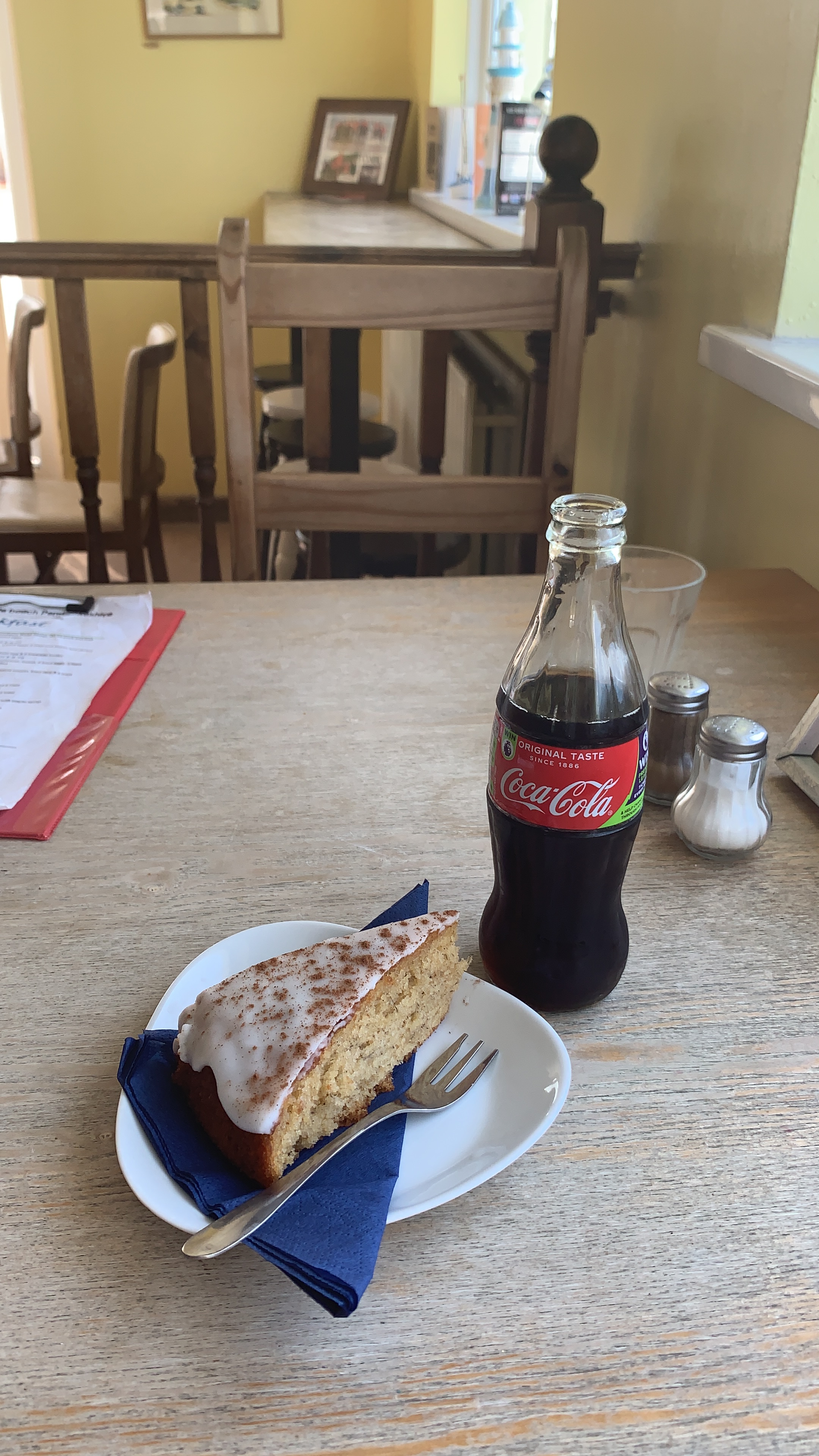
The thought of icy coca cola popped into my head (in a glass bottle, of course) and wouldn’t leave me alone. I was sincerely hoping for a nice café at the end of this sandy immensity! Well, lo and behold, my prayers were answered:
With new strength and added buoyancy, I practically flew up the following hills! Well, not quite…they were not for the faint-hearted. The undulations and frequent ups and downs made this one of the most interesting and rewarding sections of the Path. Knowing now that I wouldn’t struggle with the time, I was able to enjoy it to the max.


And sure enough, I was already in Solva by 3pm! The guidebook, as well as the official signs, had got it wrong again and the proclaimed 5,5km were a mere 4,5. Solva itself is really nothing to write home about – good old Jimmy Manthorpe had got that wrong as well (calling it the prettiest village of the Path…a real head-scratcher).


Before I reached Solva, I crossed paths with a woman from Germany, who I asked if the village ahead was really already Solva. It turned out she knew the area very well and had also found that the mileage given on the signposts was incorrect. Anyway, we chatted a bit, about the Coast Path and the wildlife, and she pointed out, with lovely German pragmatism, that the bit from Fishguard – where I was going to end my walk – to St Dogmaels, the official end of the PCP, was really overgrown at this time and not worth walking. That made me feel better about not doing all of it! She also told me that there were seals – and even dolphins – to be seen from the path around Ramsey Sound. The trick with seals was apparently to attract their attention with movement and noise. In other words, dance and whistle!
Without bothering to stop in Solva, I made it to Caerfai Bay – the end point of today’s walk – at around 5pm. It was another mile into St Davids, which I started to feel in my legs. I was faced with a further hour’s walk from St Davids to the YH, and along country roads at that. I was beginning to feel a bit foolish about having planned it that way.


Entering the town and walking along the main street, I suddenly recognised a familiar face – the German woman from earlier! She immediately presented a solution to my dilemma. There was a bus still running from the town centre to Whitesands beach, stopping close to the hostel. There was one going in 5 minutes! I hasted to the bus stop, and a moment later I was on the Coastal Cruiser (which only runs in the summer months). I was very well pleased, and even more so when it became obvious how far it was to the hostel! The bus ride was adventurous, since the driver obviously knew the roads like the back of his hands. He reversed just as fast as he was going forwards. Fittingly, we sped along the tarmac of these one-way country lanes to ACDC’s Thunderstruck…
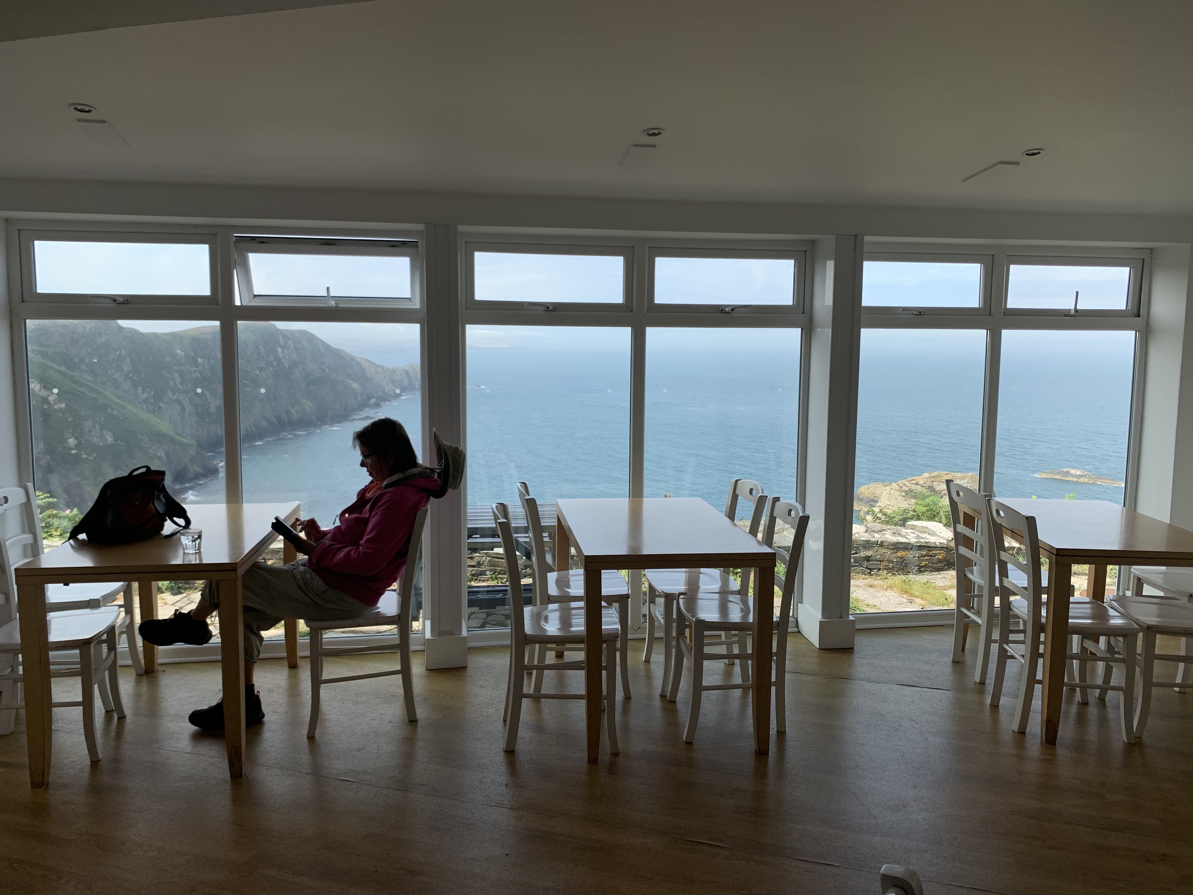
He dropped me off at the drive to the YH, which really is in a spectacular spot!
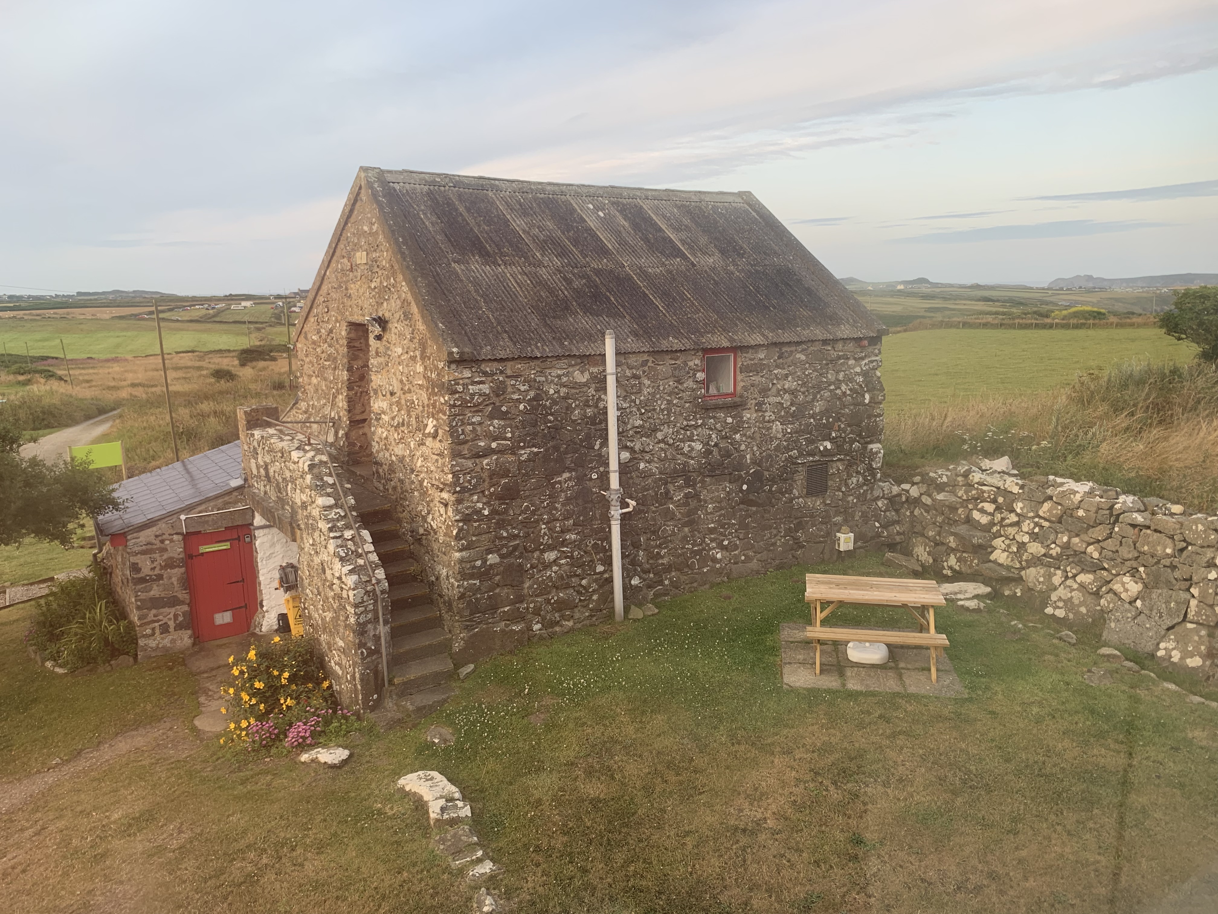
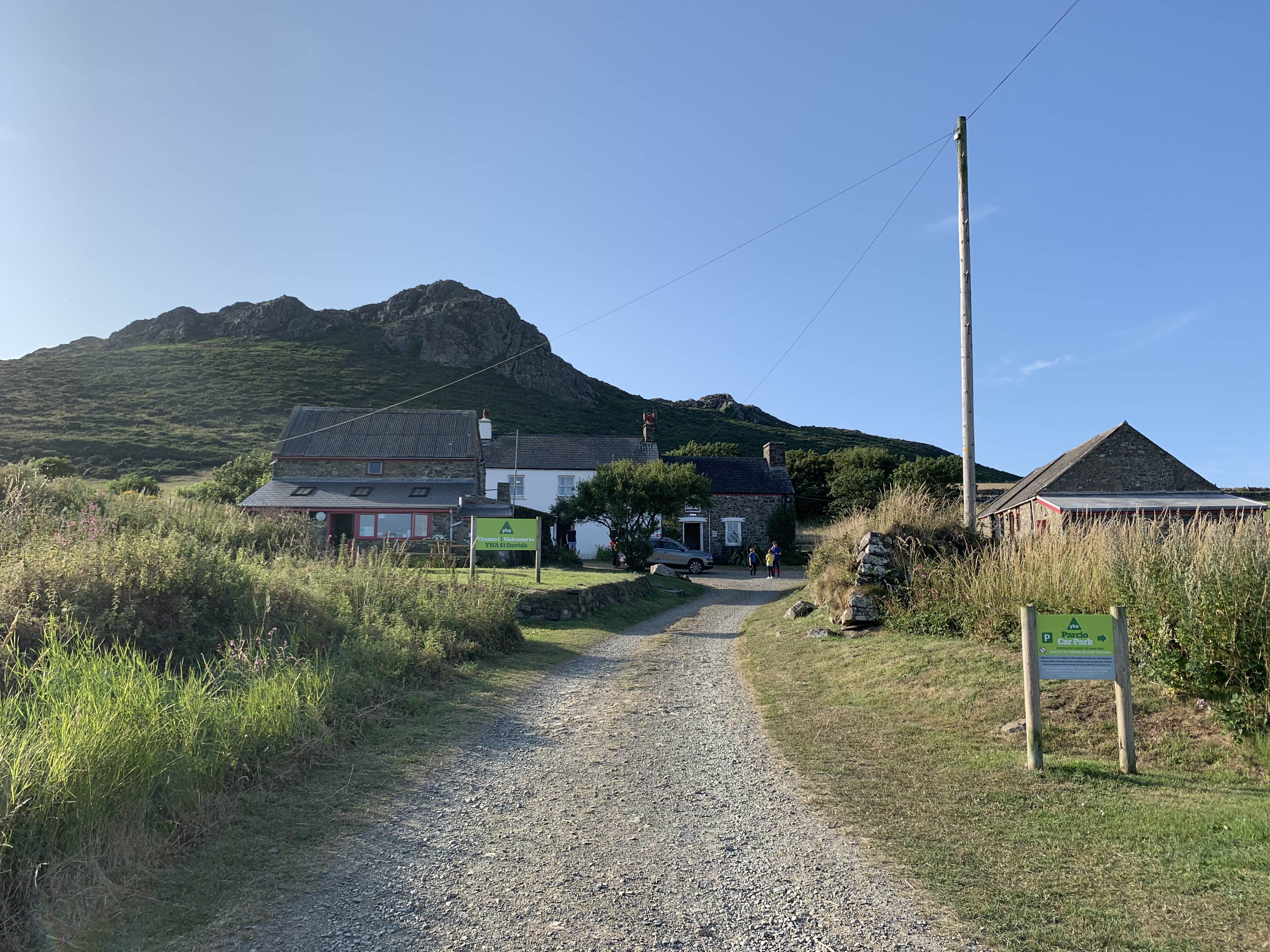
Being in a former farm, the reception was in an old cowshed. The check-in was sweet: it seems this YH is run as a family business, namely by a couple and the husband’s mother (who was a hoot!). I had told the driver that I would catch his bus again at 6:40pm (the last one running back into town), so it all had to be rather quick. I was shown to my single room and quickly had a shower, then practically ran down the long driveway (a good ten minutes walking!), just making it in time. With it being a Saturday night, St Davids was pretty busy. The Bishops Pub had a lot of free tables, but was in fact booked up till 8pm, so I headed to the Farmers’ Arms, which was too full. Feeling rather famished, I made for the expensive-looking Cross Hotel and ordered the sea bass plus dessert. No sooner had I sat down in the garden did I receive a text from Lindsey, who had just landed in St Davids and wanted to go to the Farmers’ Arms! Aaargh! Oh well – I told her where I was about to eat a tiny piece of overpriced fish, and she joined me there for a drink. Luckily, the waiter came out to say that they had run out of the dessert I wanted, so we were able to leave that place. After a (in my case) second dinner at the Farmers’ Arms, we tried some local gin in a bar around the corner. As Lindsey was driving and couldn’t finish her G&T, I suggested she pour it into the tonic bottle. Ginious. She gave me a lift back to the hostel, which I was infinitely grateful for – I didn’t really fancy walking those roads at night with only my phone torch giving me away.
Lindsey had quite a drive before her and we joked that she was going to Mexico, because her hostel was Mexican-themed (an obvious décor choice in the middle of rural Wales…). I learned the next day that she was pulled over by the police ten minutes before she was due to arrive there, and – maybe because they spotted the tonic bottle? – was breathalysed! (Thankfully she got 00.00…)
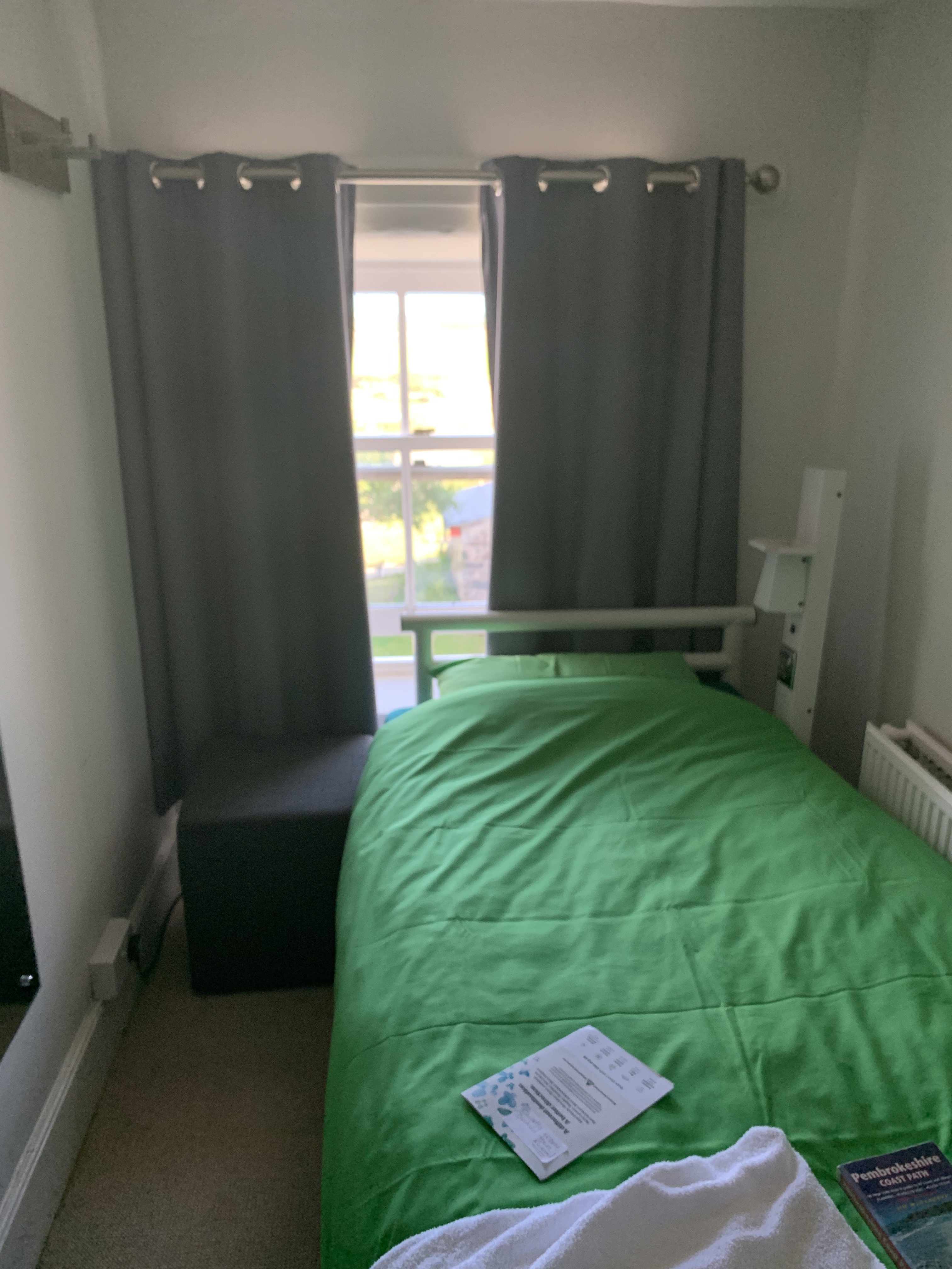
I was so happy not to share a room for two nights. My dorm was snug, but practical, with a lovely view from the window!
DAY 10: Loop from Caerfai Bay to Whitesands, 15km
I got up around 8:30, put a load in the washing machine and prepared my backpack for the day – as this time, I only needed to take the essentials. I caught the coastal cruiser and was back at the gin place from the night before, only for breakfast this time… After an excellent egg and bacon sandwich and a nice pot of tea, I went to the famous cathedral.

The sight really did not disappoint. Before going in, I went to the cute bookshop in the cathedral close. They had very beautiful postcards, so I bought a bunch, but with a heavy heart, I decided I could not fill my backpack with heavy books, so “Embroidery – A New Approach” had to stay behind…


In the cathedral, I put in the suggested £5 in the donation box and was thanked profusely by the guide who was standing close-by. He asked me where I was from and told me that he had once been to Hannover to visit the Post Museum! (It doesn’t exist anymore, so hold off on booking those flights!) Another visitor came over to ask him about the walls, which are slanted, and what followed was straight out of a sketch show:
A:”Was it due to subsiding?” B:”Was it due to subsiding?” A: “Was it due to subsiding?” B: “Was it due to subsiding?”
Turns out, it wasn’t. The clues are in the building: you can see at the side of the church tower where the roof used to be. The Tower got raised in height a couple of times, but the roof and the walls couldn’t take it. So a flat roof (with a wonderful wooden ceiling) it had to be. The cathedral is also unique in that it was built on a slope. So, quite appropriately, you feel a bit like you’re on a ship. It is called a nave, after all…


It was nearly 1pm, so time to do my day’s walk. I went back to Caerfai Bay, weaponed with some ice cream, and moved quite quickly – undoubtedly because of the lighter backpack. This route was pretty – all along the Ramsey Sound, and past St Non’s chapel as well as another lifeboat station.


At Whitesands, which was extremely busy, I bought a couple of Welsh cakes and a bag of potato crisps (“potatoes born and raised in Wales!”), sat on a rock with my feet out of my boots, and felt marvellous. I walked through the water for a while, my achy Achilles thanked me for it. Then, at the bus stop, who should I meet but my B&B chums from two days earlier! I got out at the one big(ish) supermarket in St Davids to buy food for the evening and breakfast the next day. It was pretty awful – all the holidaymakers use this shop, which has everything and nothing, accordingly. Back at the YH, I had the well-deserved shower, put another load in the wash and started to “prepare” dinner (a frozen pizza…) in the lovely kitchen.
The great thing about hostels is that you never end up having dinner on your own. I was joined by a geographer from France, who was doing bits of the Path, and who had brought home-made pork paté with him. He said he always takes it on his travels, he even got it through US border control! That is true commitment.
DAY 11: Whitesands/ St Davids YH to Trefin, 19km
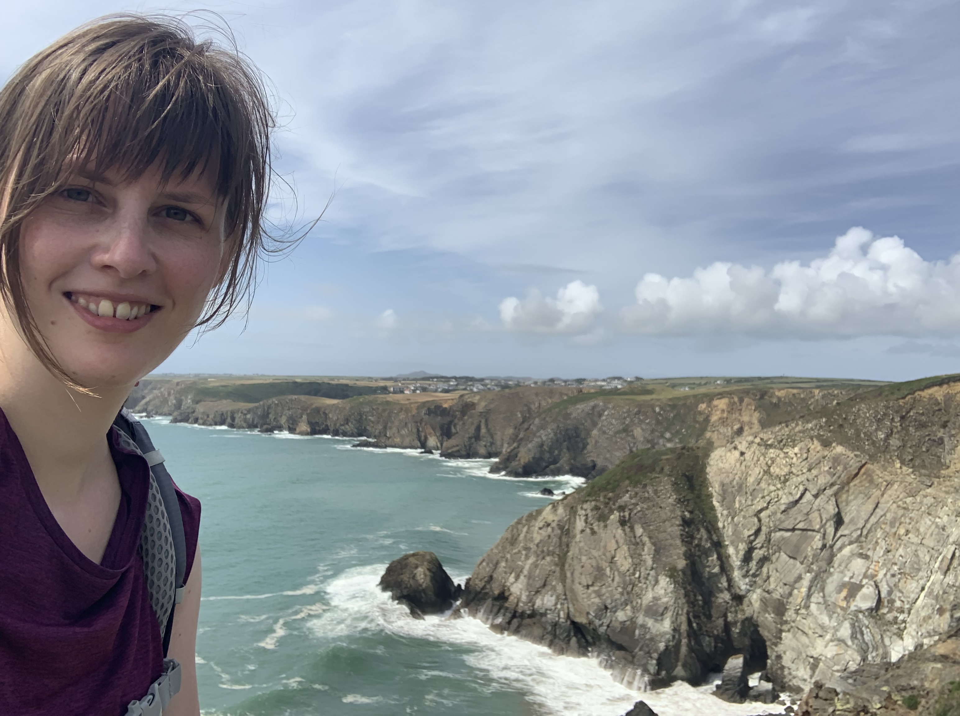
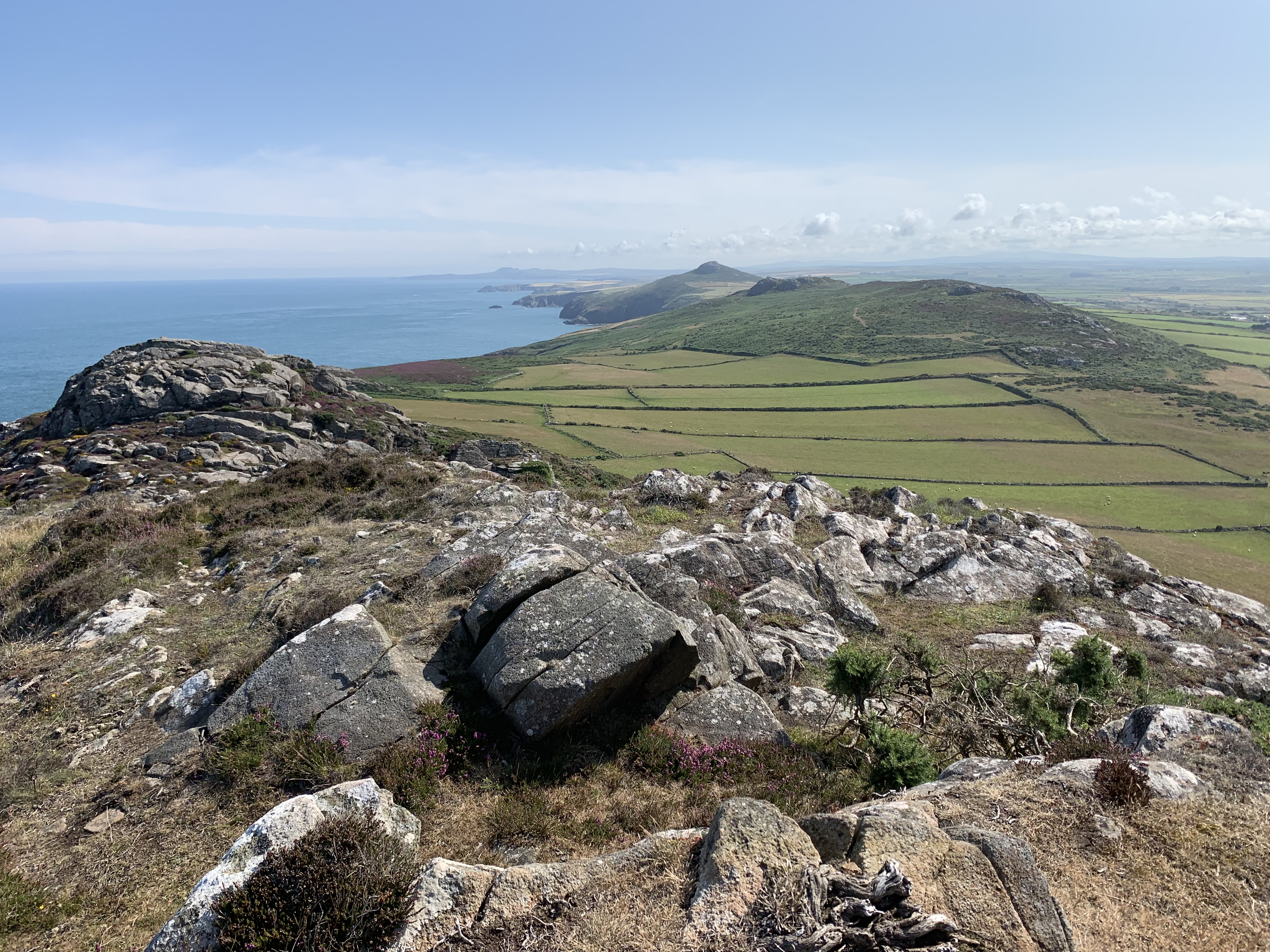
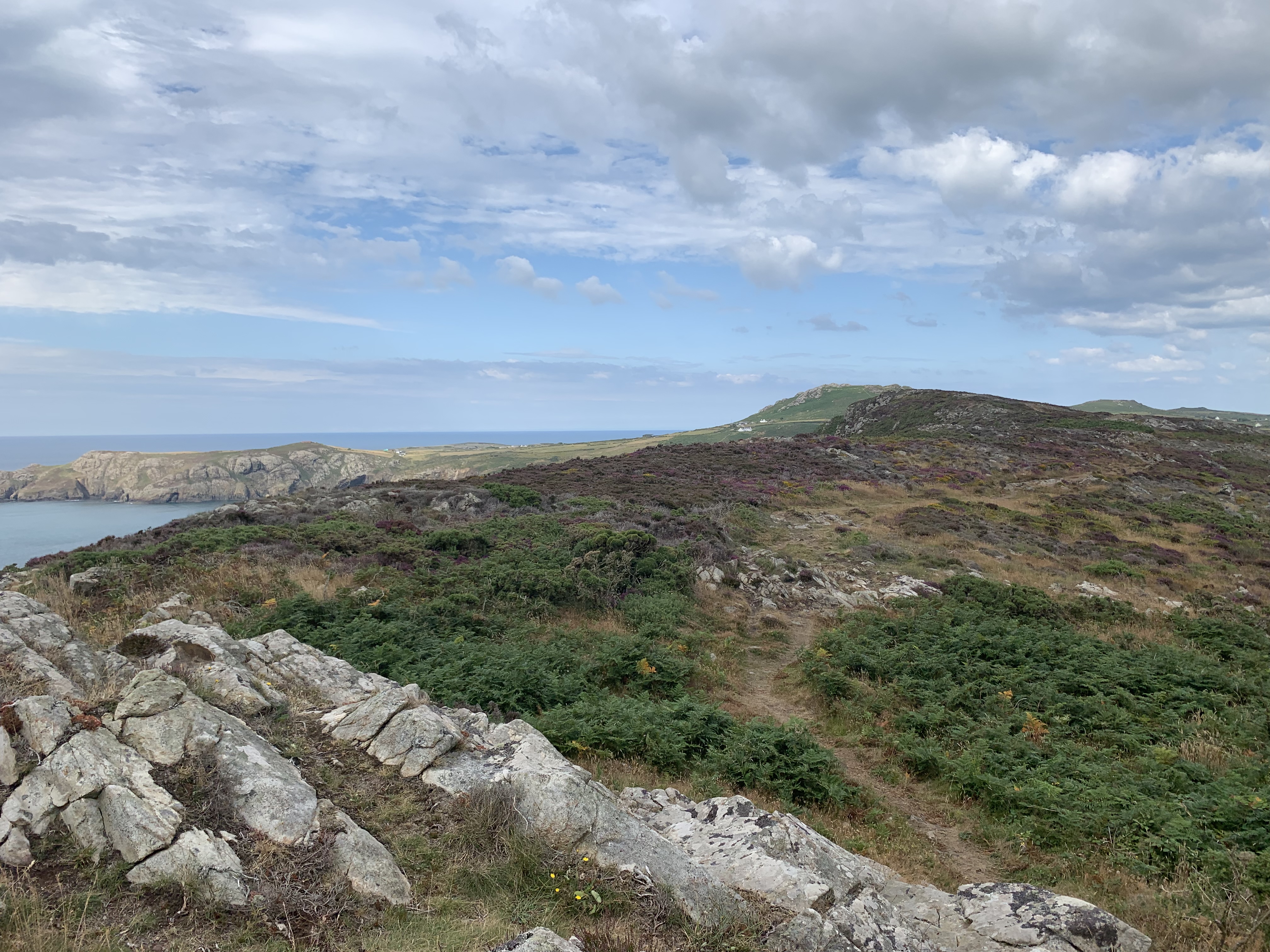
This day could not have begun in a more spectacular fashion. I started from the hostel’s doorstep, walking through the backgarden and up the hill looming behind it. The colours of the vegetation on the way up were stunning enough, but the 360 degree views were mesmerising. It was difficult to leave!
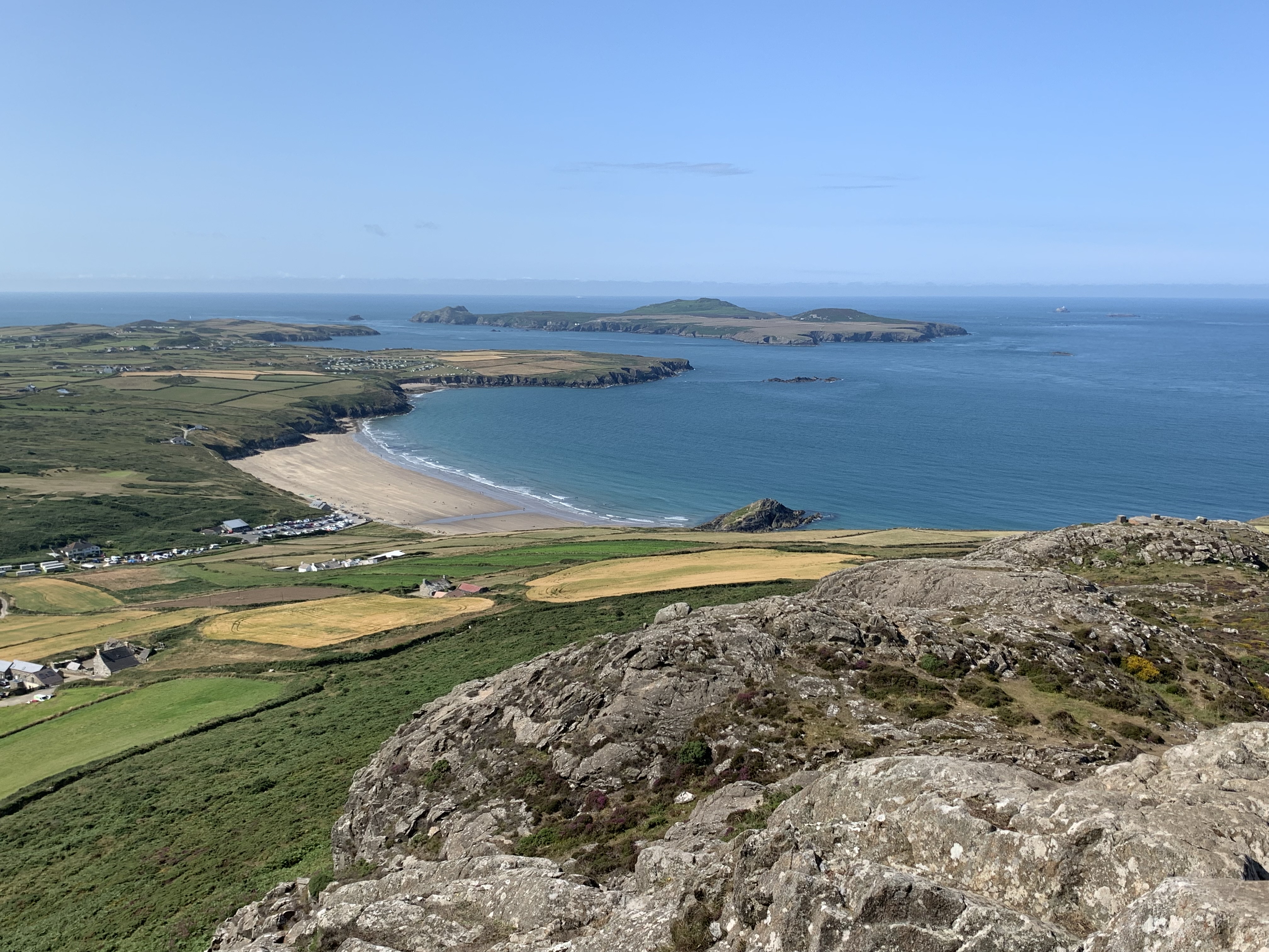
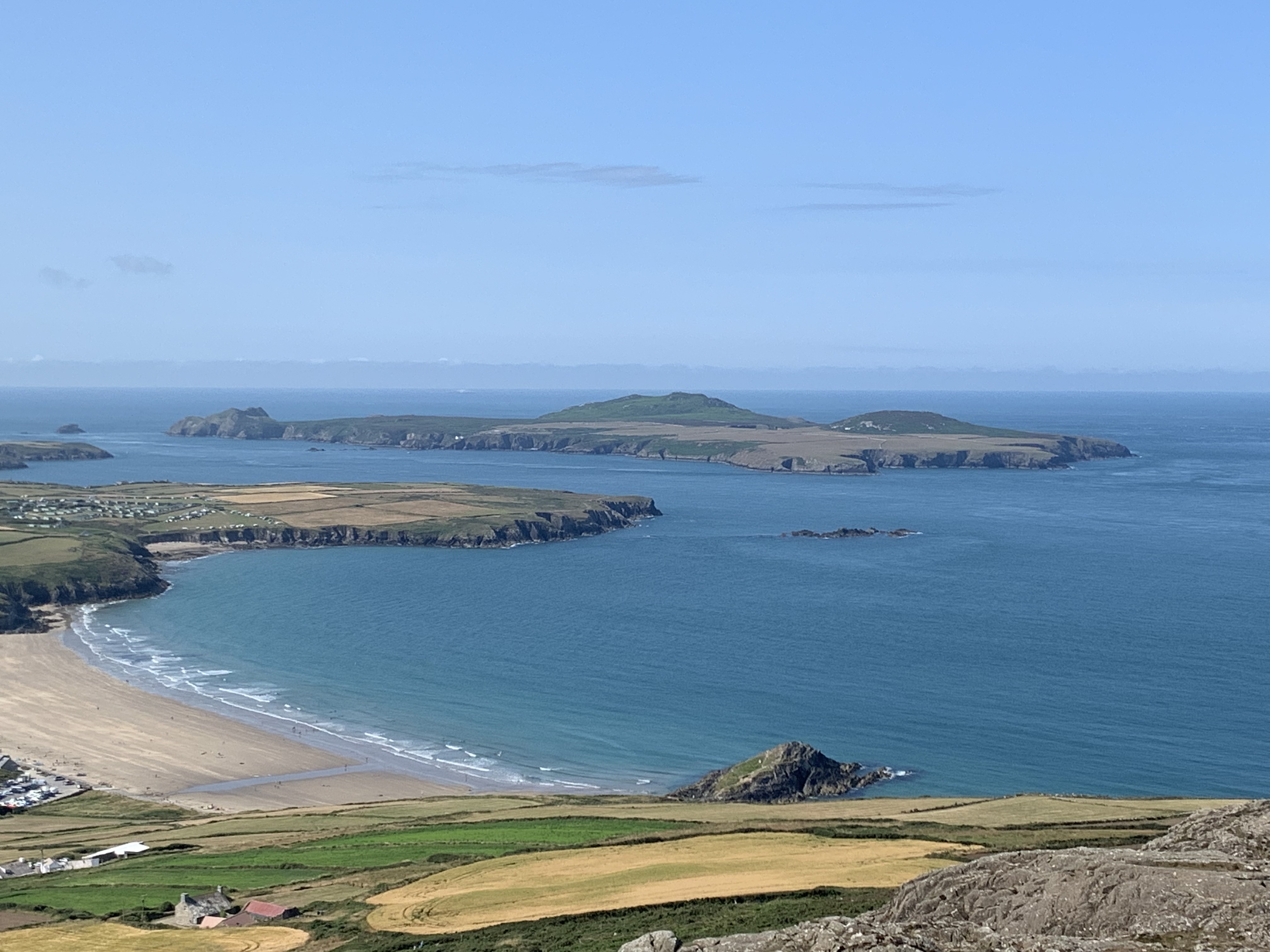
Not long into the walk, I spotted my first seals, bobbing on the waves with their heads poking out! I was happy I would not be leaving the coast without having seen any.
There was a fair bit of up and down again, but the scenery was picturesque to the extreme. After some time, I reached Abereiddy, which has a nice beach, which I crossed without stopping. My Achilles was playing up and I was eager to get up the hill on the other side and round to The Blue Lagoon, a flooded quarry that is now used for jumping into. In wetsuits, mind – the water is freezing.


I was looking forward to Trefin, but even more so to the village before it: Porthgain. Manthorpe has this to say about the industrial history of Abereiddy and Porthgain:
From around 1840 until the 1930s slate, brick and stone were quarried on the cliff tops between the two villages. […] Look out for […] the ruins of the quarrymen’s houses by Abereiddy Bay. The sad remains […] are testament to the great storm of January 14, 1938, when the swell of the sea severely damaged five of the homes. The storm damage and an ensuing typhoid epidemic effectively brought the local slate quarry industry to an end.
Moreover, Porthgain was recently used as a setting for the very recommendable film Their Finest, set in the Second World War and starring Gemma Arterton and Bill Nighy). However, the real draw here is one of the Path’s best pubs – The Sloop Inn.
Once I had descended into the harbour, I suddenly heard little peeping noises. And sure enough, there was a little (baby?) bird in the undergrowth! To this day I don’t know exactly what creature I was dealing with, but it sure was cute! Here’s my pathetic attempt at channelling David Attenborough…
Having settled in the sun on the Sloop Inn’s terrace, who did I spot coming towards the pub? You guessed it, the two couples from Dale! It was a lovely surprise and we had a nice dinner together. From Porthgain, it was then only a short walk into Trefin and to my next accommodation – The Old Schoolhouse!


And an old schoolhouse is exactly what it was, back in the 60s. The current owners had only recenty taken over this well-established hostel and were still in the process of updating it. I got a whole dorm to myself, and I instantly fell in love with it! Here’s the link: https://oldschoolhostel.com/


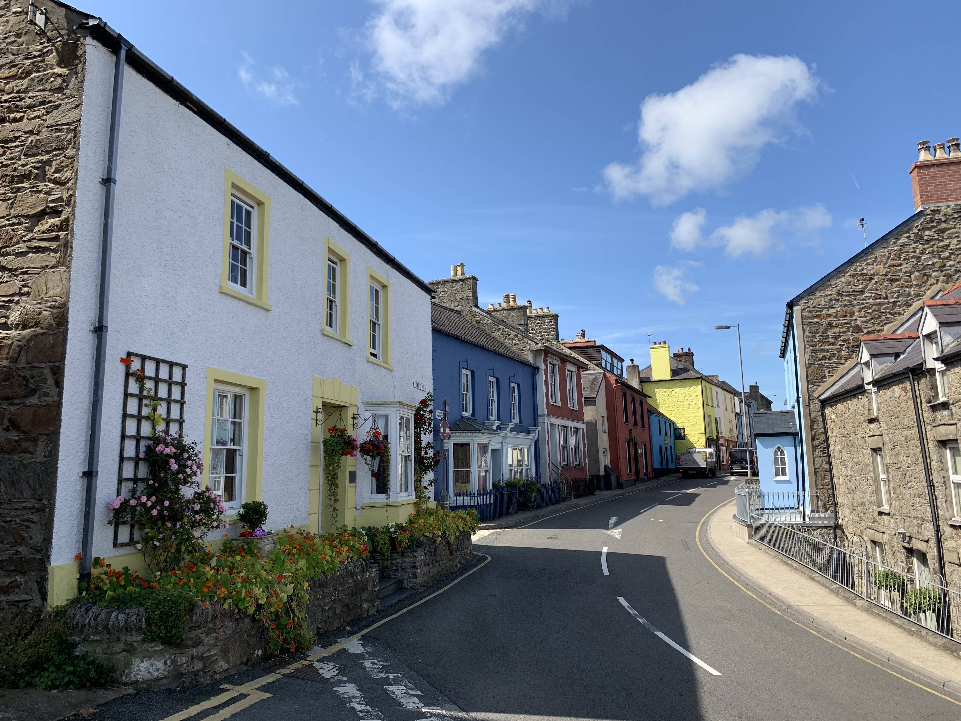
After sorting my stuff out, I went on a little explore around Trefin. Well, there is not much to see, but the peace and quiet were absolutely charming! It’s the kind of place that gives you the illusion that the world is still okay.


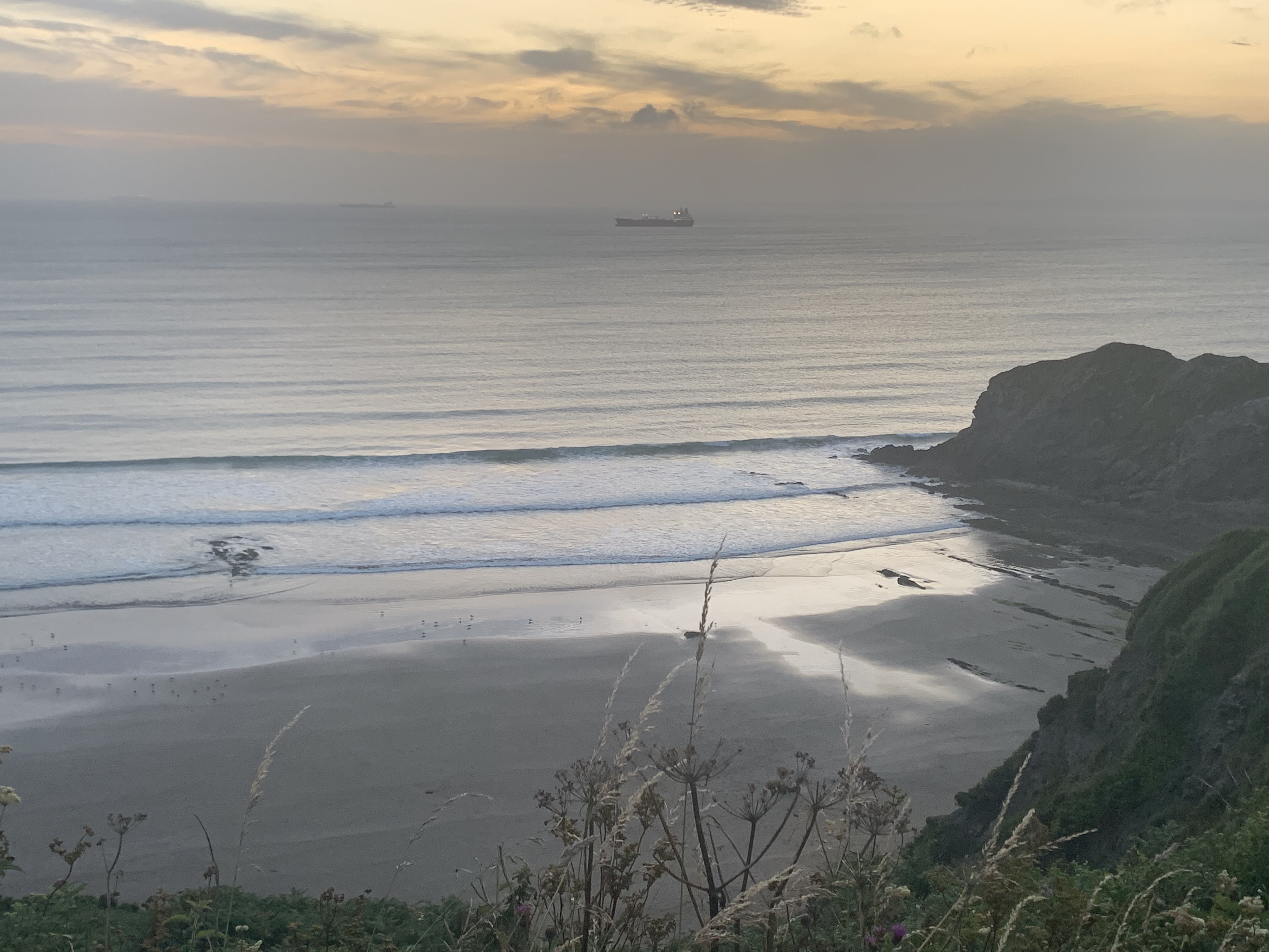
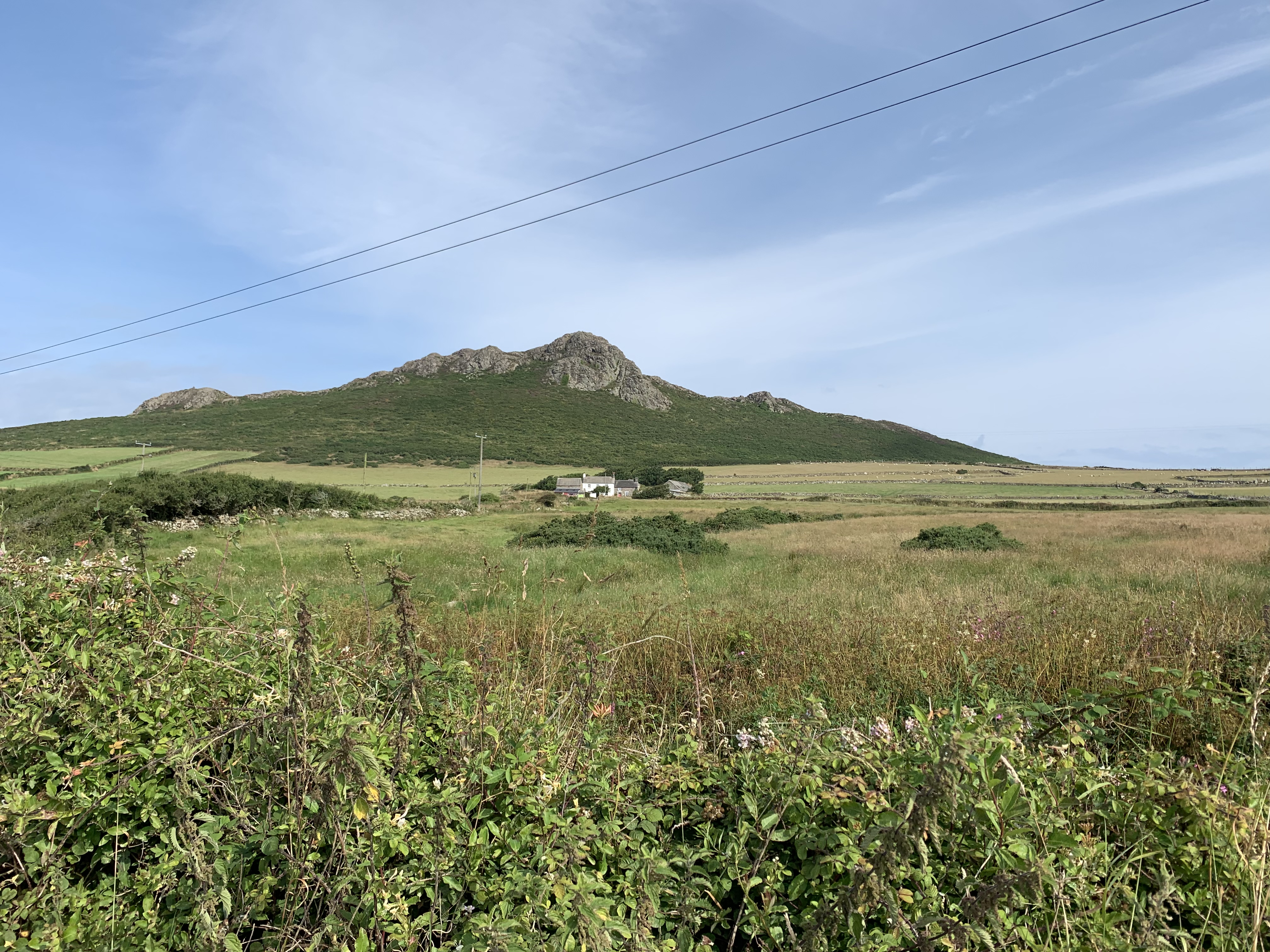
DAY 12: Trefin to Pwll Deri, 15km
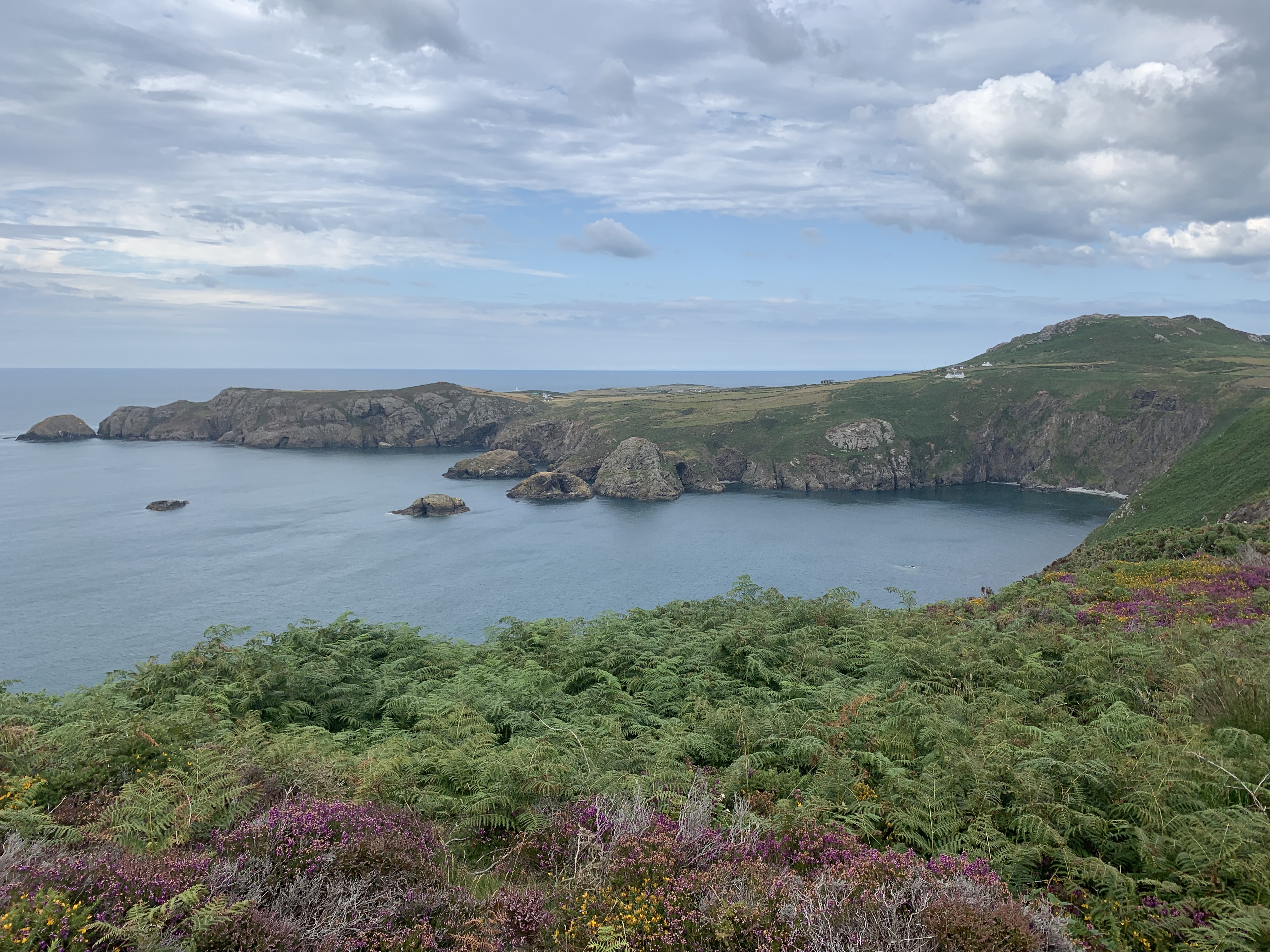
After a fantastic night’s sleep, I headed back through Trefin and popped into the old village chapel. It was used as an exhibition space, with lots of beautiful photos of Pembrokeshire by a local artist who had only recently moved to the area and had documented his first impressions. The photos were lying on the slim pew desks, with descriptions on each one.


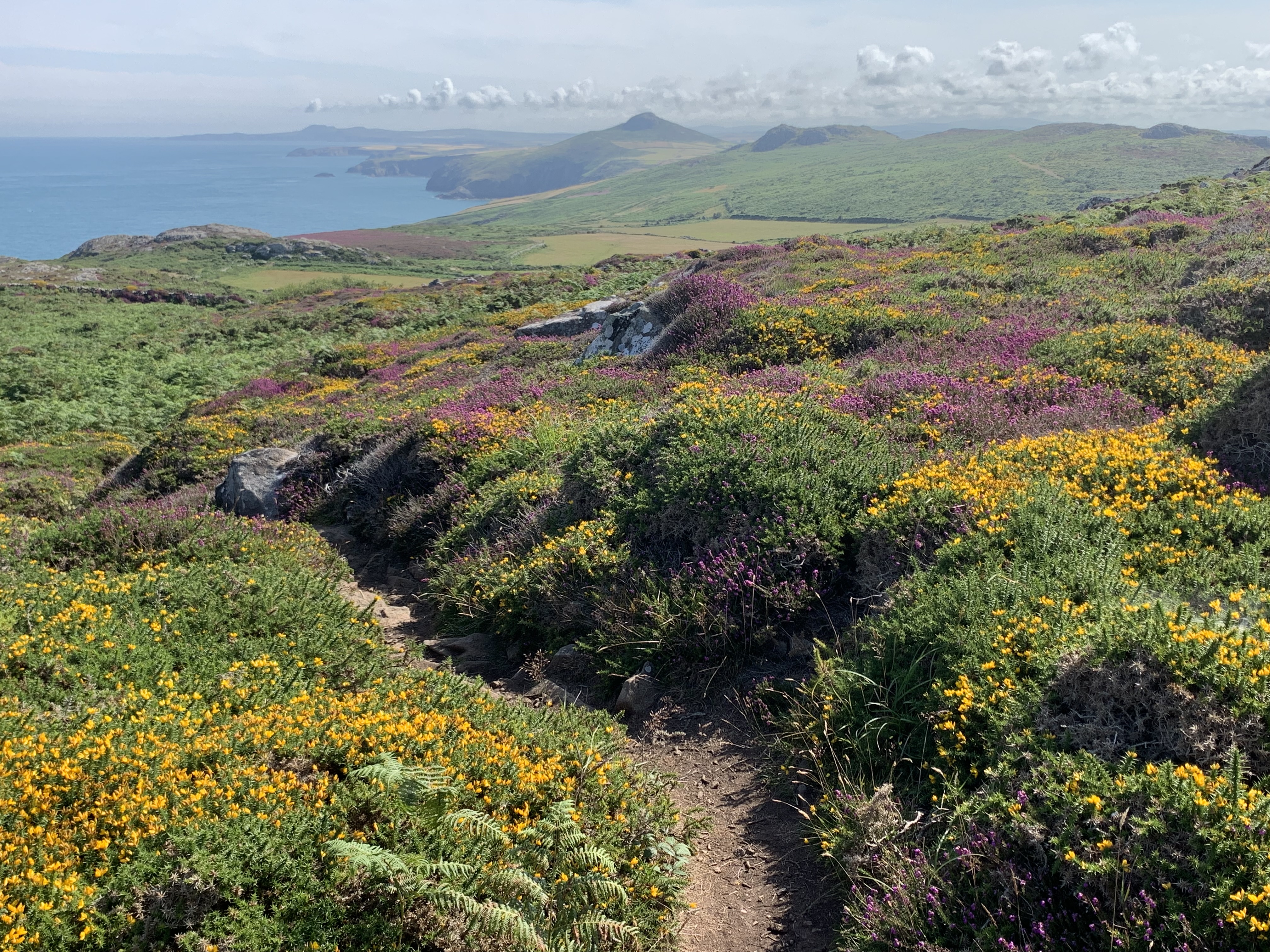
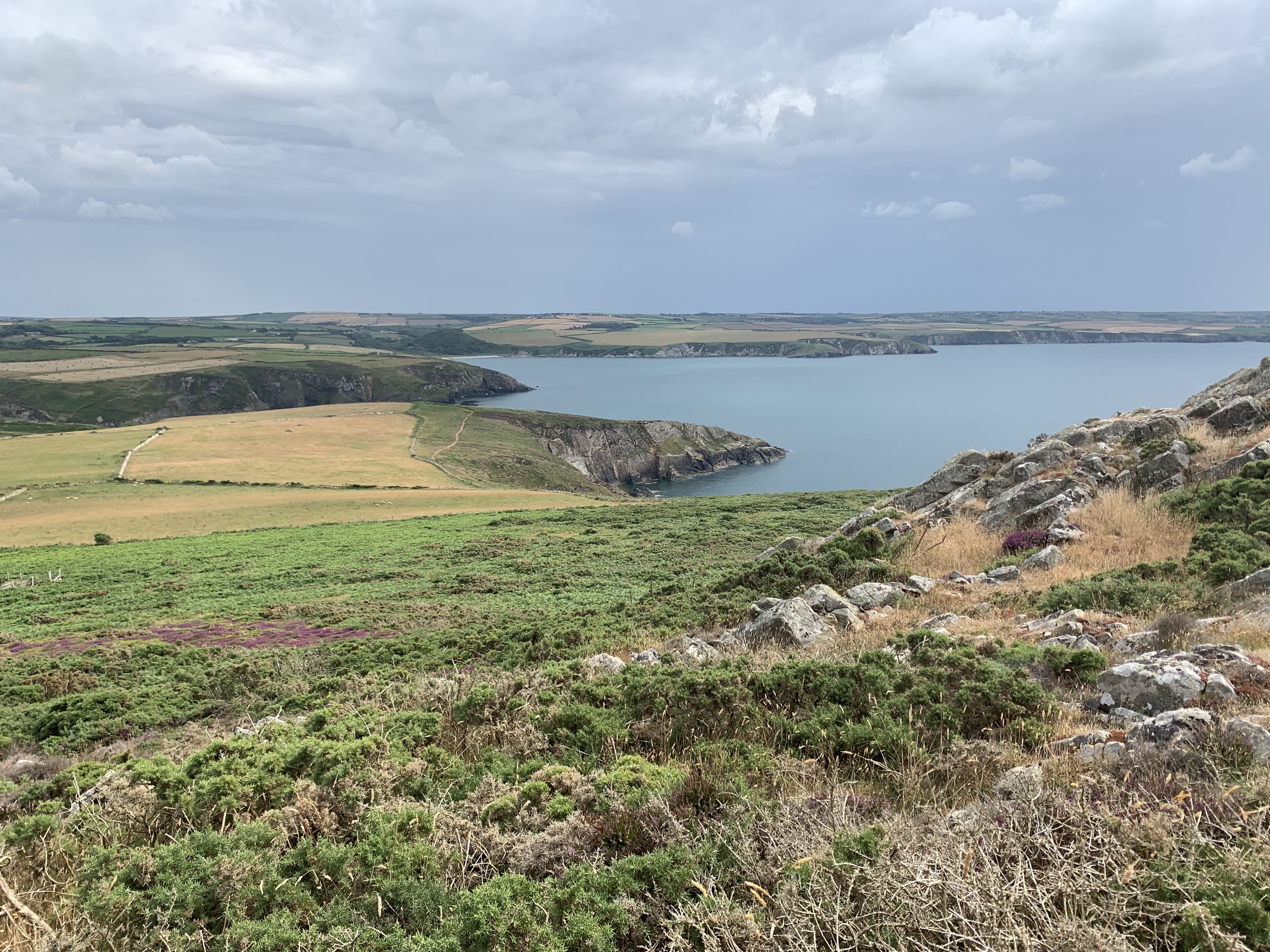
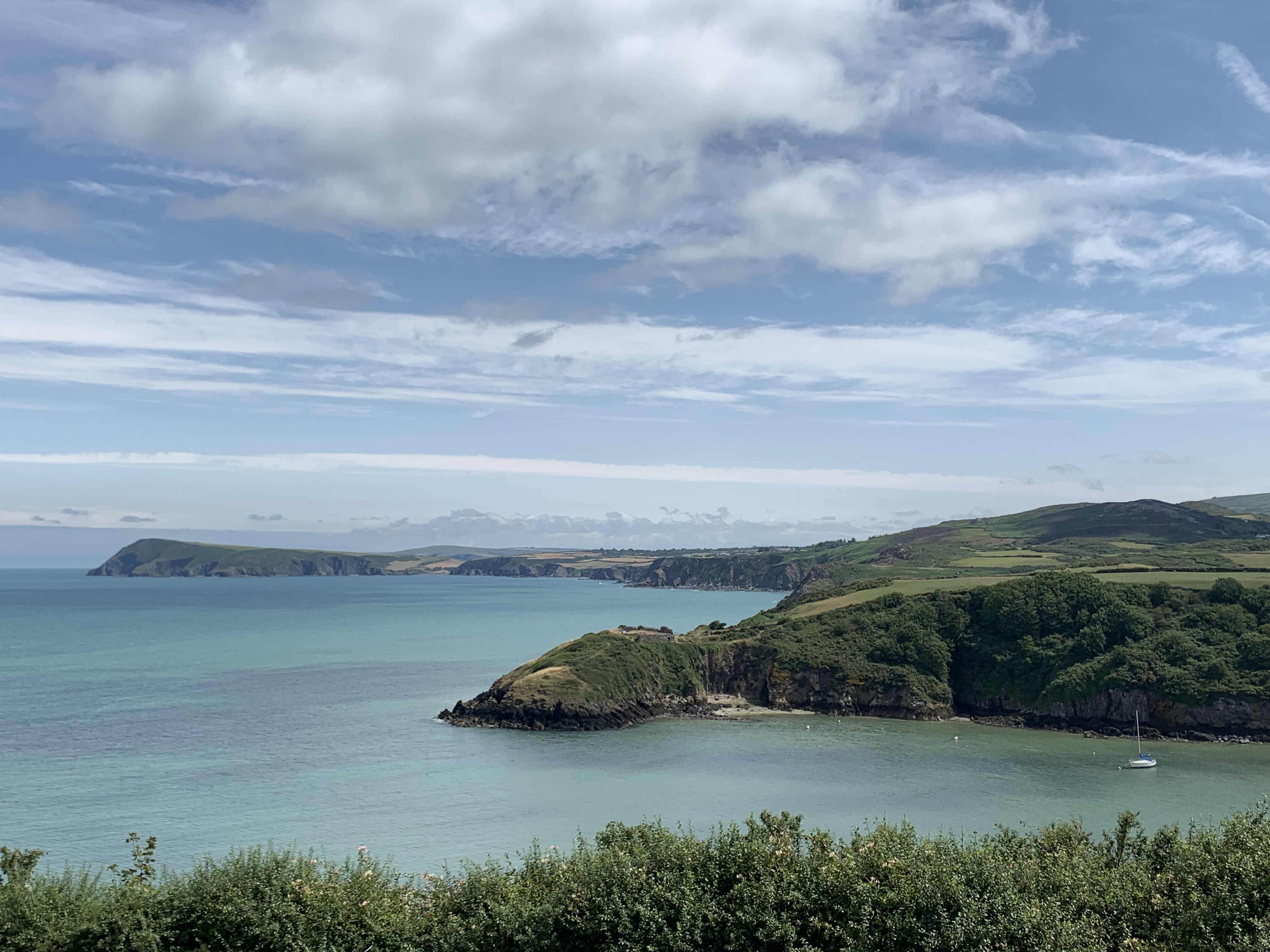
I took some of my favourite photos from the whole walk on the next stretch. The greens were extra green and the blue of the water seemed especially blue that day!


This night, no cosy village or inviting pub would await me – my destination was the Pwll Deri Youth Hostel, one of the most remote places a hostel could be in, at least in Britain! I had to carry some provisions, which I had bought in St Davids. Can’t say I was much looking forward to bolognaise out of a package after days of fish pie and crumble, but I was sure it would do the job after another day with plenty of ascent and seemingly no descent! The Path took me through pretty Abercastle, where there’s a pebbled beach – and nothing else.
Further on, I crossed the beaches of Aber-Mawr and Aber-Bach. At this point, I really had to look up the meaning of “aber” – this is what I found: “Aber goes back to Common Brittonic. In Old Welsh it has the form oper (later aper) and is derived from an assumed *od-ber, meaning ‘pouring away’. It is found in Welsh, Cornish and Breton.” Well, there you go! Of course, all that had popped into my head was Aberforth Dumbledore… So much for a whole semester of Old English and two semesters of Irish Gaelic. No help at all!


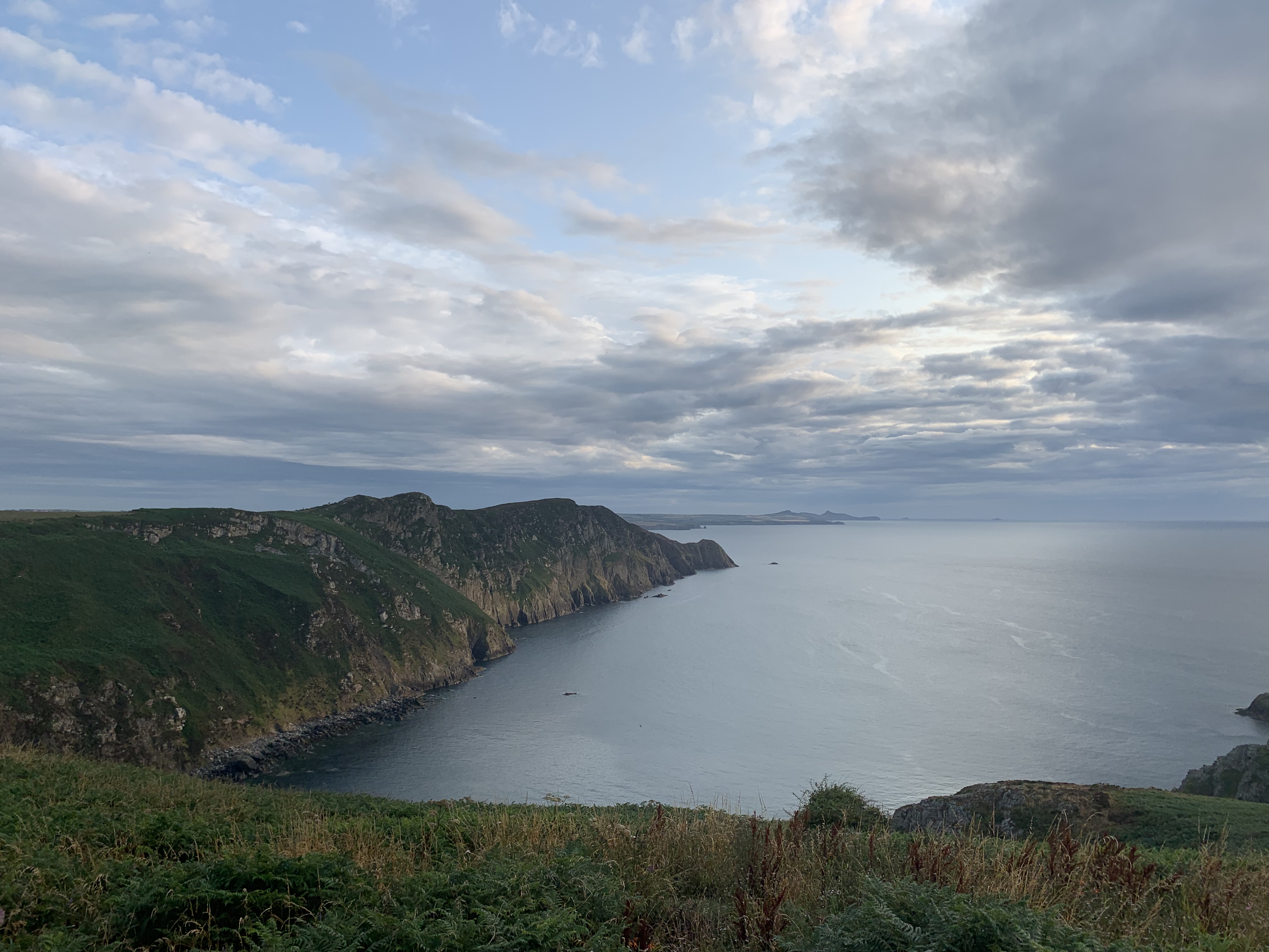
Eventually, I was able to spot the white-washed youth hostel in the distance, with Strumble Head Lighthouse to the far left.
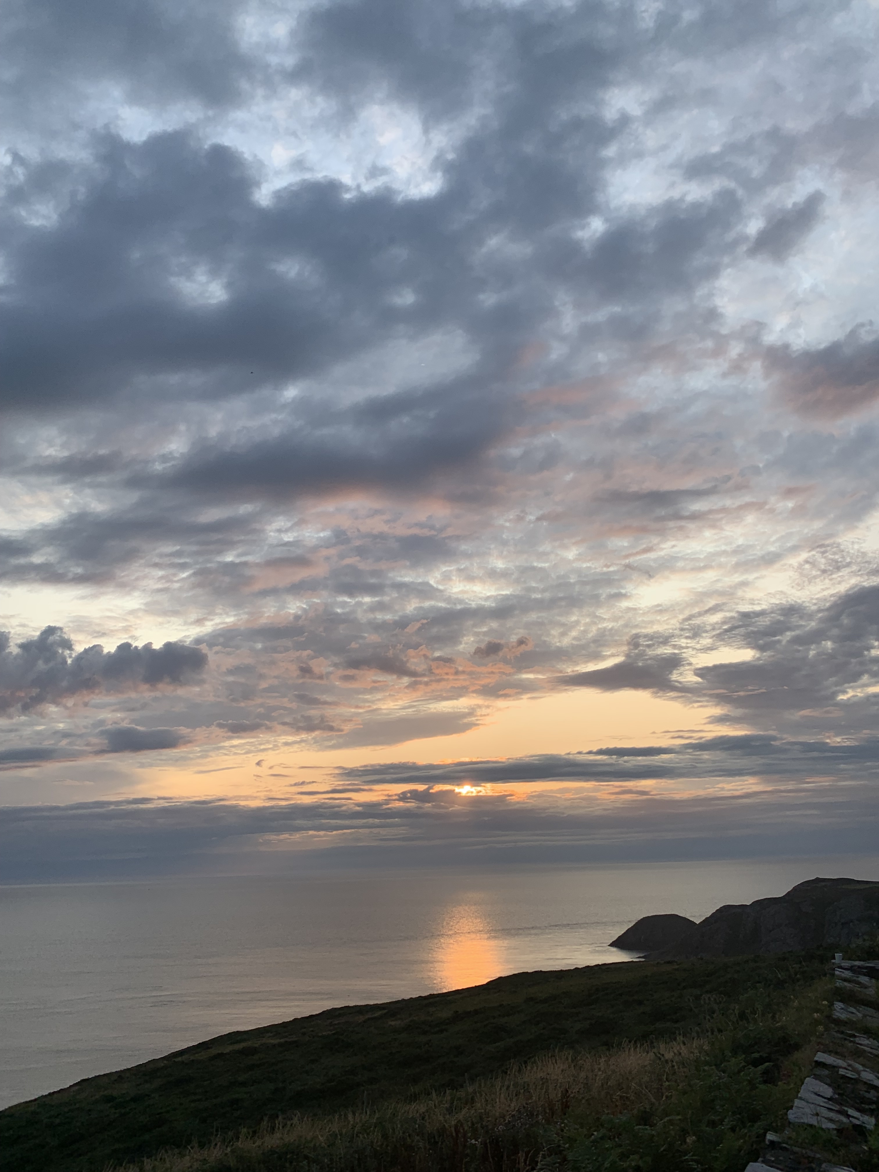
I had just reached the hostel when it started to rain – for the second time only in ten days of walking! I chose my bed in the crammed 8-bed dorm (there was bound to be a snorer) and then got to work in the kitchen. The weather soon cleared again and I guess the views weren’t bad…

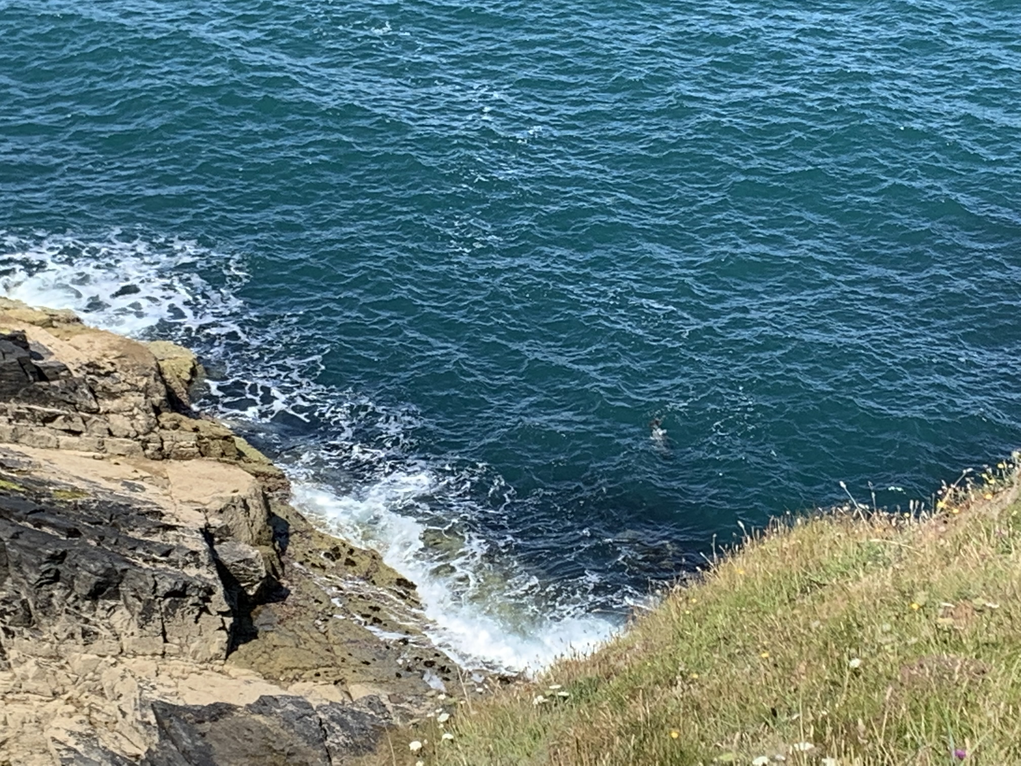
However, the highlight of the day was probably spotting a seal pup and its mom in one of the countless coves. I watched a whole drama unfold! The little family was soon joined by a huge seal, who came in from the sea and was creeping around the bay – until he got so close that the mum started to get restless and the pup seemed to flee to safety by crawling over the pebbles. You can watch it all here – the pup has already made it all the way up the beach when we join the action:
Puzzled by the fight that ensued between the two adult seals, I tried to find out what type of behaviour I witnessed – only to find articles about “Crazed” Cannibal Seals and titles like “Cannibalism by Sea Lions Shocks Scientists”. Now take a guess what publications they were in…
DAY 13: Pwll Deri YH to Fishguard, 19,5km
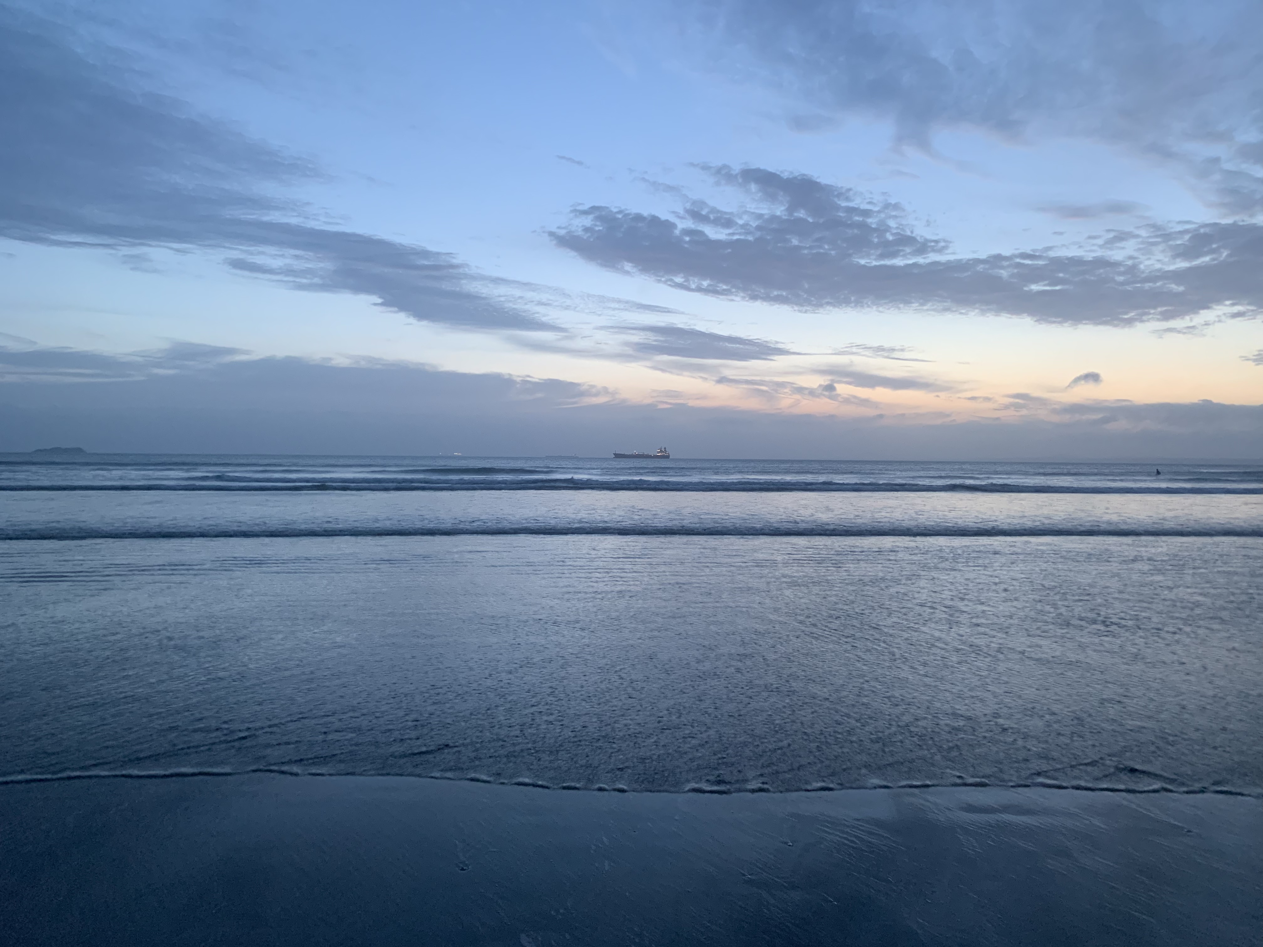
The last day of coastal walking was upon me! Just an hour into it, I was at Strumble Head Lighthouse, where there’s a marine wildlife observation station. Sadly, I didn’t get to see any dolphins or porpoise, but there were quite a few more seals!


The route was not quite as scenic as on previous days, but that was also due to the clouds, which tinted everything in grey. It did feature a nice patch of woodland around the bay of Aber-Felin and a stone commemorating the Last Invasion of Britain – an event the town of Fishguard still makes a great deal of, as I was about to find out. For the moment, I only had the info Manthorpe was providing:
On 22 February 1797 four French sailing vessels […] anchored […] west of Fishguard. This was the beginning of the last invasion of Britain, a somewhat half-hearted and short-lived affair. The 1400 or so Frenchmen occupied the stretch of coast around Strumble head for a grand total of two days. The story goes that they got so drunk on stolen beer that the locals soon overpowered them, and they finally surrendered […]. The hero of the whole affair was one Jemima Nicholas who, to this day, is something of a local folk hero. Armed with her pitchfork she single-handedly rounded up 12 Frenchmen and is now honoured by having a local ale named after her.
What a way to become immortal! I wonder what the French version of this part of history sounds like…


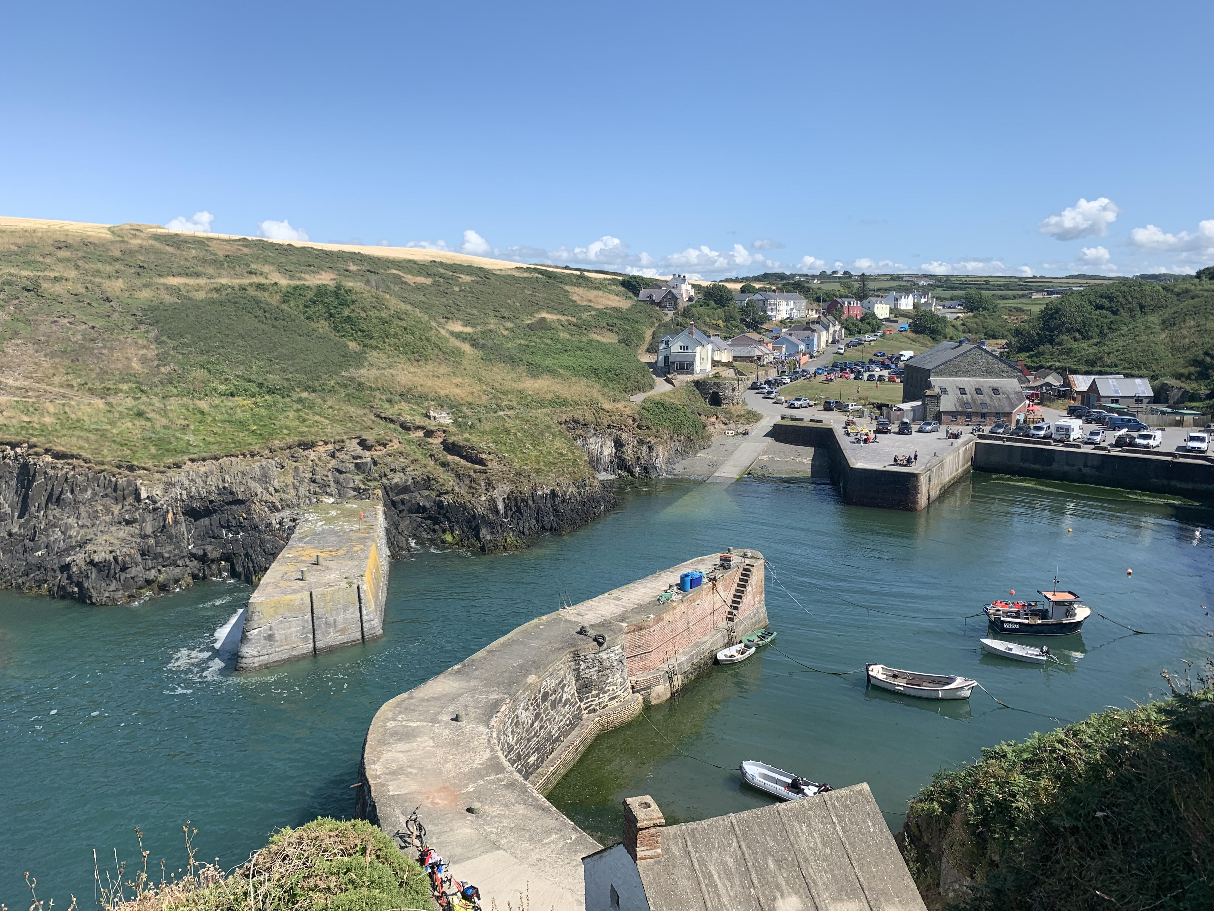
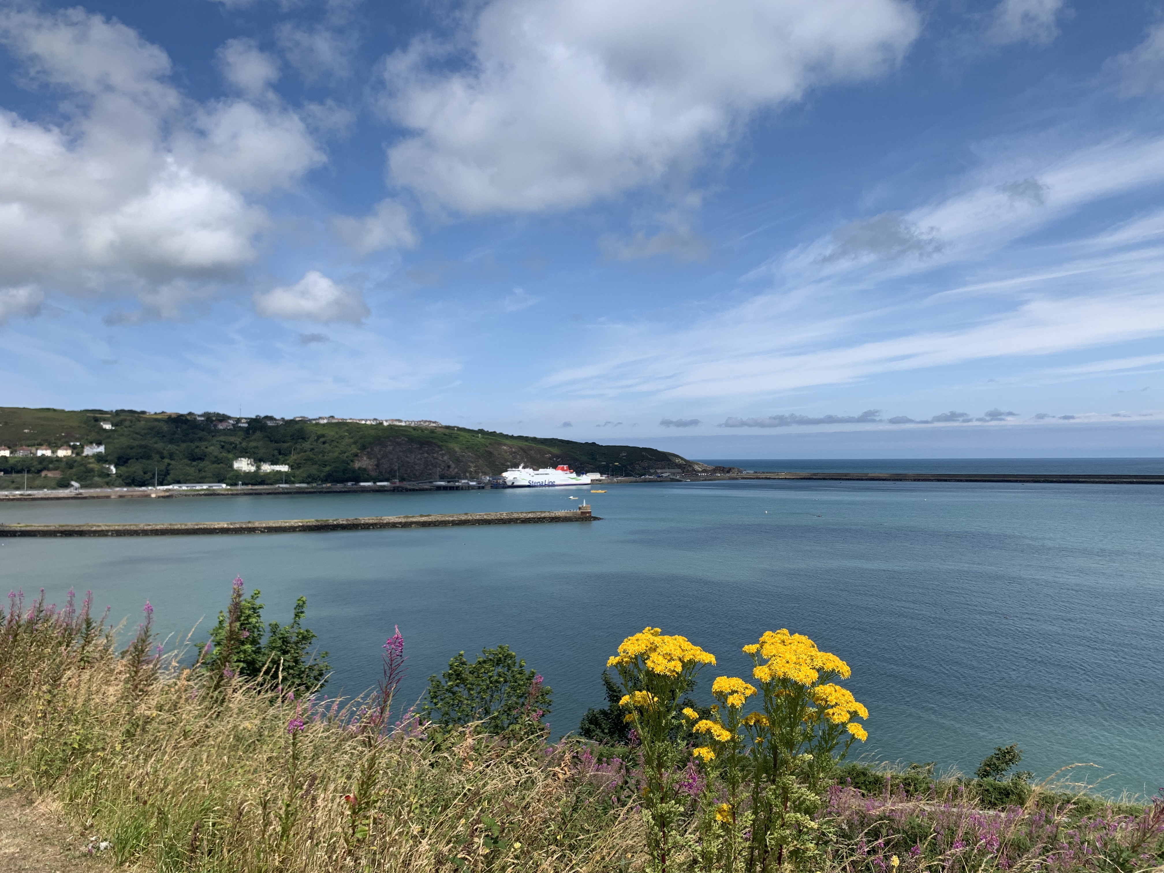
Finally, a ferry heading for Ireland came into view, and I knew Fishguard was around the corner. You first come through Goodwick, which is almost a separate town, and, since it was closest to the station, was where I had booked my last B&B. It’s also the location of the rather formidable Fishguard Bay Hotel, which was built in style for the newly opened ferry route in 1906.


Technically, I “should” have walked all the way to Lower Fishguard, which is the location of the old harbour, but I was very hungry and didn’t fancy any more hills – also considering that I would venture there in the evening anyway, meeting up with my friends from Lincolnshire for the folk night at the Royal Oak. I did go down to the beach though, and had a late lunch at the busy café there.
In the B&B, I was greeted by a jolly landlady, a filthy carpet and a bewildering decoration scheme.
The bathroom was down the hall and on the landing, and turned out to be bigger than my room! It had a huge bathtub and I had been looking forward to a nice soak, but then discovered to my dismay a little note that said it was out of order and that the plumber had been called. Funnily enough, one of the reviews on google pointed this out, but that had been over two months before… Granted, it is a cunning way to save water!
Bemused, I got ready for dinner and then descended into Goodwick and up the hill into Fishguard proper. It’s one of these towns that has its charms, but also seems strangely left behind. Still, I kept an open mind, and the Royal Oak was definitely inviting. Thankfully, the Lincolnshire contingent had booked a table, as the pub was absolutely packed! If you want to find out the real character of a place and its people, head to the local folk night. Safe to say this was a very fitting and quirky end to my Pembrokeshire adventure! And yes, that is Vanessa Redgrave in the background…
DAY 14: It’s all over now, baby blue. Or: Fishguard ain’t so bad!
This was it, my last day in what to me is the most stunning area of a country full of natural beauty. Wales, you are a marvel!
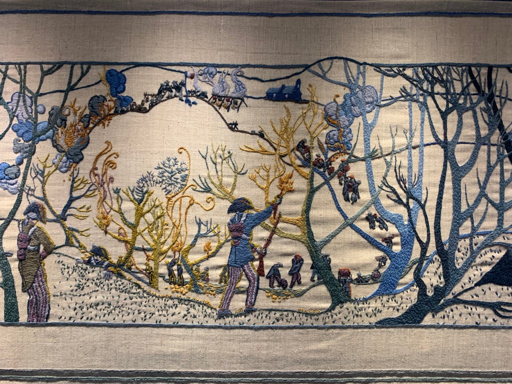
It was a hot day and I was mighty glad I was able to leave my backpack at the B&B! I took a bus into Fishguard and visited the Town Hall/Local History Museum. It features an extraordinary piece of art – Wales’ answer, so the humble statement of the makers, to the Tapestry of Bayeux! But it is very striking, and naturally depicts the events of the aforementioned ill-fated French invasion in colourful detail:


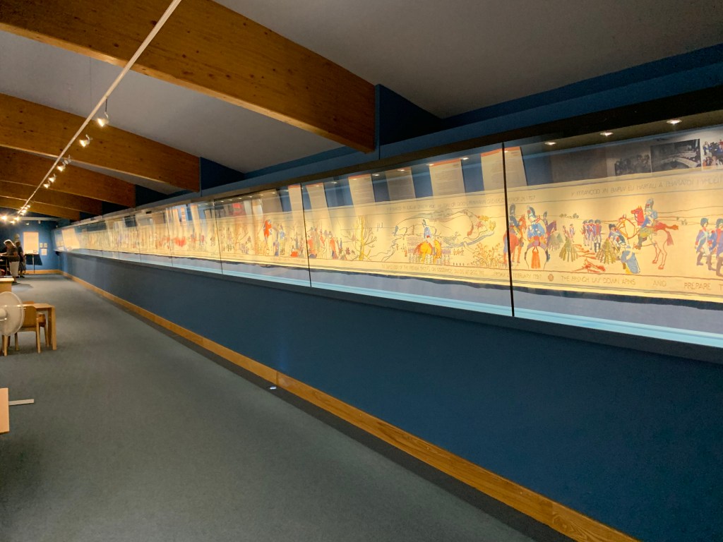

There was also a sweet video that had been made with all the contributors to the tapestry talking about their motivation for joining in and what the experience was like. They ranged from hobby crafts(wo)men to artists with degrees in Fine Art, to complete novices! It was pretty lovely to see a community come together like that to achieve something pretty special.
After a quick look on the old harbour from above, I went back to the B&B and actually risked missing my train by walking the panoramic route. Severely out of breath, I collected my backpack and waddled down the road to the station. I arrived there with time to spare, of course…time for a can of coke! And then, time to say goodbye.
I had mixed feelings about it. On the one hand, I was looking forward to going home – to getting back to creature comforts, to trousers not made from polyester, and to walking without all my possessions on my back. On the other, I was absolutely dreading the end of this extraordinary holiday. I do think I could have happily walked on for another week at least!
I’m going to come back to this wonderful part of the world, that I know for sure. After all, I still have to do Fishguard to St Dogmaels!

Ach, das war schön. Ich habe ja ein paar Strecken davon auch erlaufen bzw war an einigen Punkten, da wurde mir ganz wehmütig. So lebendig und abwechslungsreich hast du das gestaltet- ich war selbst traurig, als die Wanderreise ans Ende kam, ich hätte noch weiter lesen mögen. Vielen Dank, mehr davon!
LikeLike
A wonderful recollection of your coast walk, such an enjoyable read. Lovely photographs and in particular the photo from day 11 of heather and gorse covered slopes and panoramic view is glorious. Marvellous! Best wishes Rich
LikeLike
Hi Rich, thanks very much for reading! Nice to hear you enjoyed it! That photo is also one of my favourites. Best wishes, C.
LikeLiked by 1 person